In Brief:
Tropical moisture is headed our way to cool us down Sunday-Tuesday and bring good rain chances as next week begins.
Forecast Discussion:
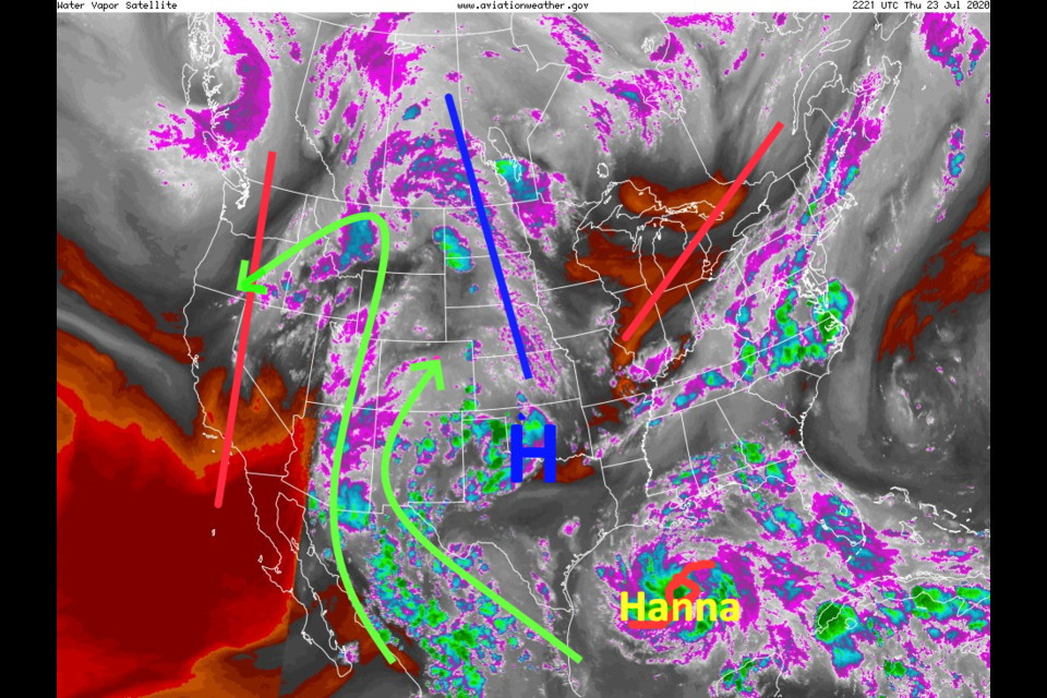
All eyes are watching the location of the high pressure center aloft currency located in SW Oklahoma (Figure 1 in the gallery above). This will bring or repel needed moisture to our state. Hanna has formed as a tropical storm in the Gulf while earlier moisture is flowing into the West (light green lines) around this high pressure center. On Friday, the high center shifts to the Oklahoma/Arkansas border (Figure 2). The moisture flow is less blocked and heights lower a bit allowing better storm chances each day on through the weekend. We can see this currency even better as abnormally high water content in green flowing northward in Figure 3.
The ridge off this high center is still dominate enough that storms will remain isolated to afternoon and early evenings with high temperatures breaking 90F for a couple more days (Figure 8); Friday and Saturday.
The Longer Range Forecast:
By Saturday, the trough in the West inches our way and the high moves to sit over Kansas City (Figure 4). The river of moisture, enhanced by Hanna's water, continues to flow into Colorado (Figure 5). Rain chances remain elevated Sunday through Monday (Figure 8). We'll have to watch for local flooding and some severe weather chances.
Over the next 5 days, we might see around a quarter inch of rain in Longmont while the southern mountains may get a whopping 3-5 inches (wow if real! - Figure 6). Over the next 10 days, the heavy rain totals move north and also douse areas around Colorado Springs (Figure 7). This is relief in some drought stricken regions. Nice!
Wednesday, the ridge is expected to build westward again bringing back highs in the low 90'sF and drier conditions again.
Tropical update:
Tropical Storm Hanna is in the Gulf setting its sights on Corpus Christi, TX (Figure 9) and Tropical Storm Gonzalo may become a hurricane in time for an impact on the Windward Islands over the weekend (Figure 10).


