In Brief:
Tropical (or monsoon) moisture continues to stream into the West giving us a cool and wet period now through Thursday.
Forecast Discussion:
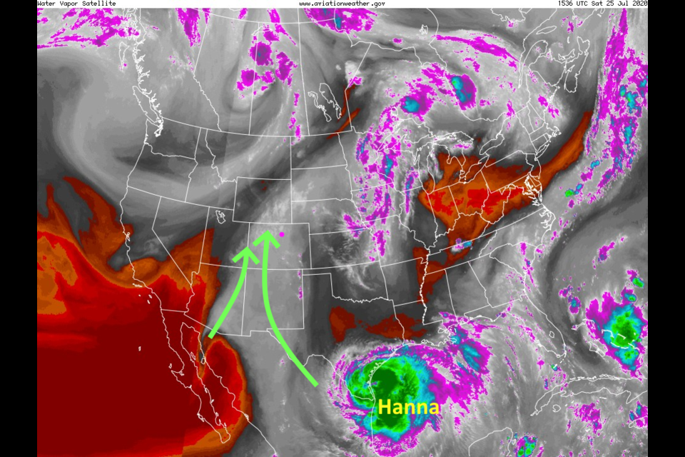
Moisture is still streaming into the West (Figure 1 in the gallery above - green arrows and grey shading). The upper level high pressure ridge stretches from Texas to off the east coast (Figure 2). The trough to our west is helping with this moisture transport as well. The tropical system Hanna became a hurricane overnight and its moisture will take a while to make it our way in this flow.
With less fire activity out west and the mid level air flow pattern in place, smoke will remain to our north for the next few days (Figure 3). You can breath easy.
A passing trough to the north (Figure 3) will help to kick up additional showers Saturday/Sunday but rainfall amounts around Longmont should remain light (unless we get a lucky thunderstorm move through - Figure 4). This elevated chance of rain will continue through Monday with comfortably cool temperatures (Figure 5).
The Longer Range Forecast:
The next period of better precipitation chances runs Tuesday PM through Thursday aided by passing short wave troughs embedded in the overall ridge in the west (Figure 6 red dashes). These will act on some of the moisture stripped from Hanna. Some low level moisture will travel towards Colorado moving northwest by Monday PM while the mid level moisture heads west across Mexico (Figure 7). Over the next 5 days, southern Colorado and the eastern Plains should do well in the rainfall department. We miss significant rain totals around the northern I-25 corridor.
I do see that blob of moisture crossing Mexico from Hanna getting entrained into the westerlies about a week later (the start of August - Figure 9) and returning to Colorado with normal tropical air flow. There is also a possible new hurricane (that would be named Isaias if it forms and nothing else gets named first in the Atlantic basin) scaring the folks on the U.S. East Coast. We'll keep an eye on it...
Speaking of hurricanes, Hanna is a hurricane now and will be making landfall today (Saturday). It will slam into the higher mountains of central Mexico by the start of the week (Figure 10). Tropical storm Gonzalo is going to fizz out and die along the coast of Venezuela this weekend (Figure 11). Hurricane Douglas is rapidly loosing strength as it crosses colder water on an approach to Hawaii. It should become a tropical storm as it passes over the islands.


