In Brief:
A tug-o-war between moisture plumes and dry westerlies will result in on and off again monsoon-like weather followed by more hot and dry weather in the long term.
Forecast Discussion:
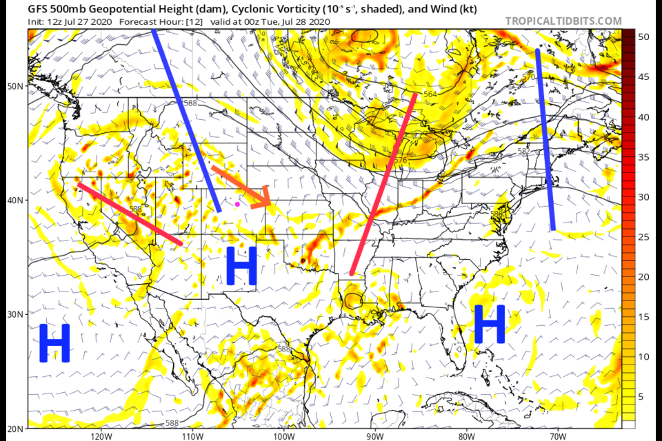
The ridge has reformed in the west giving us some northwest flow aloft (Figure 1 in the gallery above). An approaching trough will kick up some better storm chances Tuesday (Figure 1 and Figure 7). The green shading is abnormally moist tropical air flowing up from the Gulf and the recently expired hurricane Hanna - Figure 2). The water vapor satellite shows the dry air over the northern Rockies and the moisture flow up the eastern Plain (Figure 3). We are right on the edge of the dry air in Longmont. That northwest flow is also brining in some smoke from the Western state's fires reducing our air quality (Figure 4).
On Tuesday, that trough in Figure 1 over in California is passing through the overall large scale ridge and will pull some deeper moisture back to create thunderstorms again (Figure 5). You can see that moisture nicely in Figure 6.
After that trough passes, dry air and smoke will return and we return to the low 90'sF on Wednesday (Figure 7).
The Longer Range Forecast:
The ridge is getting even bigger in the west which will make it harder to bring moisture into Colorado. Our last trough digs into Colorado Thursday cooling us down again (Figure 8), bringing in moisture once more (Figure 9), Rainfall over the next 5 days should be only 1/4th to 1/2 inch even though some areas to our northeast may pull 1-2 inches with thunderstorms (Figure 10).
Even longer out, 90'sF for highs return (Figure 7) as the western ridge dominates our weather. Hot and dry summer weather is back (Figure 11).
In the tropics, an easterly wave called 92L INVEST "may" become our next named storm and scare the east coast in 6-10 days. IF it gets the next tropical name, it will be Isaias (Figure 12).


