In Brief:
Elevated afternoon storm chances (with smoke) change back to very hot, dry and smoky conditions for the weekend.
Forecast Discussion:
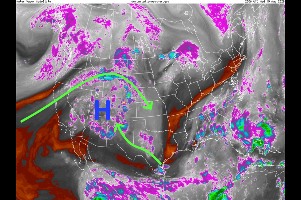
The return of moisture has clouded skies and brought in actual rain to spots (and lightning unfortunately - see Figure 1 in the gallery above). Amounts of rain were very spotty. This surge of moisture can be seen in the precipitatable water anomaly map in Figure 4. This is mostly coming from the Pacific ocean this time. The ridge in the west with its close loop of air flow is the biggest feature in U.S. weather right now (Figure 5). This ridge is so large that it has smaller ridges poking off of it. This keeps smoke circling the entire western U.S. allowing the smoke to build and build (Figure 2 and Figure 3). Yuck.
Some of this moisture (and future moisture) will be sucked into the ridge from Genevieve as it dies moving to the northwest (Figure 6).
We do have a Marginal Risk of severe weather for most of eastern Colorado Thursday (not shown in a map) - the primary risk is for strong gusty thunderstorm winds (not good for the fire conditions).
The Longer Range Forecast:
The moisture gets cut off for a bit over the weekend (brown shading over the state in Figure 7). You can see Genevieve dying and spreading atmospheric moisture out of its center in the lower left of that figure. Over the next 5 days, precipitation will still be very light and confined mostly east of the Rockies (Figure 9). Most of those rain totals come from Wednesday, Thursday and next Monday (when some moisture returns again). High temperatures will remain pegged in the upper 90'sF for a while. We should set the record for the 2nd largest number of 90F+ high temperatures in a calendar year by Saturday afternoon.
Better moisture returns middle of next week (Figure 10). We will see storm chances begin to increase again.
Looking even FURTHER out, amazing amounts of moisture flood into the West (from the death of the next tropical system's death by September 1/2 (Figure 11) followed by a brief sharp cool down on September 3/4 (Figure 12). Some relief IS in sight!


