In Brief:
Lots of smoke and peak heat stretches through the weekend before small rain chances return with a small cool down later in the week.
Update 8/21 10pm:
Tropical depression fourteen has reached tropical storm strength with winds at 35 knots and has been named tropical storm Marco.
End update 8/21 10pm.
Forecast Discussion:
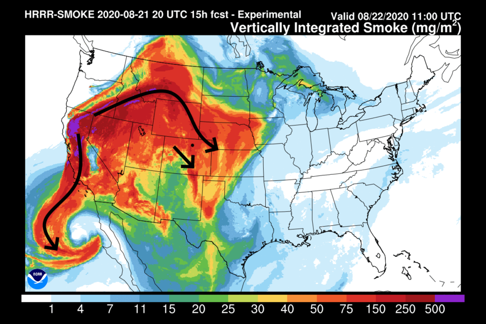
Local fires and the giant fires in California are filling the U.S. West with smoke (Figure 1 in the gallery above). Smoke won't be leaving for a while. The remains of Genevieve have pumped some moisture into the southwest (Figure 2) but dry air is drifting in north of it to cover Colorado through Tuesday (Figure 2). The monster high pressure system is firmly set in place with air circulating clockwise around it (Figure 3). Because of this, we will have high temperatures near 100F each day through Wednesday and smoke. Precipitation will be very light and mainly in the southwest part of the state (Figure 4).
The Longer Range Forecast:
Tropical systems in the Gulf and off the California coast are our hope for moisture (Figure 5). Laura (Figure 7) should hit near Louisiana around Wednesday while the unnamed system (currently tropical depression fourteen) hits near Houston on Tuesday (Figure 6). Moisture from fourteen might come in the low levels later next week.
We don't see much relief until a trough pushes into the Western U.S. by Thursday (Figure 8). We cool to still-above-normal temperatures and see a bit of afternoon rain chances return. The GFS gives us maybe a quarter-inch over the next 10 days (Figure 9). That cool air floods the northern Rockies (Figure 10) but now may not quite push into Colorado (darn it). At that time, the high-pressure center is down in Texas and we have a more westerly flow (Figure 11). Fall will come someday, as will cool air and rain ... hang in there.


