In Brief:
The end of the smoky heat is nigh - cold fronts begin to return, as do small rain chances this week.Forecast Discussion:
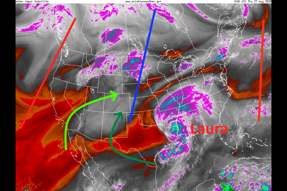
I've decided to not show that pesky upper air high this time- nobody liked it anyway. The upper air pattern is beginning to become progressive (troughs and ridges will begin to move around the hemisphere again). Some moisture is leaking back into the state from the tropics as well (mid level light green arrow, lower levels dark green arrow - Figure 1 in the gallery above).
A weak cool front that arrived on Wednesday began the process of pushing smoke away from the state (Figure 2). There are still large sources of smoke in California and with our local fires unfortunately.
By Sunday, another dying tropical system off the Baja coast will keep higher humidity air flowing in (Figure 3).
The bottom line - we'll see cooler temperatures this weekend, a small chance of afternoon storms, and less smoke from time to time (Figure 5).
The Longer Range Forecast:
The big news is the advent of high temperatures that remain only in the 70's F Monday and Tuesday (the weatherunderground model in Figure 5 is too warm, I think). That cold front, arriving early Monday morning, is quite remarkable (Figure 4). The afternoon shower chances, over the next five days, may give us 0.25 to 0.50 inch of water (Figure 6). The cold front doesn't look particularly wet at this time.
We'll warm up to the 80's F again before another cold front hits Thursday (Figure 7). One might ask: are the 90's F+ high temperatures gone for good? Looking at the weather records, we have had high temperatures above 90 F every day of the month except for August 22nd and August 24, when we've only hit 89 F. Passing ridges could still push us close to the record number of 90 F+ days this month. I don't think we will get locked into a long term heat wave right away.
I'll be taking a bit of a rest this weekend and will post again on Sunday. Thanks all!


