In Brief:
The march of cold fronts begins Monday morning with cool and strong winds.
Forecast Discussion:
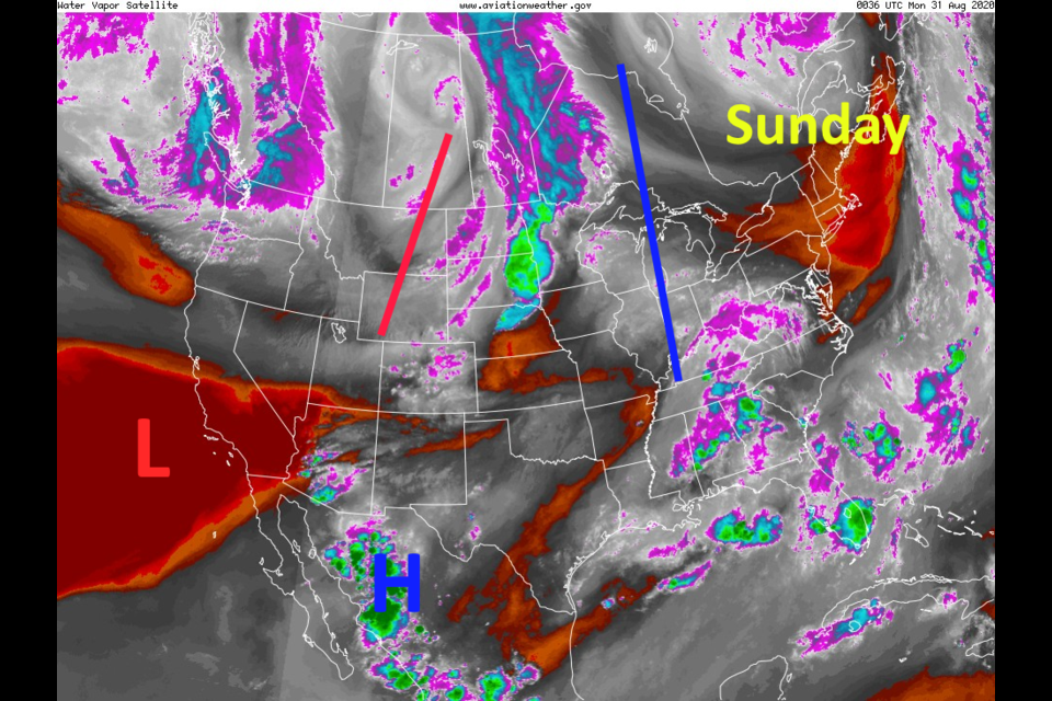
The water vapor satellite image (with 500mb height features drawn on top) shows a weak trough passing Sunday and moderate moisture levels in the atmosphere over Colorado - Figure 1.
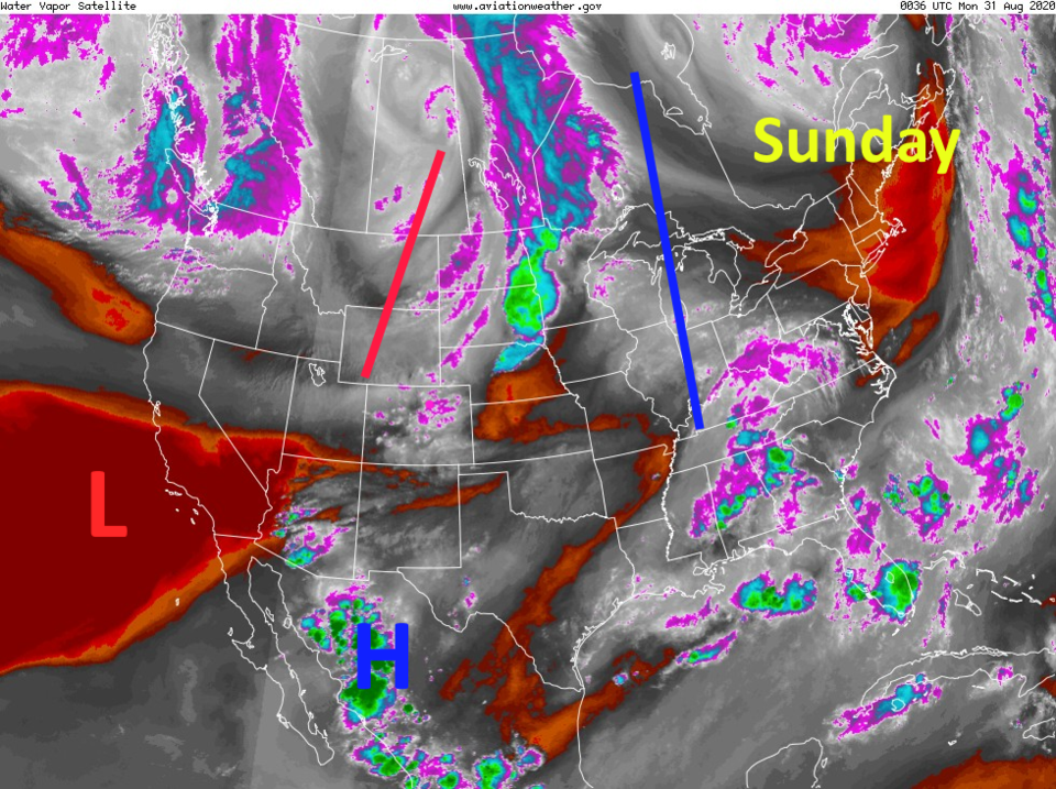 Figure 1: the water vapor satellite image from Sunday PM and NOAA
The great news is the (previously mentioned) "progressive pattern" is underway. Troughs and ridges are on the move bringing us shots of cool air. Figure 2 shows the trough passing Tuesday. This trough is powering the (dry) cold front Monday morning. I'm not showing the precipitation map because so little precipitation is expected. We "may" see a trace to a few 100ths of an inch or water with this first change in the weather.
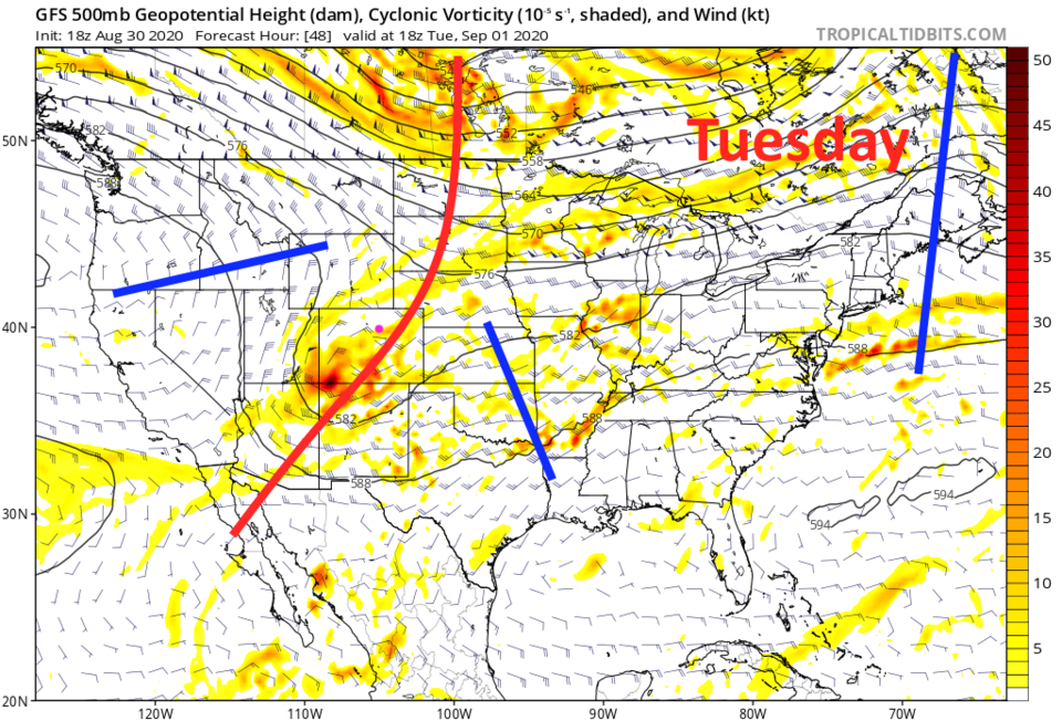 Figure 2: the 500mb upper air forecast for Tuesday from the GFS and tropicaltidbits.com
We still have smoke feeding into the state, mainly from the California wildfires (Figure 3 - Monday and Figure 4 - Tuesday below). A higher moisture content in our atmosphere and cooler temperatures have calmed our local fires for now. It is interesting, in Figure 4, to see the low pressure system (now approaching Colorado) and its cold and warm fronts (added) interacting with the smoke pattern.
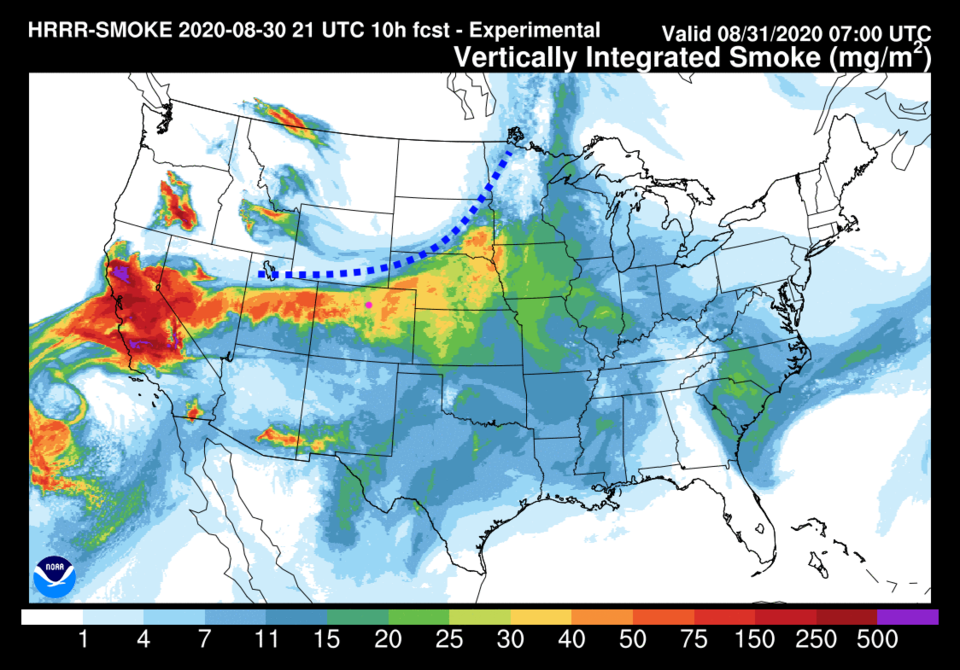 Figure 3: the HRRR smoke at all levels forecast for Monday morning from NOAA
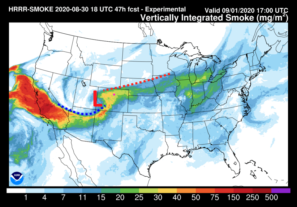 Figure 4: the HRRR smoke at all levels forecast for Tuesday midday from NOAA
Expect small precipitation chances Monday night into Tuesday morning with temperatures in the upper 70's. Even with some smoke around, this will feel GREAT!
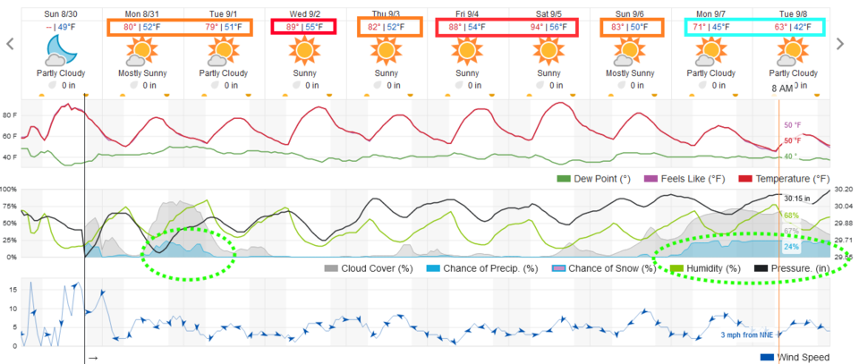 Figure 5: the 10 day graphical forecast for Longmont from weatherunderground.com
The Longer Range Forecast:
Troughs will be replaced by ridges, which will then be replaced by troughs again. We could rack up another 90F+ day on Wednesday and again Friday/Saturday (Figure 5). Notice that Thursday and Sunday will feature comfortable highs in the lower 80'sF on the other side of the "bounce."
An even stronger trough is showing up in the GFS modeling next Tuesday. This one brings cold air straight out of the north (Figure 6). The weatherunderground model in Figure 6 actually drops highs into the 60'sF and lows in the lower 40'sF!! You'll need to find your coats and hats again.
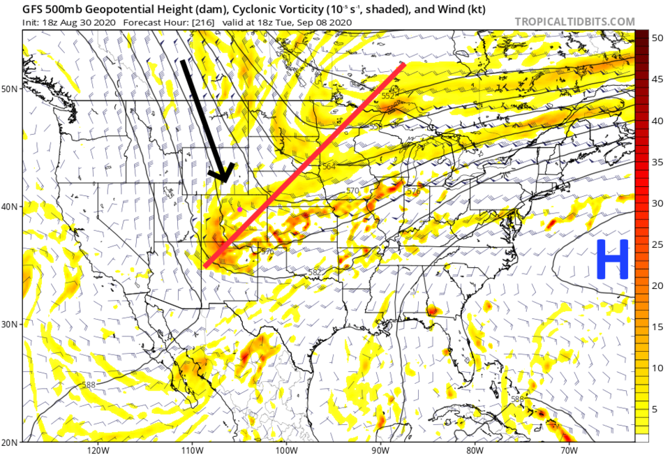 Figure 6: the 500mb upper air forecast for NEXT Tuesday from the GFS and tropicaltidbits.com
We are entering a new month. It is time to check in on what the NOAA outlooks are for September. Figure 7 shows they expect us to have a better chance of above normal heat for September.
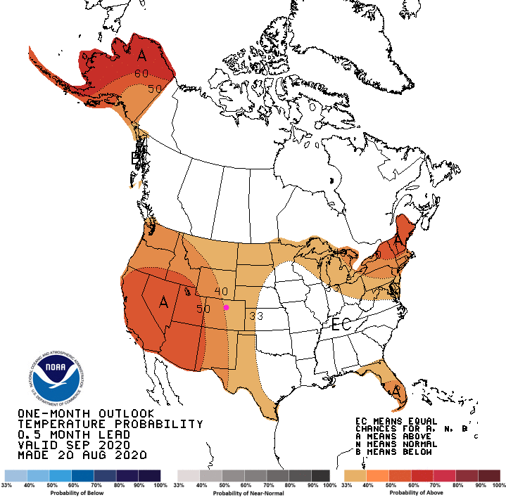 Figure 7: the temperature departure from normal chances from NOAA for most of September.
 As far as precipitation goes, NOAA is quite confident we will remain below average.
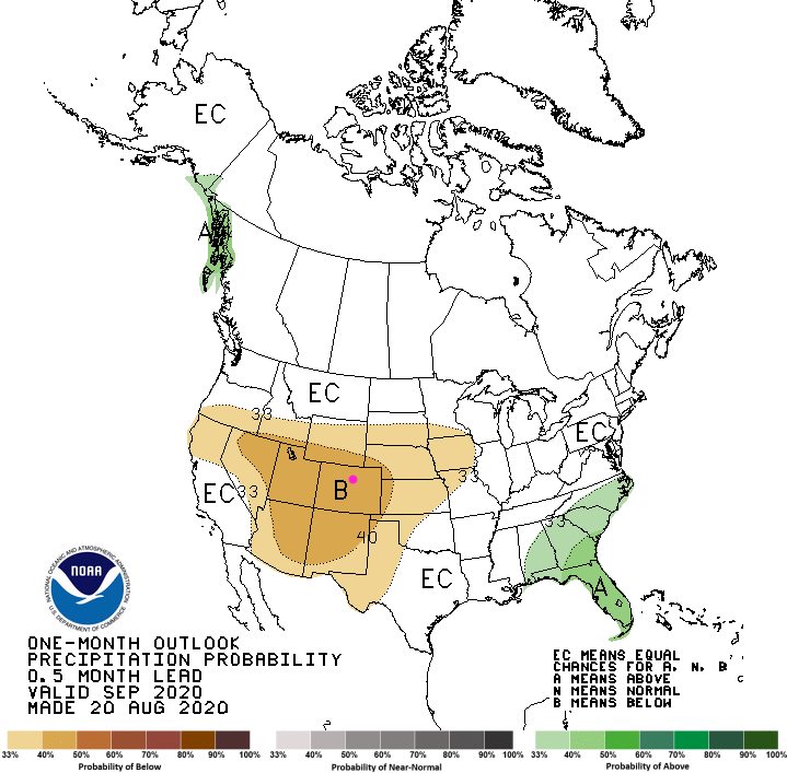 Figure 8: the precipitation departure from normal chances from NOAA for most of September.


