In Brief:
The high is back - the air is dry - hot and dry weather will hold for most of the next week.
Forecast Discussion:
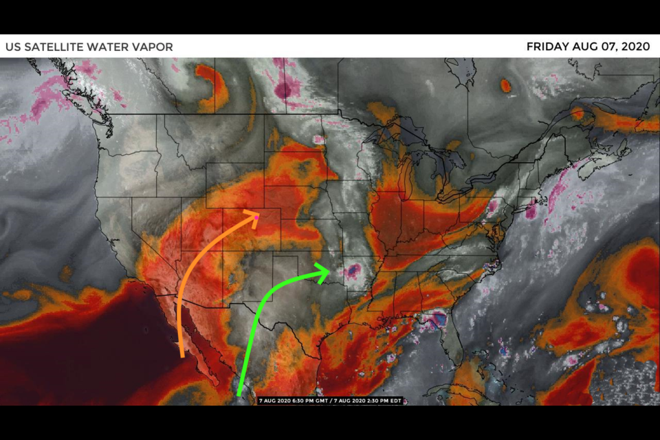
The ridge has shifted as predicted shuttling the moisture flow off to the east (see green line in Figure 1 in the gallery above). Dry air (red and orange colors and the orange arrow) is flowing across the state. There is a low off the west coast with a ridge to our east (Figure 2). Southwest flow across the state will warm air a bit more as it flows downslope off the Rockies. The weekend will see upper 90'sF weather again and dry conditions (Figure 3).
The Longer Range Forecast:
Over the next 5 days, rainfall will be very llight and confined to the far eastern and southeastern plains of Colorado (Figure 4). The only fly in our summer ointment will be a small shortwave approaching and passing the state Monday and Tuesday (Figure 5, wiggle in the black 500mb line over Colorado). We briefly cool to the upper 80'sF Monday and have a very small chance of thunderstorms those two afternoons (Figure 3).
This is the last 3 day post for my last summer vacation week.


