
In Brief:
A cool upper air low slowly pulls away this week allowing us to warm back to normal temperatures by the end of the weekend- but with no rain.
Forecast Discussion:
Let's look at the water we received. Figure 1 (below) shows the snowfall totals reported this morning. It snowed for more than 24 hours but the warm (hot) ground temperatures kept snow from building up. Still, Boulder reported 4-6 inches across town. Longmont piled up 1.5-2 inches (the very bottom of my forecast window). A chilled snow measurement plate might have saved 2-3X that depth.
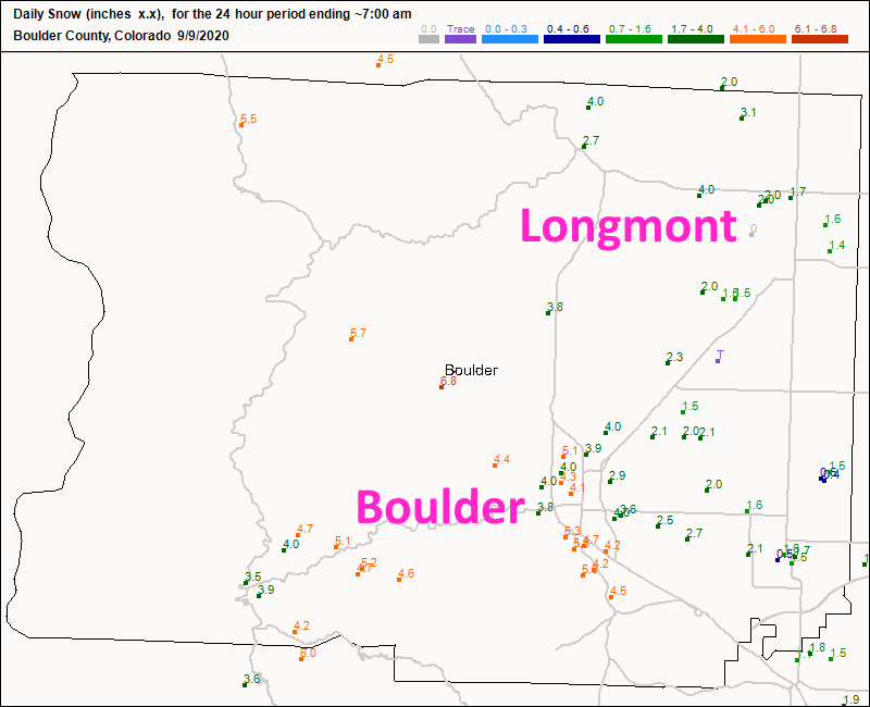 Figure 1: CoCoRaHS snow reports as of 7am Wednesday
The first day of the storm gave Boulder about 0.25-0.4 inch of water (Figure 2) and up to 1.25 inches of water on the second day (Figure 3). Total ~1.50"
Longmont received about 0.3 inch of water on the first day, and 0.5 to 0.75 inch of liquid on the second day. Total ~ 0.9"
The closest stations to the Cameron Peak fire seem to have received about 1 inch of liquid and 5-7 inches of snow.
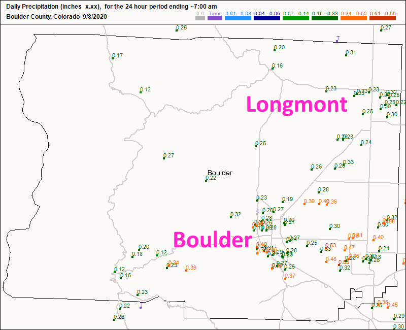 Figure 2: CoCoRaHS liquid precipitation reports as of 7am Tuesday
 Figure 3: CoCoRaHS liquid precipitation reports as of 7am Wednesday
The upper level low that changed our world is still sitting and spinning near the Four Corners area (Figure 4). This will take days to drift into Wyoming and away.
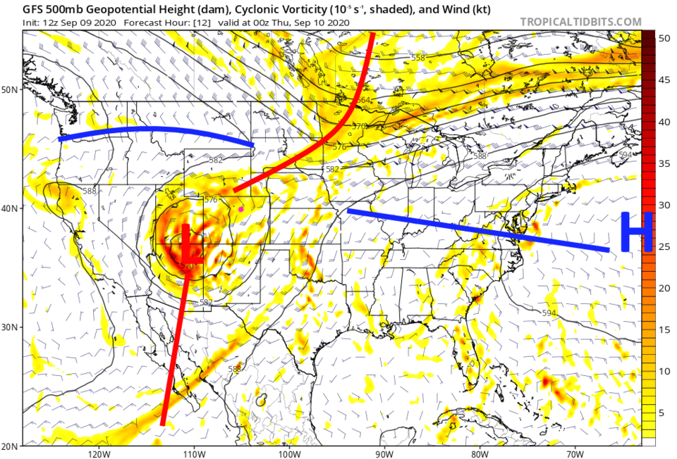 Figure 4: the Wednesday PM 500mb upper air forecast map from the GFS and tropicaltidbits.com
You can clearly see the swirl of moisture around the low in the water vapor satellite image in Figure 5. There are even thunderstorms ahead of the trough south of the low in Mexico and New Mexico.
 Figure 5: the water vapor satellite image from Wednesday PM and NOAA. With 500mb features added.
 The Colorado fires have calmed down a lot. There are no local smoke sources, though they are not out yet. The smoke on the west coast is terrible (Figure 6) but moving out to sea for now.
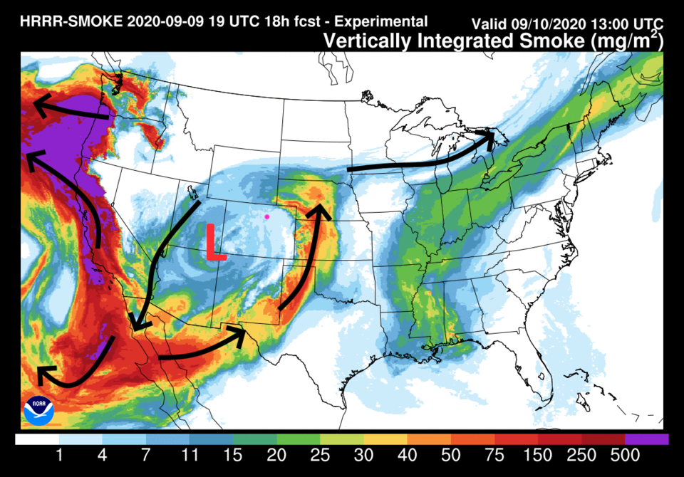 Figure 6: the HRRR smoke at all levels forecast for Thursday AM.
Temperatures will remain cool and the air, mostly, smoke free into the weekend.
The Longer Range Forecast:
Temperatures are around 80 F this weekend with sun and dry weather. If the smoke stays at bay, it will be a great weekend to be out and about.
The hottest weather over the next 10 days will come next Monday and Tuesday with a short-lived ridge passage (Figure 7). You can see a narrow ribbon of heat stretching from southern California up to the western Great Lakes (Figure 8).
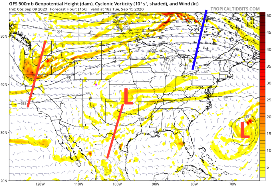 Figure 7: the Tuesday noon 500mb upper air forecast map from the GFS and tropicaltidbits.com
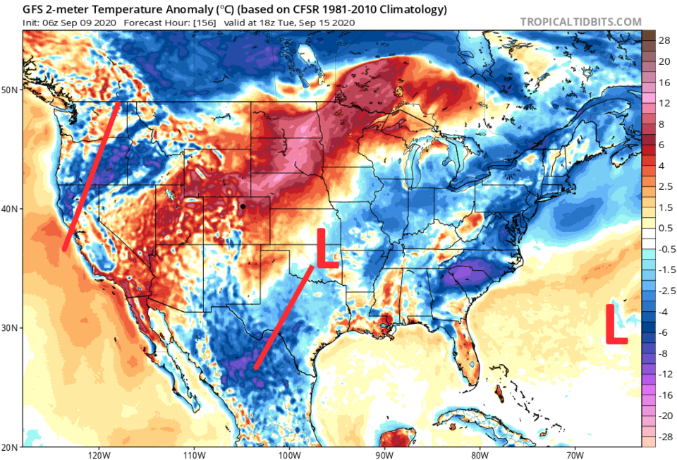 Figure 8: surface temperature anomaly forecast for Tuesday noon from the GFS and tropicaltidbits.com. With 500mb features added.
 In the extreme forecast for Friday, Sept. 18, the models are hinting at another cold front sliding down the Plains (Figure 9).
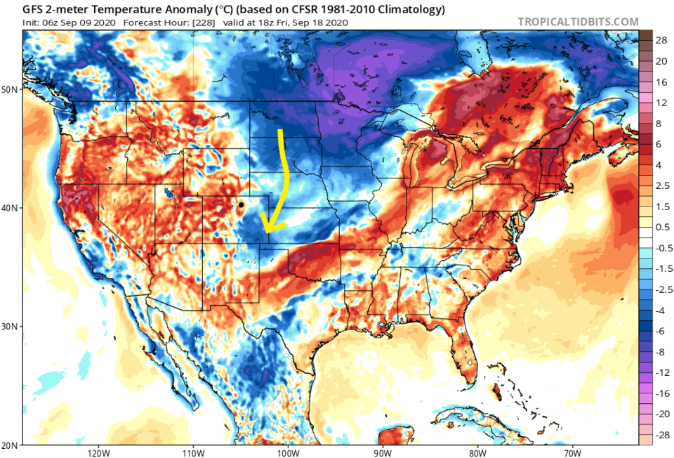 Figure 9: surface temperature anomaly forecast for NEXT Friday noon from the GFS and tropicaltidbits.com
A quick recap at the end: There are very small shower chances Thursday then it remains dry for the next 10 days (Figure 10). We don't return to normal temperatures until around Sunday or Monday. There will be no extreme heat in the forecast this week. Whew!
 Figure 10: the 10 day graphical forecast for Longmont from


