
In Brief:
Mild dry weather stretches through the week ahead with a short taste of summer Monday and Tuesday.
Forecast Discussion:
Our cool, wet, upper level cutoff low is beginning to drift to the northeast away from the state. For a day or two, we'll continue to have clean clear air flow into the state from the north (Figure 1 below). Eventually, that unbelievable mass of smoke out west will spread eastward again. For now, we can breathe easy.
 Figure 1: the HRRR smoke at all levels forecast valid Saturday morning from NOAA.
The weekend will be fantastic with a chill in the morning and gentle afternoon warmth. There will be no rain this weekend (Figure 2).
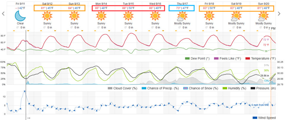 Figure 2: the 10 day graphical forecast from weatherunderground.com for Longmont, CO.
The Longer Rang Forecast:
We come out of the weekend to a brief return of the western ridge, but not to the extreme over the last month. (Figure 3)
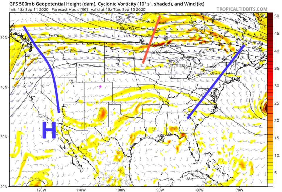 Figure 3: the 500mb upper air forecast map for Tuesday noon from the GFS and tropicaltidbits.com
This ridge will warm the western U.S. a few degrees above normal, including Colorado. Still, we may only break 90 F once this week (Figure 4 and Figure 2).
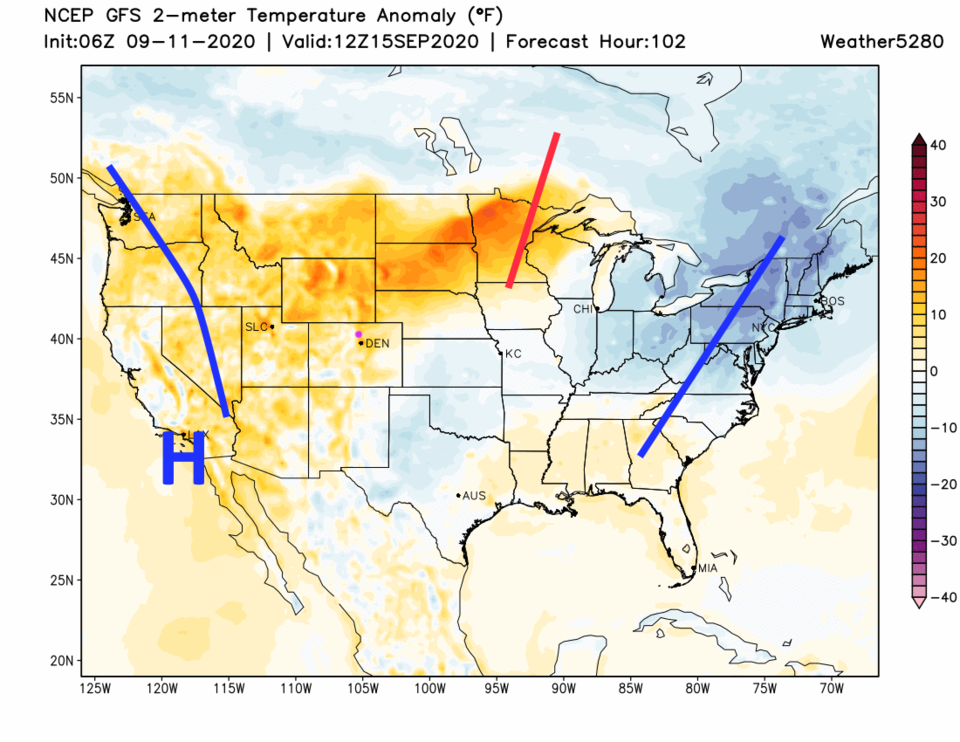 Figure 3: the temperature anomaly for Tuesday noon from the GFS and weather5280.com
Very little rainfall is expected across Colorado except in the mountains and on the far northeast plains (Figure 5). Enjoy this transition into fall.
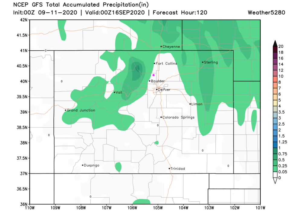 Figure 5: the accumulated precipitation over the next 5 days from the GFS and weather5280.com


