In Brief:
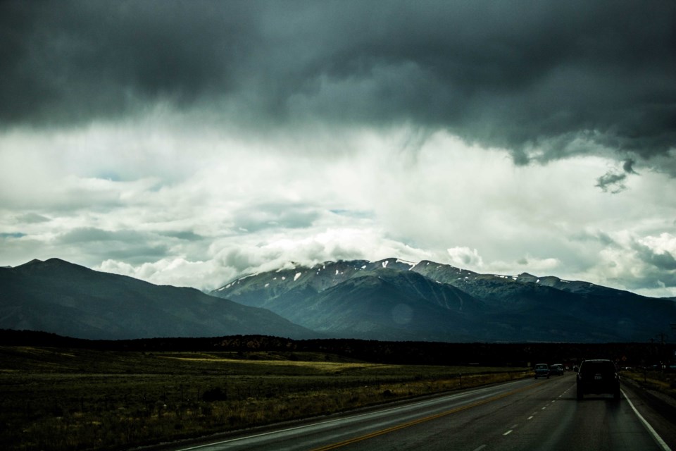
Troughs and ridges are on the move again giving us a dry, not-so-hot-all-the-time, week.
Forecast Discussion:
Our first taste of really cool weather has arrived with the trough that is now moving through Texas and Oklahoma (see Figure 1 below). The nasty high pressure center that dominated our summer has been pushed over to the west coast. This gives us a dry northwest flow over the top of the ridge and confines air over California to that part of the country (black arrows in this figure).
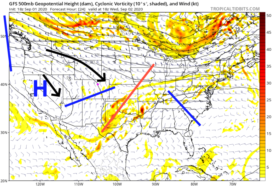 Figure 1: the 500mb upper air forecast for noon Wednesday from the GFS and tropicaltidbits.com
Moisture levels in Colorado are rapidly decreasing with air flow from the region north of the ridge (Figure 2).
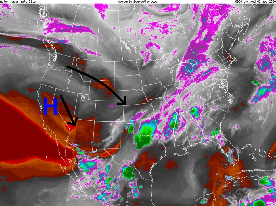 Figure 2: the water vapor satellite image from Tuesday evening and NOAA.
Cooler temperatures and higher humidities (with some light showers) really lowered the severity of fires in Colorado. Firefighters should be able to tame some portions of the ongoing fires. The northwest air flow and quieter fire activity means we'll be smoke free for a few days (Figure 3). Hurray!
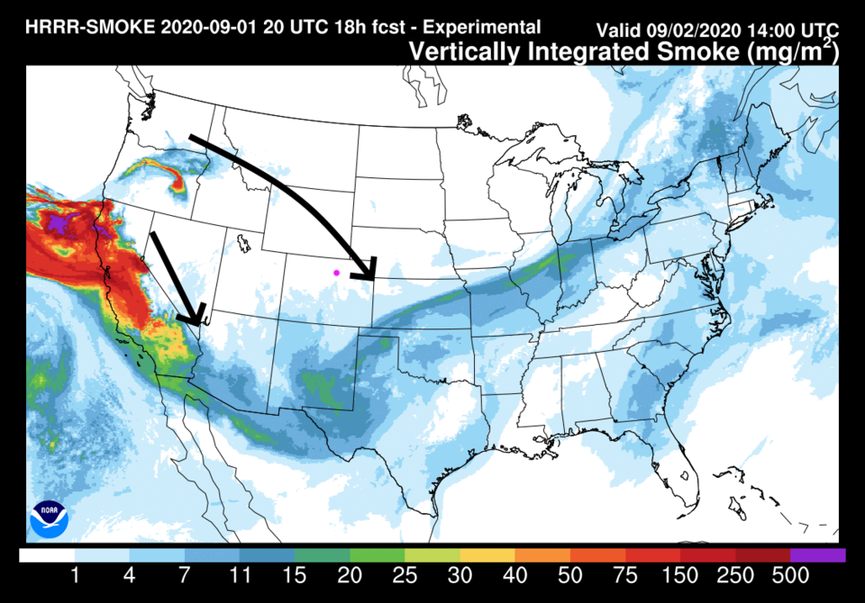 Figure 3: the HRRR smoke at all levels forecast for Tuesday night from NOAA
The Longer Range Forecast:
The ridge noses back on Wednesday and we almost break 90 F. Another trough grazes the state Thursday and we cool back to normal. The high returns for the weekend and we get reminded of what mid 90s F temperatures feel like (Figure 4). (As if you could forget...!)
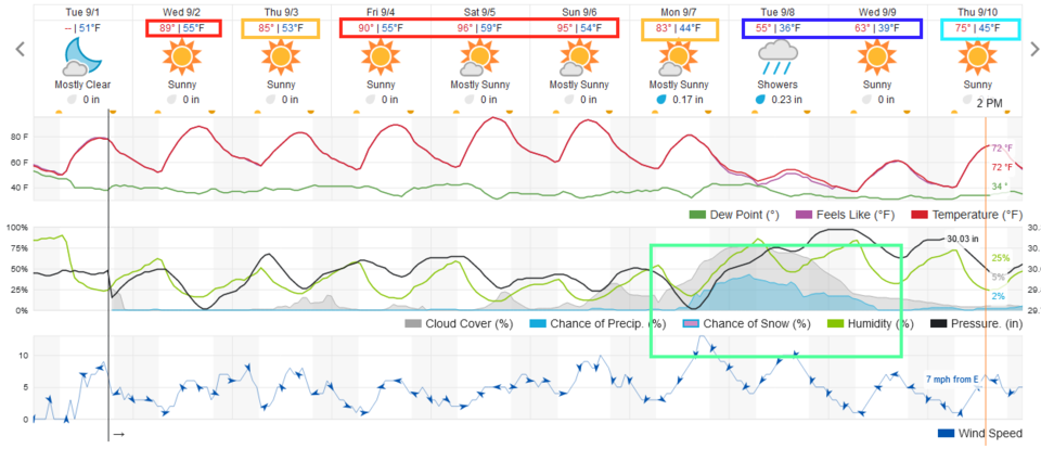 Figure 4: the 10 day graphical forecast for Longmont from weatherunderground.com
Figure 4 and 5 show that there is no rainfall expected for most of the state over the next five days.
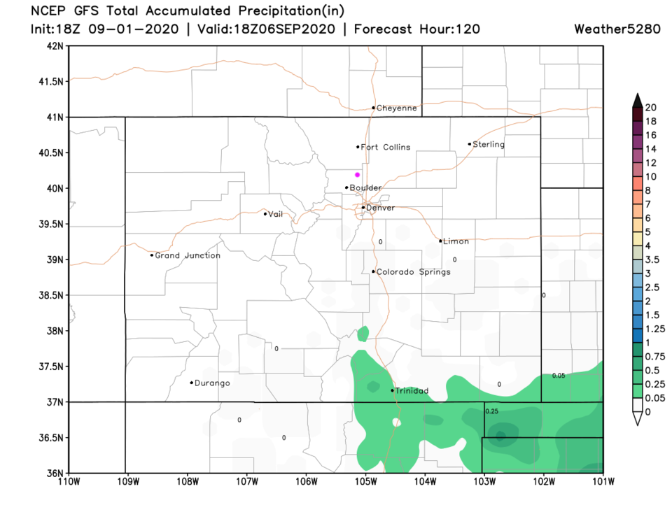 Figure 5: the 5 day precipitation accumulation map from the GFS and weather5280.com
Our next major weather change comes with a strong cold front Monday afternoon (Figure 4). It will bring a bit of up-slope rain to the Front Range Monday night through Wednesday morning (Figure 6).
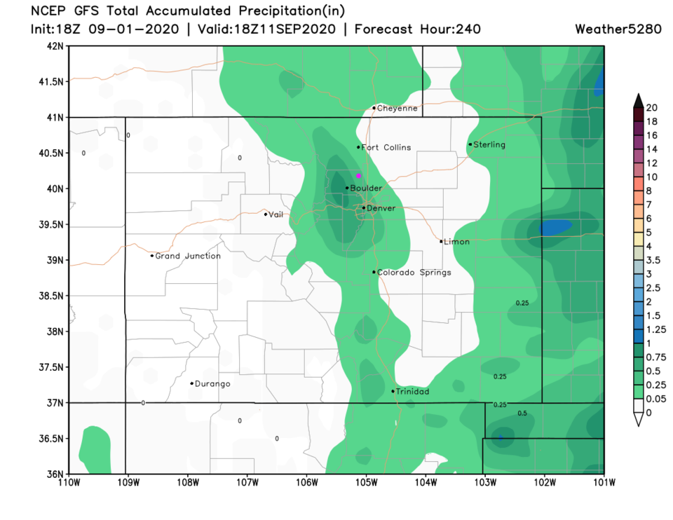 Figure 6: the 10 day precipitation accumulation map from the GFS and weather5280.com
The main story is: shockingly cold air will roar in behind this front. The weatherunderground.com model keeps highs down in the 50s F next Tuesday and gives us our first taste of low temperatures in the 30s Tuesday night (Figure 7) along I-25. Mountain communities will see their first freeze this season. This blob of cold air will be really impressive. You will need a coat.
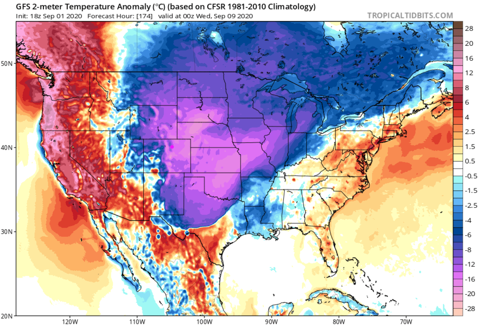 Figure 7: the surface temperature anomaly (departure from normal )forecast for next Tuesday evening from the GFS and tropicaltidbits.com


