In Brief:
Cooldowns visible in the future.
Forecast Discussion:
Happy First Day of Fall! Tuesday 9/22 7:30am!
A passing trough to the north is changing the wind direction a bit but is not shaving anything off our high temperatures. Winds are coming more directly from the west over the weekend into the start of next week (Figure 1 below). Ridge-based heating is being replaced with downslope flow heating from those westerly winds.
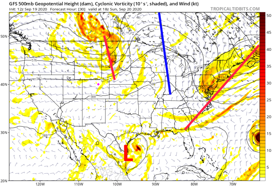 Figure 1: the 500mb forecast upper air map for Sunday noon from the GFS and tropicaltidbits.com
More smoke will arrive early in the week, but the trough is mixing in slightly cleaner air for Colorado in the short term (Figure 2). You might see the mountains and some blue sky.
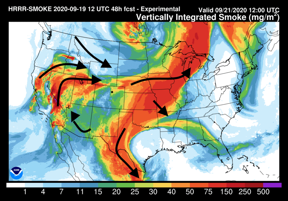 Figure 2: the HRRR smoke at all levels forecast for Monday morning from NOAA.
The atmosphere is still very dry at the lower levels and high pressure is in control. We will see no rain and mid- to upper- 80 degree temperatures into Monday (Figure 3).
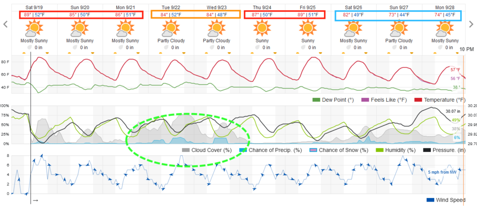 Figure 3: the graphical forecast for the next 10 days for Longmont from weathereunderground.com
The longer-range forecast:
Another trough passes the state Tuesday/Wednesday. This one will cool highs to the lower 80s (maybe upper 70s — the weatherunderground.com model has a warm-bias at times). This trough will bring some more moisture with it (Figure 4). Note: Fall begins Tuesday at 7:30 a.m. MST.
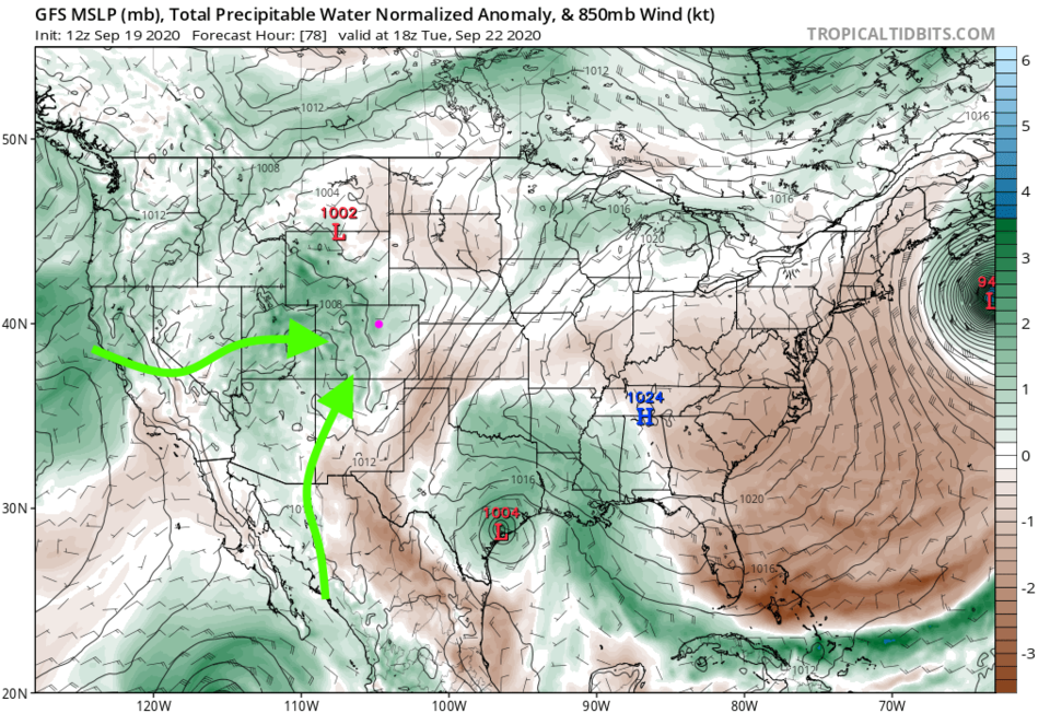 Figure 4: the precipitatable water anomaly forecast map for Tuesday noon from the GFS and tropicaltidbits.com
With this moisture and lift, we might see a bit of water across the state. Rainfall totals will be very light, even in the mountains (Figure 5).
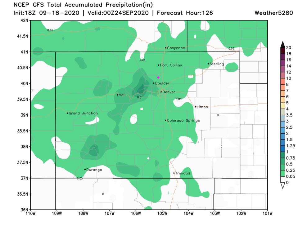 Figure 5: the total precipitation forecast from the GFS for the next 5 days and weather5280.com
After that trough, the big ridge returns yet again. Grrrrr. We'll push high temperatures close to 90 again at the end of the week (Figure 6). The high-pressure center is sitting right over Colorado on Friday.
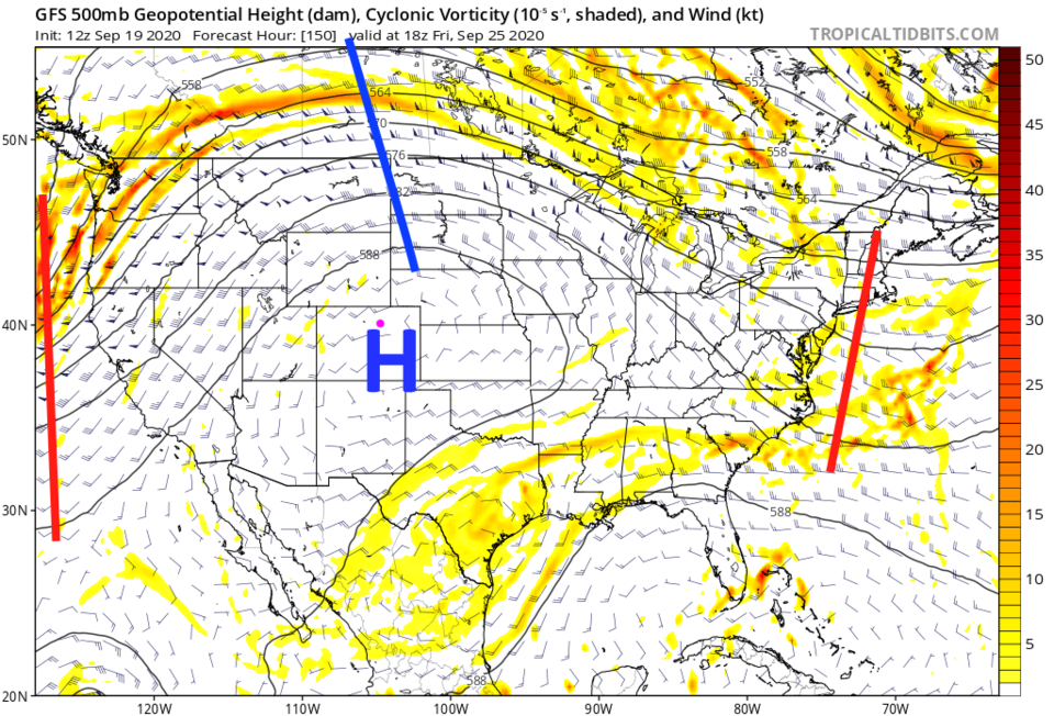 Figure 6: the 500mb forecast upper air map for Friday noon from the GFS and tropicaltidbits.com
A bit of HOPE!
Looking into the GFS crystal ball, I do see a cold front (there is no snow at lower elevations in the models yet) coming in with a powerful trough that cuts off (like our snowstorm system last week) next weekend. This certainly looks like a significant system (Figure 7).
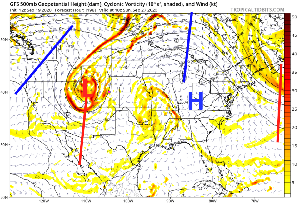 Figure 7: the 500mb forecast upper air map for NEXT Sunday noon from the GFS and tropicaltidbits.com
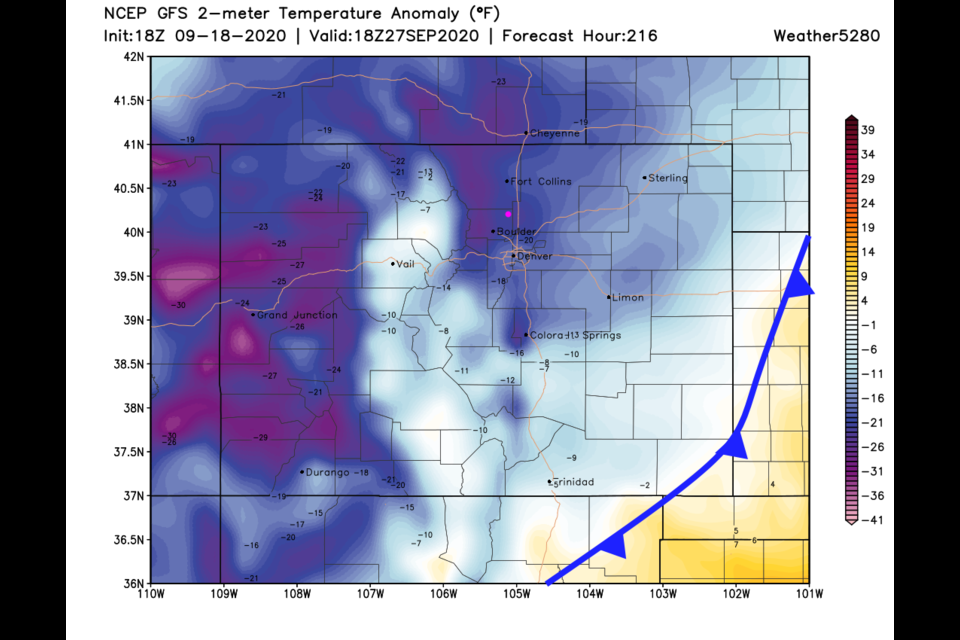
A cold front crosses the mountains Sunday morning (Figure 8) and blasts across most of Colorado by noon (Figure 9). This could be a fantasy created by the model (this is eight days away) but the GFS gives us 1.5 to 2 inches of rain with this storm (Figure 10). We'll see!
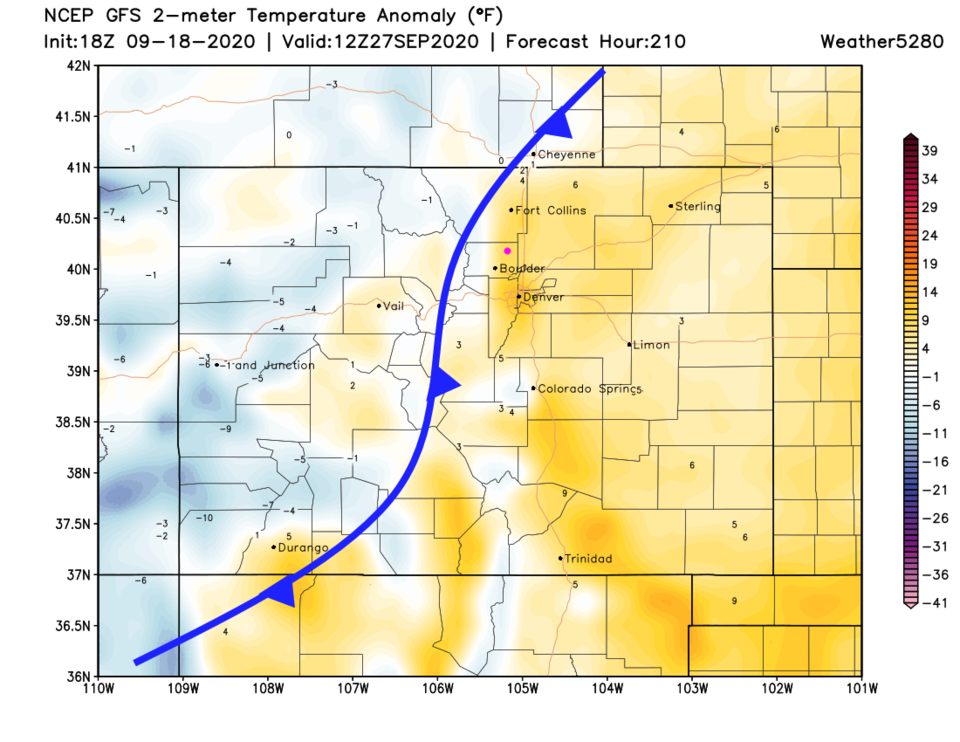 Figure 8: the surface temperature anomaly forecast for Colorado NEXT Sunday morning from the GFS and weather5280.com
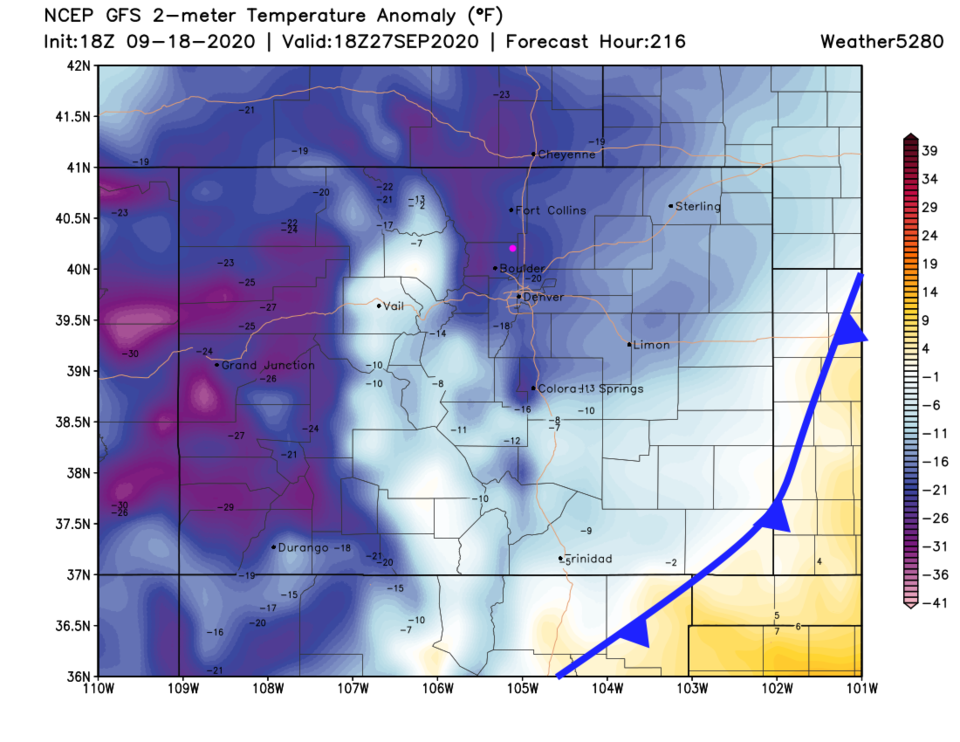 Figure 9: the surface temperature anomaly forecast for Colorado NEXT Sunday noon from the GFS and weather5280.com
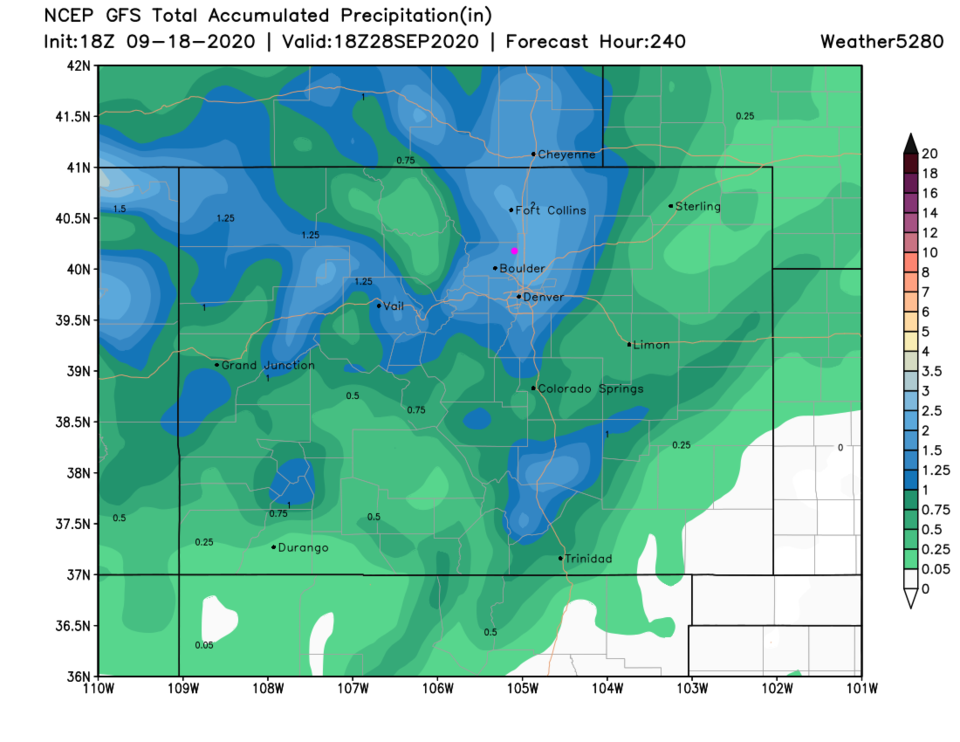 Figure 10: the total precipitation forecast from the GFS for the next 10 days and weather5280.com


