In Brief:
Heat and smoke are still in place into the start of the weekend, then a (now very dry) cool down extends into next week.
Forecast Discussion:
Welcome to the first day of Fall - starting at 7:30 am MT Tuesday.
More smoke (not as bad as it has been, overall) and more heat (not in the mid 90'sF or 100'sF anymore) continues through Friday. Winds across the U.S. are moving a bit quicker than they were 2-3 weeks ago. This faster flow is keeping the smoke more localized and keeps it moving across the country and off into the Atlantic (Figure 1 below). You can see the smoke from our local Cameron Peak fire becoming an issue again, especially over northern and northeastern Colorado. Notice the giant circulation around tropical system Beta (we ran out of proper names for tropical systems and have gone into the Greek alphabet).
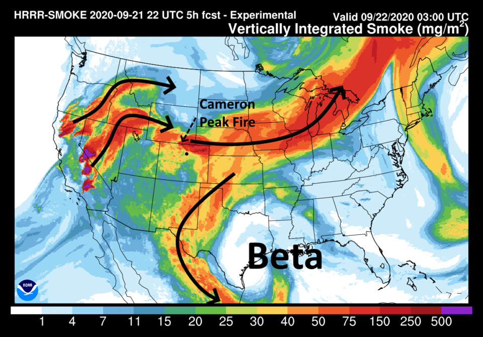 Figure 1: the HRRR smoke at all levels forecast map and wind arrows for Tuesday morning from NOAA
We are still sitting under that pesky western ridge (Figure 2) that is keeping us hot. Note, you can see hurricane Teddy passing the U.S. off in the Atlantic also in Figure 2.
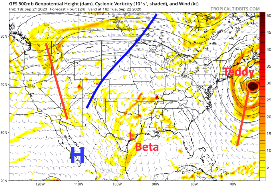 Figure 2: the 500mb upper air forecast map for Tuesday noon from the GFS and tropicaltidbits.com
By Wednesday, the smoke-train continues across the U.S. Longmont is sitting on the edge of sort-of clean air and very smoky air (depending on upper level flow and the activity level of the Cameron Peak fire - Figure 3).
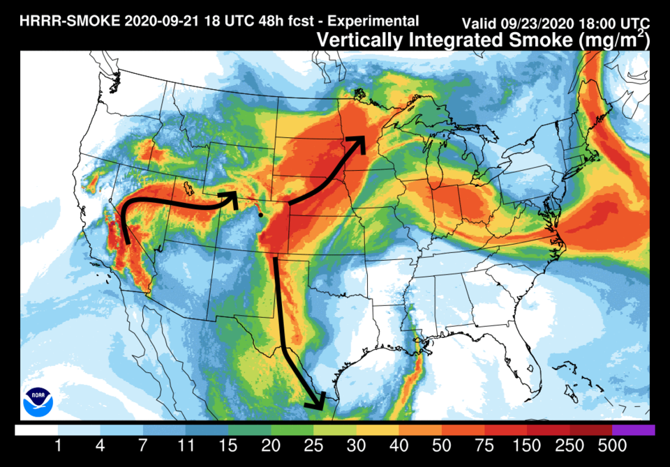 Figure 3: the HRRR smoke at all levels forecast map and wind arrows for Wednesday noon from NOAA
The trough visible in the west in Figure 2 may kick off a few afternoon weak thundershowers across western and central Colorado. Nothing severe is expected across the country except where Beta is effecting Texas and Louisiana (Figure 4).
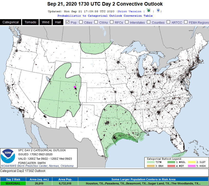 Figure 4: the SPC storm and severe storm forecast map for the U.S. for Tuesday.
 For the short term this week - high temperatures are going to keep hovering around 90F with very small chances of showers (Figure 5).
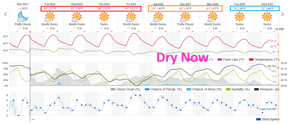 Figure 5: the 10 day graphical forecast for Longmont from weatherunderground.com
The Longer Range Forecast:
In the last forecast, I was showing a possible fantasy storm with a lot of rain and mountain snows on on Sunday. There is still a trough coming for the weekend that will start to cool us down (Figure 5 and 6), but the big storm has completely evaporated. It is gone from the models. I'm sorry - it was exciting there for a bit.
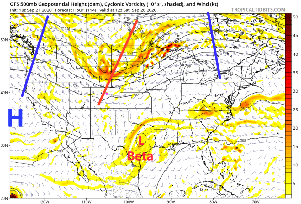 Figure 6: the 500mb upper air forecast map for Saturday noon from the GFS and tropicaltidbits.com
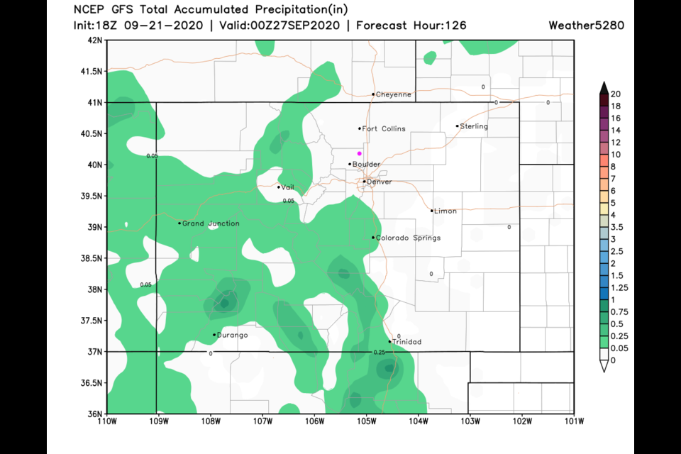
Over the next five days - we see virtually no rainfall at all (Figure 7).
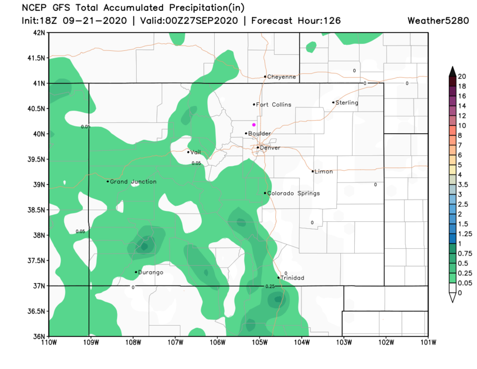 Figure 7: the total precipitation forecast map for Colorado from the GFS for the next 5 days from weather5280.com
Beyond the weekend, another trough slips by and sets up northwest flow aloft. This will cool us down even more next week (Figure 5 and Figure 8). But no additional rain is slated for the state on the GFS for the next 10 days (Figure 9).
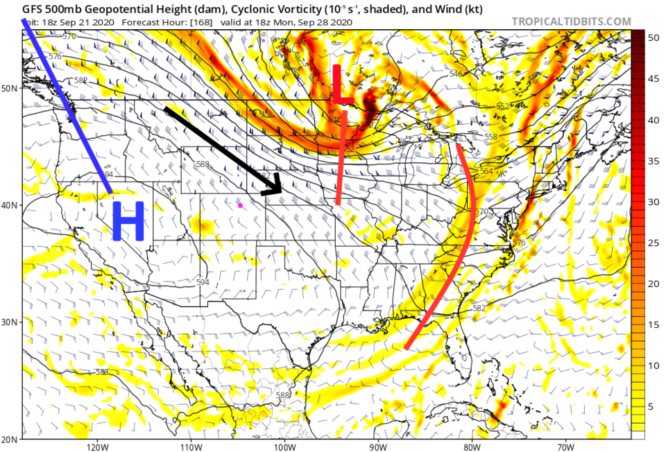 Figure 9: the 500mb upper air forecast map for Monday noon from the GFS and tropicaltidbits.com
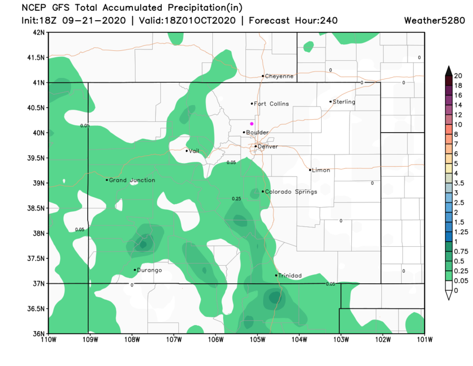 Figure 9: the total precipitation forecast map for Colorado from the GFS for the next 10 days from weather5280.com


