The video forecast for the week beginning Sept. 23
In brief:
Remarkable heat (with some smoke) remains the story through Friday with a two-step cooldown into next week.
Forecast discussion:
The ridge in the west just won't give up. It is centered over Arizona with the ridgeline draped across Colorado and into Canada (Figure 1 below). This is creating the much higher than normal temperatures for this time of year (it should be in the lower and mid-70s for highs).
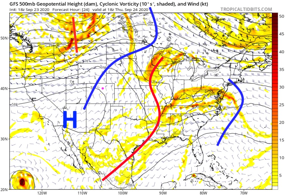 Figure 1: the 500mb upper air forecast map for Thursday noon from the GFS and tropicaltidbits.com
Smoke is still an issue. Thankfully, the Colorado fires are not burning as intensely as they have recently. Winds will remain light in the mountains through Thursday. Smoke levels are only somewhat bad (Figure 2).
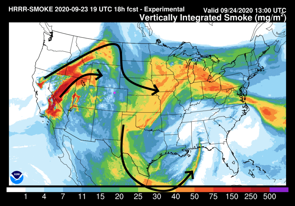 Figure 2: the HRRR smoke at all levels forecast for Thursday AM from NOAA.
Zeroing in on surface-level smoke (Figure 3), only moderate smoke levels should affect the air you breathe.
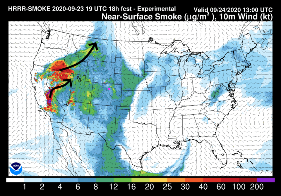 Figure 3: the HRRR smoke near the surface and wind barbs forecast for Thursday AM from NOAA.
High temperatures will keep approaching or exceeding 90 degrees through Friday (Figure 4). The ridge will keep precipitation out of the forecast.
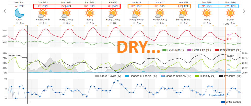 Figure 4: the 10 day graphical weather forecast for Longmont from weatherunderground.com
Longer-range forecast:
A trough to the east begins to push the ridge off to the west beginning this weekend. We will see temperatures drop about 10 degrees Saturday through Monday (Figure 4). Rain chances will still be nearly nonexistent. The 10-day precipitation forecast shows just light sprinkles up in the mountains (and that is mainly on days nine and 10 - Figure 5).
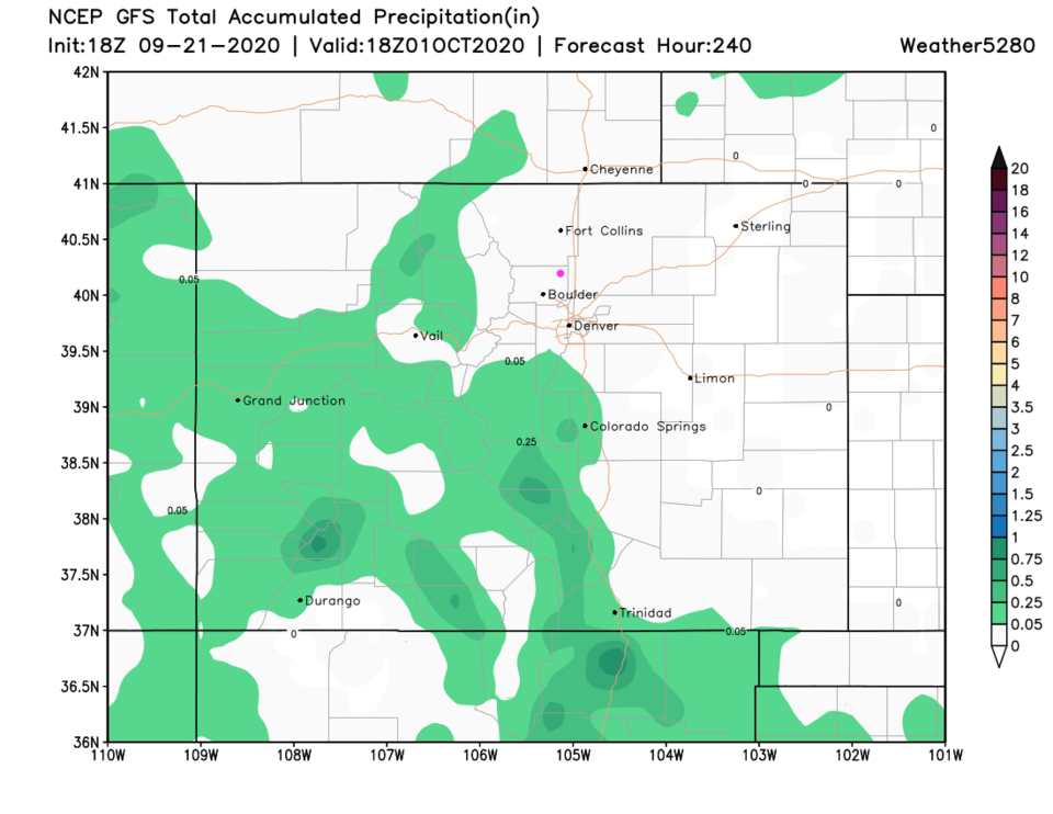 Figure 5: the 10 day precipitation totals forecast from the GFS and weather5280.com
By Tuesday, the ridge will inch a bit further west as that eastern U.S. trough expands (and really delivers a chill for more than half of the nation). This will bring in stout north winds that will clear the air and cool us down another 10 degrees to close-to-normal temperatures (Figures 4 and 6).
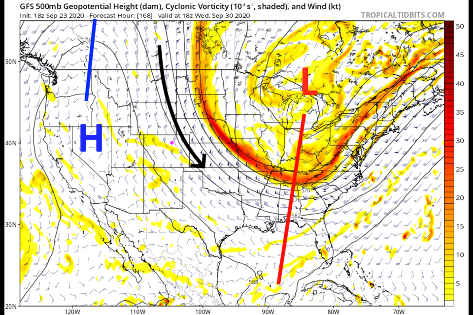
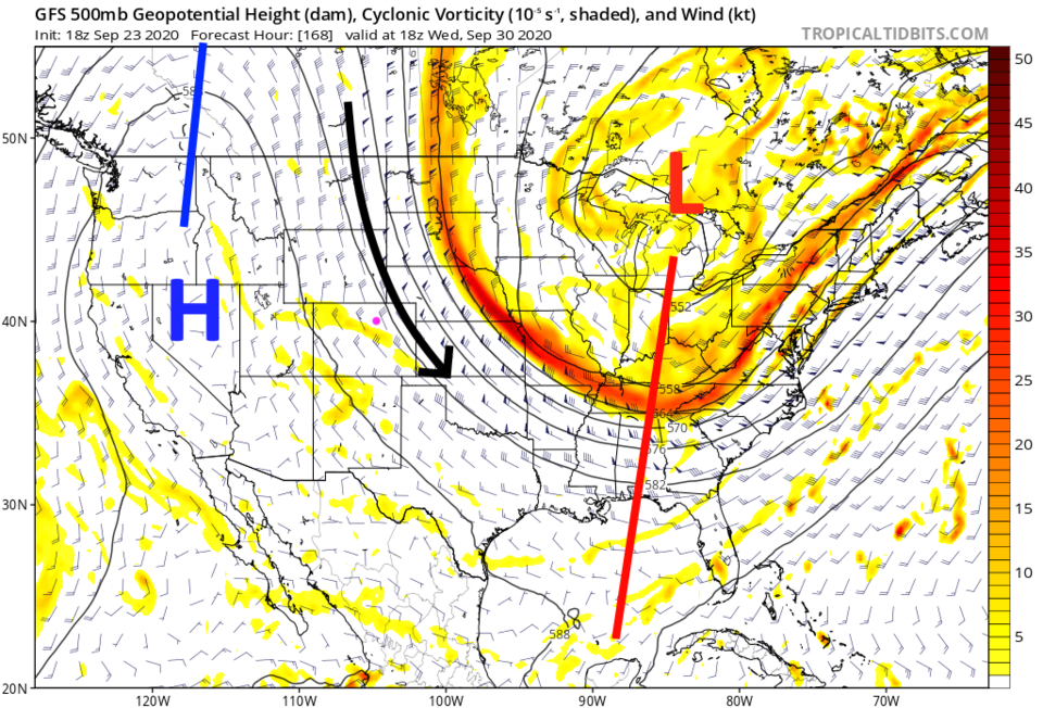 Figure 6: the 500mb upper air forecast map for next Wednesday noon from the GFS and tropicaltidbits.com

