In Brief:
Rain and snow have arrived and will continue through Wednesday late morning.
Forecast Discussion:
The NWS has issued a Freeze Warning and a Winter Storm Advisory for Longmont .
Take a deep breath of the cool and (mostly) clear air outside. The trough has arrived in the west (red lines in Figure 1 below) forming a cut-off low (red "L") over the Arizona/Utah border.
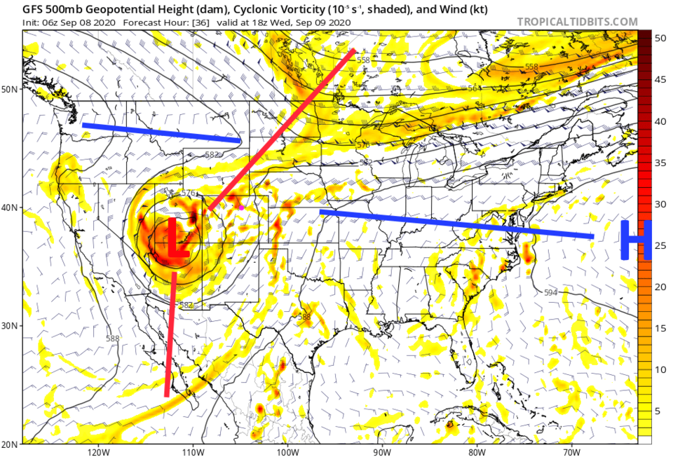 Figure 1: the 500mb upper air forecast map for noon Wednesday from the GFS and tropicaltidbits.com
Fires in the West and Colorado are ongoing, but clear air is being pulled into the circulation (black arrows in Figure 2). Precipitation is also helping to improve air quality.
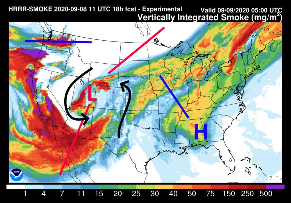 Figure 2: the HRRR smoke at all levels forecast for noon Wednesday from NOAA.
Much of eastern Boulder County has received 1/3rd of an inch of rain already (Figure 3). We are off to a great start.
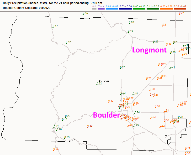 Figure 3: the CoCoRaHS precipitation report up to 7am Tuesday.
 Temperatures will remain in the 30's F Tuesday and barely get into the 40's F Wednesday. According to the weatherunderground model the best snow chances will continue through about 10 a.m. Wednesday (Figure 4).
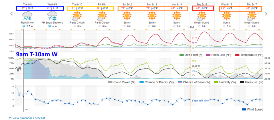 Figure 4: the 10 day graphical forecast for Longmont from weather5280.com.
The GFS (through the 7! Timer output) keeps the better snow chances continuing on to noon Wednesday (Figure 5). The models are in pretty good agreement concerning the duration of this snow event.
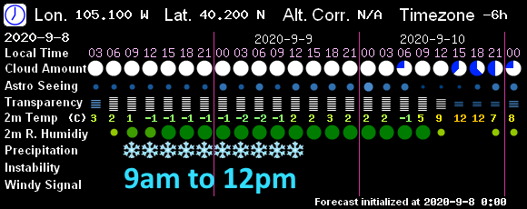 Figure 5: the 7! timer model graphical forecast (based on the GFS) showing sky conditions and precipitation.
 A lot of water is still coming from this storm, both as snow and rain. Longmont should still receive about an inch of additional liquid this week. The Cameron Peak fire region should get about 1 to 1.5 inches of water. Note that southern counties, where drought conditions are significant, could see 3-4 inches of water.
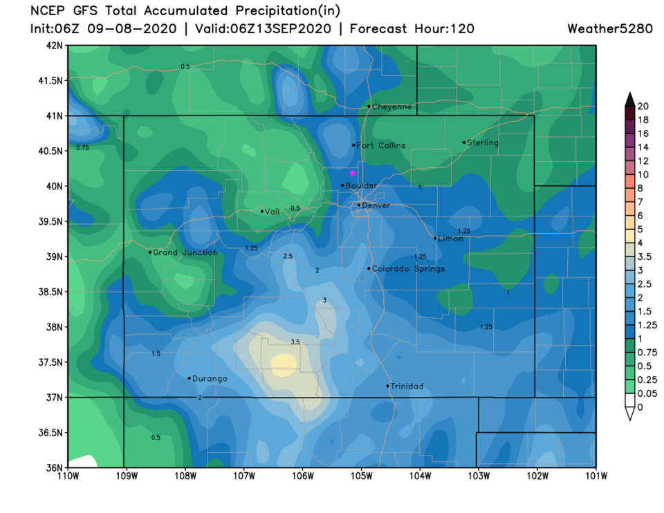 Figure 6: the total precipitation forecast from the GFS over the next 5 days and weather5280.com
Snowfall Roundup:
The Weatherunderground.com (Figure 4) model: 2-3 inches.
The GFS (Figure 7): 4-6 inches.
The NAM (Figure 8) 5-7 inches.
The HRRR (up to 10pm Tuesday only - Figure 9): Tr-1 inch.
I'm still calling for 2-6 inches (accumulation mainly overnight Tuesday into Wednesday morning and mainly on grassy/cool surfaces).
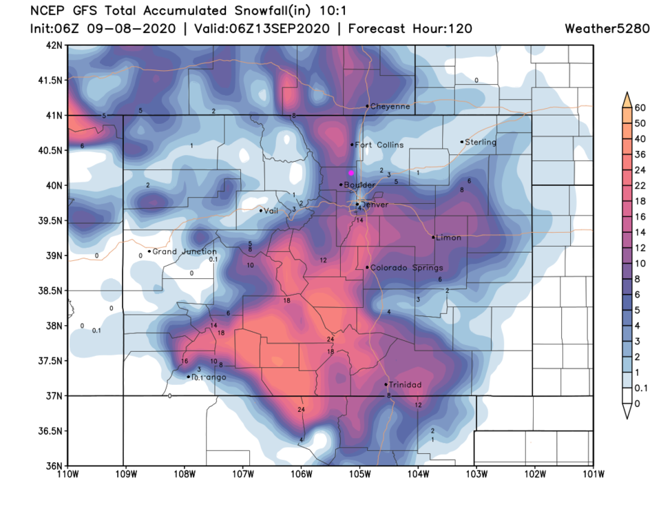 Figure 7: the total snow forecast from the GFS over the next 5 days and weather5280.com
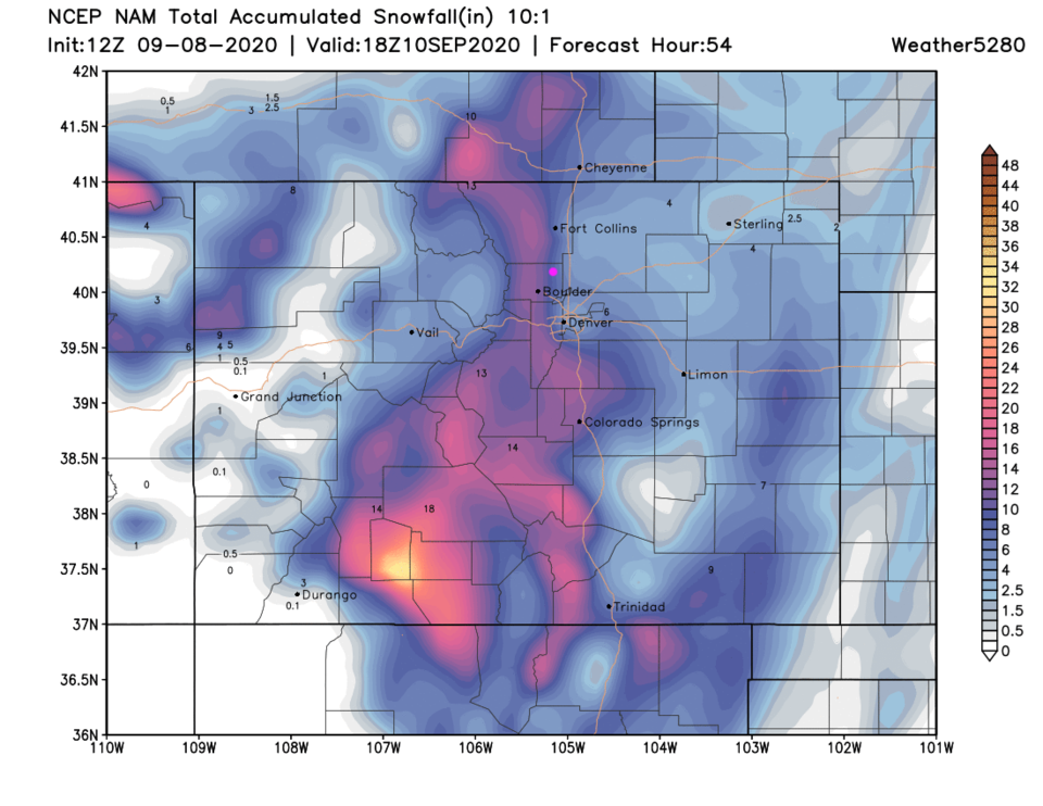 Figure 8: the total snow forecast from the NAM over the next 5 days and weather5280.com
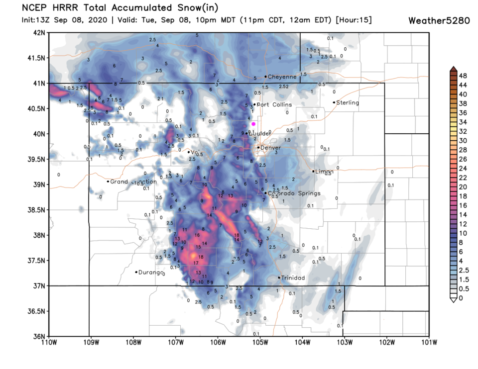 Figure 9: the total snow forecast from the HRRR over the next 15 hours and weather5280.com
The Longer Range Forecast:
The low will be slow to rejoin the jet stream. It will linger near Colorado through the end of the week. Temperatures will remain below normal and a small chance of showers will continue with cold air aloft (Figure 4). The weekend will be beautiful with highs in the 70's F and light breezes. Nice weather continues into next week as well.


