In brief:
Snowfall ended Monday night beginning a very slow warm-up over the next week with another long break in precipitation.
Forecast discussion:
I'll post the snowfall totals that fell after reports come in Tuesday morning, but Longmont seemed to have received 1 to 3 inches across town. There is a mean trough in the west now keeping us very chilly — about 15 degrees below normal. Moisture is far away, meaning that passing troughs won't kick off showers along Interstate 25 as they pass (Figure 1). Thankfully, there is no smoke to show from any fires in the U.S. currently (not shown).
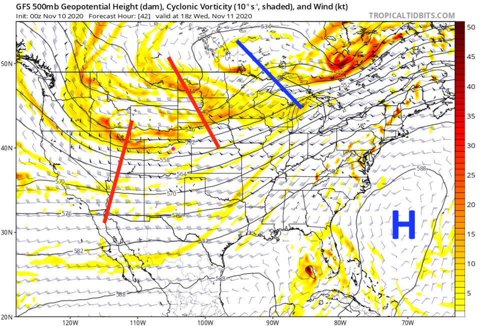 Figure 1: The 500mb upper air forecast map for Wednesday noon from the GFS and tropicaltidbits.com
Tuesday through Thursday we see 40s as highs and teens to 20 degrees as lows. Brrr. (Figure 2)
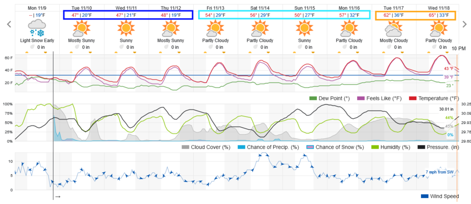 Figure 2: The 10 day graphical forecast from weather5280.com for Longmont, CO.
The longer-range forecast:
We step up to the 50s for the weekend as passing ridges get a touch stronger. At least the pattern is on the move again (Figure 3).
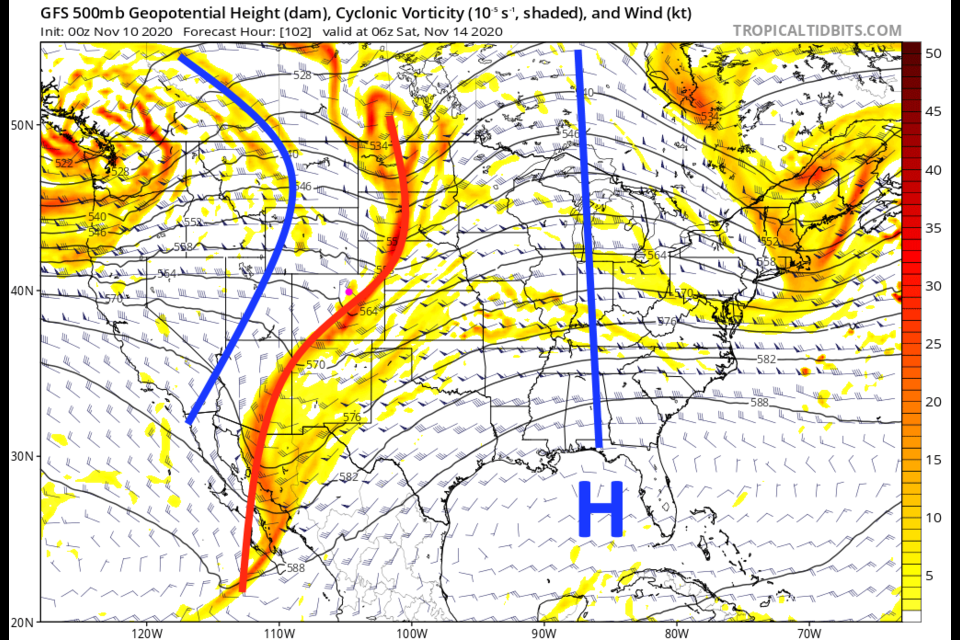
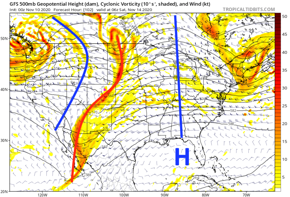 Figure 3: The 500mb upper air forecast map for Saturday morning from the GFS and tropicaltidbits.com
The departing precipitation Monday night is all that is showing up on the GFS forecast (snowfall Figure 4, precipitation Figure 5). Figure 3 shows things remaining dry into next week.
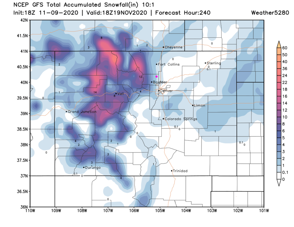 Figure 4: The 10-day snowfall total from the GFS and weather5280.com
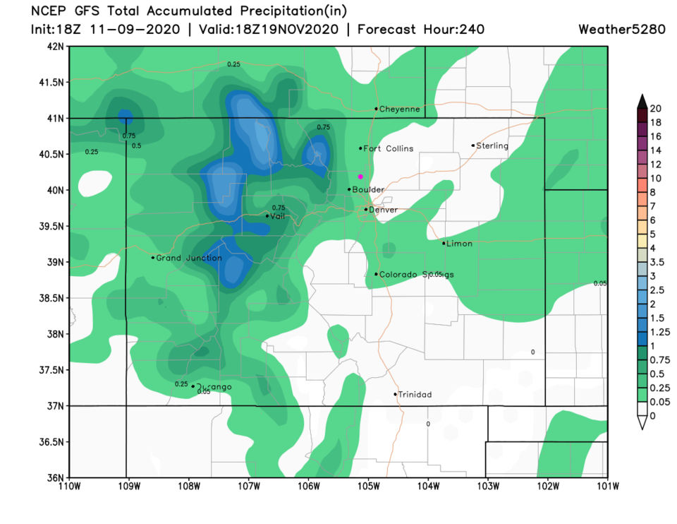 Figure 5: The 10-day precipitation total from the GFS and weather5280.com


