
This week's video forecast.
In brief:
Comfortable, almost early springlike weather turns to winter conditions Tuesday night and beyond.
Forecast discussion:
We'll start off with the graphical weather forecast this time (Figure 1 below). Very warm and dry conditions are in place due to a large ridge (blue line) that will slip slowly across the West (Figure 2).
 Figure 1: The 10-day graphical forecast from weatherunderground.com for Longmont.
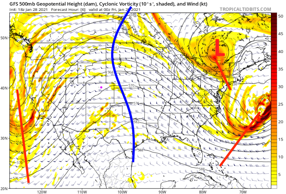 Figure 2: The 500mb upper air forecast map for Thursday PM from the GFS and tropicaltidbits.com
A big storm out west will weaken as it moves toward our state Saturday. It will spend its energy and dump its moisture on the western slopes of Colorado (Figure 3).
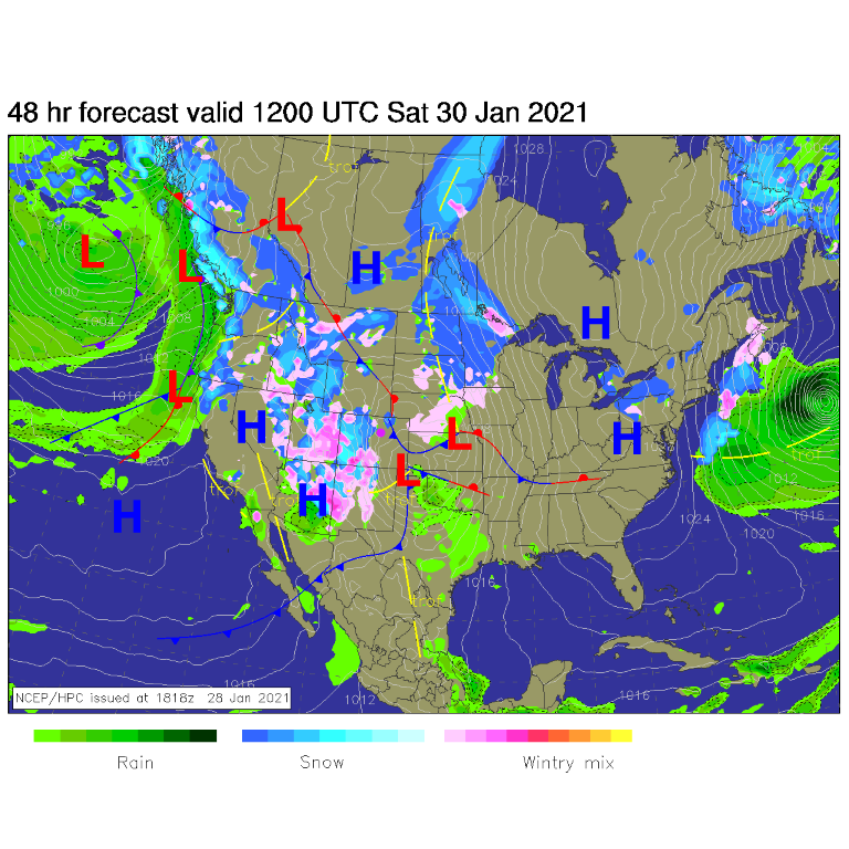 Figure 3: The surface forecast analysis for Wednesday PM from NCEP.
 From this, the GFS is showing some snow over western Colorado counties (Figure 4). It gives us a dusting, which could happen Saturday PM if some clouds and precipitation blow east of the mountains.
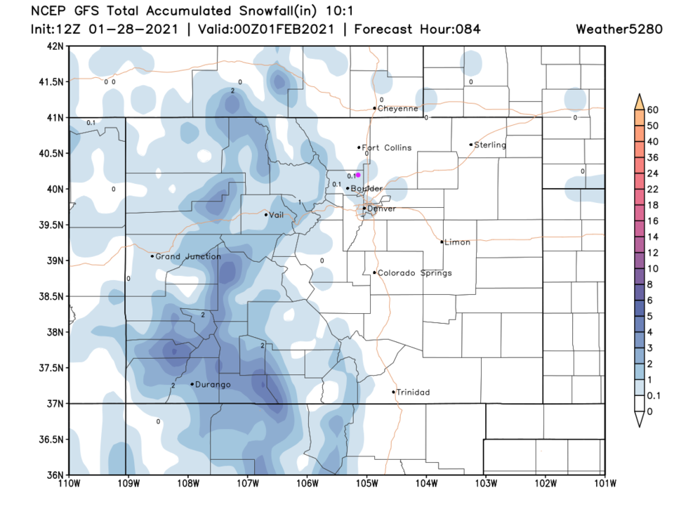 Figure 4: The 3.5-day (10:1 ratio) total snowfall forecast from the GFS and weather5280.com
The longer-range forecast:
A much bigger trough approaches the state starting Tuesday. By late Wednesday night, a fairly complex and deep trough dominates the U.S. (Figure 5). The 10-day snowfall forecast from this gives the mountains a foot or two of snow across wide areas and 2 to 3 inches in Longmont (Figure 6). Here's to hoping! It certainly is much colder the end of next week into the weekend.
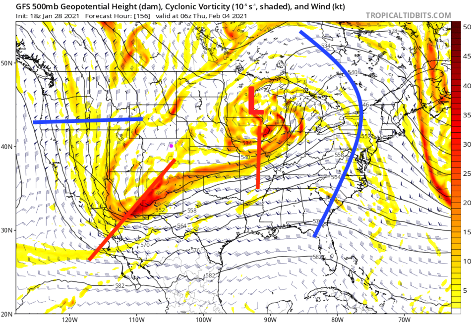 Figure 5: The 500mb upper air forecast map for late night next Wednesday from the GFS and tropicaltidbits.com
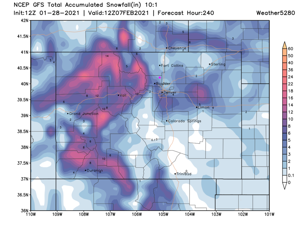 Figure 6: The 10-day (10:1 ratio) total snowfall forecast from the GFS and weather5280.com


