In brief:
Remarkable warmth returns this week (of course) followed by weekend cold rain and PM snows.
Forecast Discussion:
The giant ridge is back. It is November so we aren't seeing 100-degree highs, but we will be pushing 70 later in the week (figure below). Record highs are still in the mid-70s to 80 this week. We won't be setting records, thankfully.
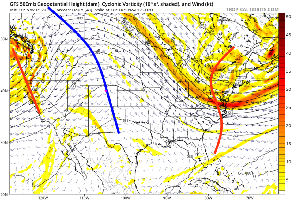 Figure 1: the 500mb upper air forecast map for Tuesday noon from the GFS and tropicaltidbits.com
We are bone dry through Friday midday with warm comfortable temperatures (Figure 2).
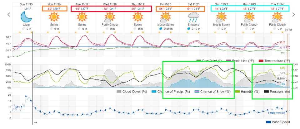 Figure 2: the 10 day graphical forecast from weather5280.com for Longmont, CO.
The longer-range forecast:
You can see in Figure 2, our next big front arrives late morning Friday with rain following soon after. This is powered by a large trough sweeping across the nation this weekend (Figure 3).
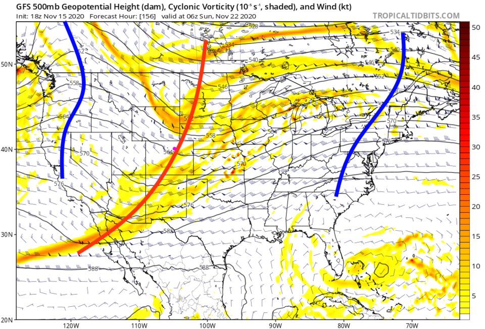 Figure 3: the 500mb upper air forecast map for early Sunday morning from the GFS and tropicaltidbits.com
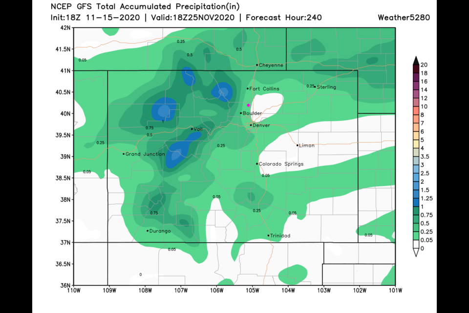
The 10-day snowfall (Figure 4) and total precipitation (melted plus rain Figure 5) show the snow remains mainly a mountain event with a foot to a foot and a half at the higher elevations. We may pick up a tenth of an inch of moisture by mid-next week (pre-Thanksgiving).
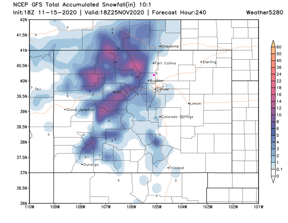 Figure 5: the 10-day snowfall (10:1 ratio) total from the GFS and weather5280.com
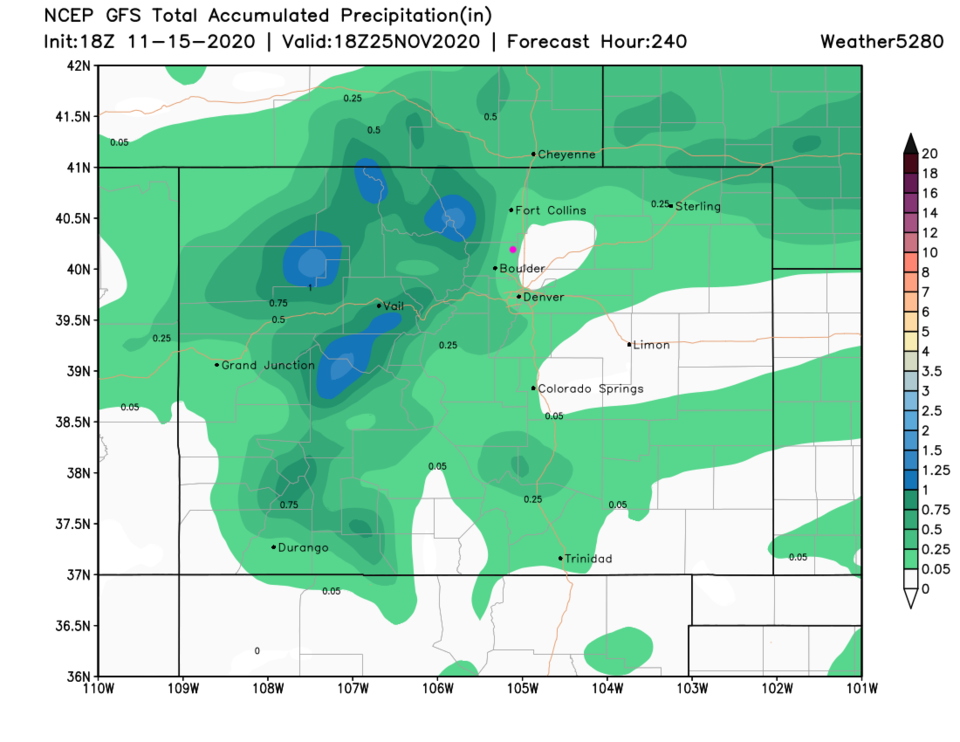 Figure 5: the 10-day precipitation total from the GFS and weather5280.com
Thanksgiving Crystal Ball forecast:
The GFS gave us a pre-Thanksgiving storm a few days ago, now it is giving us one arriving Thanksgiving night into Friday with another strong trough (Figure 6). This storm looks like it will be largely a regional upslope flow snowstorm (Figure 7). This is still way off in partial-fantasy-land. Don't bet money on it yet. Enjoy this week.
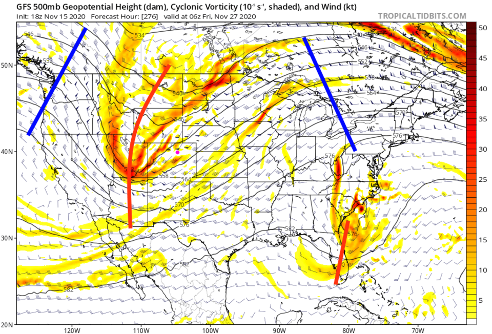 Figure 6: the 500mb upper air forecast map for early Friday morning after Thanksgiving from the GFS and tropicaltidbits.com
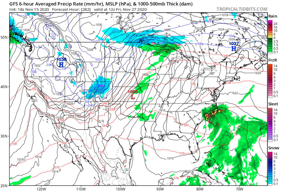 Figure 7: the 6 hour averaged precipitation around Thanksgiving evening/Friday AM from the GFS and tropicaltidbits.com


