
In Brief:
Spring-like weather holds strong until a vigorous cold front arrives Wednesday evening.
Forecast Discussion:
Surface high pressure dominates the Rockies early in the week (Figure 1) and remarkable warmth results (Figure 2).
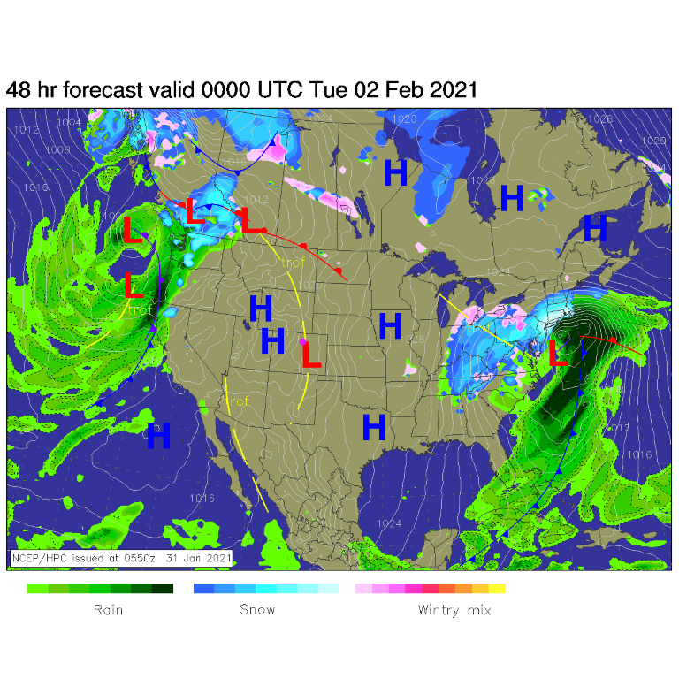 Figure 1: the surface forecast analysis for Monday PM from NCEP.
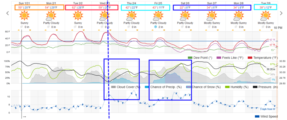 Figure 2: the 10 day graphical forecast from weatherunderground.com for Longmont, CO.
This warmth and the surface high pressure is created by a gigantic ridge spanning the hemisphere (Figure 3). Temperatures mid-week will be around 20 degrees above normal on the plains (Figure 4). Wow!
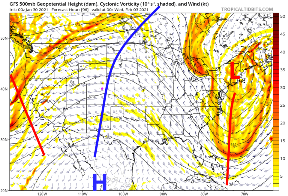 Figure 3: the 500mb upper air forecast map for Tuesday night from the GFS and tropicaltidbits.com
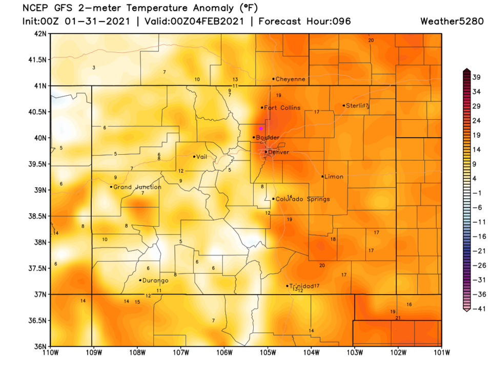 Figure 4: the temperature anomaly (departure from normal) for Wednesday from weather5280.com
The Longer Range Forecast:
Winter returns as that giant ridge is replaced by an equally large trough that will also span the hemisphere (Figure 5). By the weekend, temperatures will be around to 30 degrees below normal (Figure 6). This is going to be a memorable temperature swing. We will look at snowfall totals with better accuracy early in the week, but the forecast map (Figure 7) from the GFS shows the two periods of snow, Wednesday/Thursday and Friday/Saturday, possibly totaling to three to six inches around I-25.
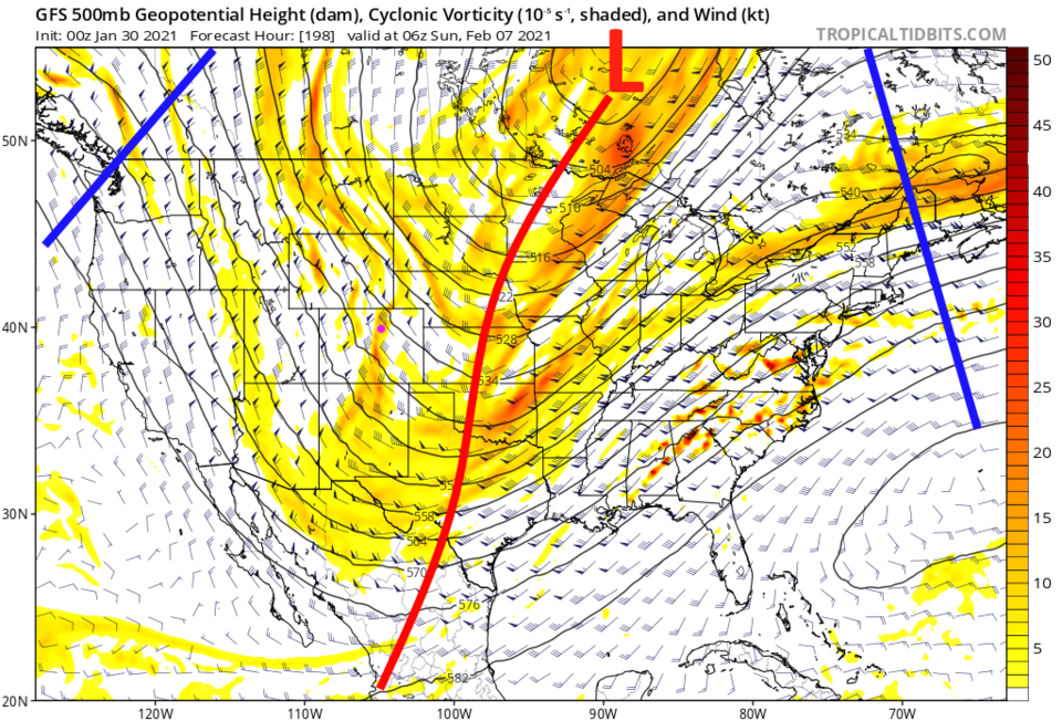 Figure 5: the 500mb upper air forecast map for late Saturday night from the GFS and tropicaltidbits.com
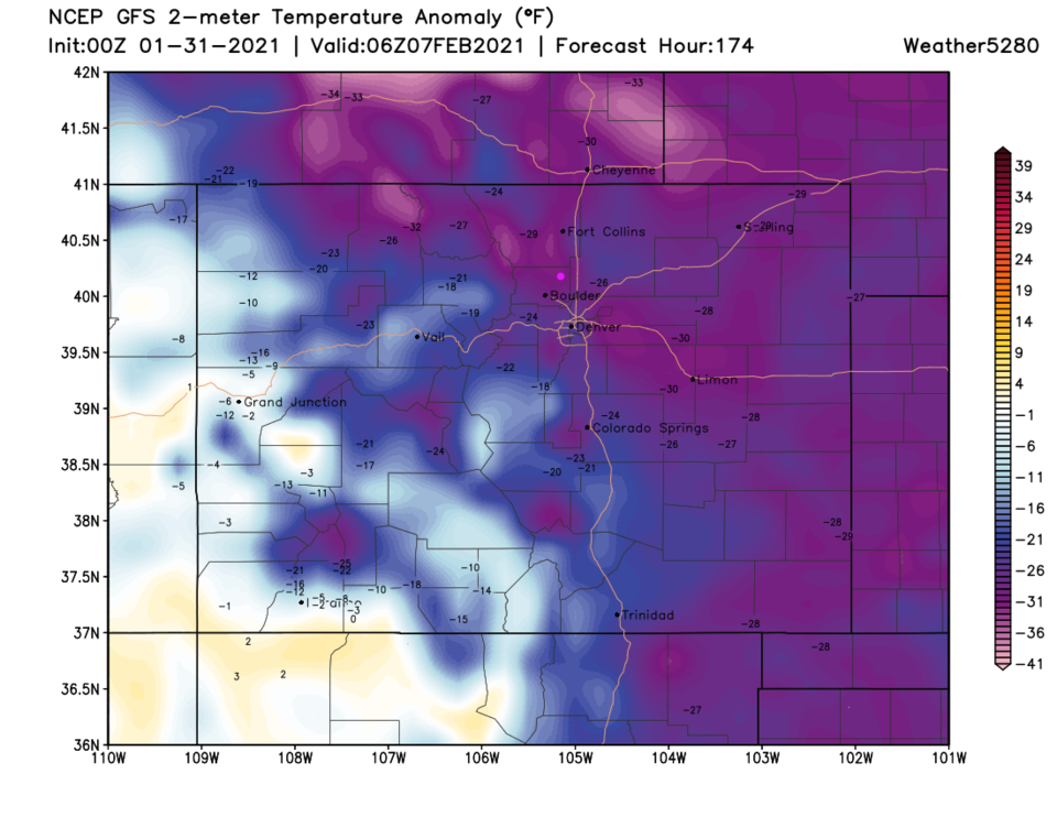 Figure 6: the temperature anomaly (departure from normal) for Saturday PM from weather5280.com
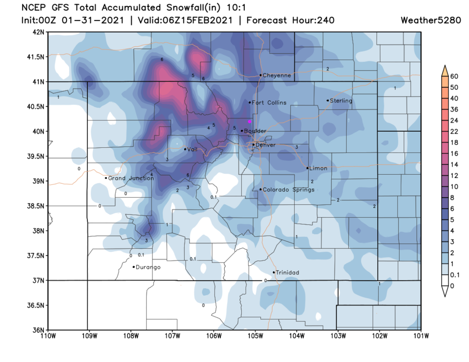 Figure 7: the 10 day (10:1 ratio) total snowfall forecast from the GFS and weather5280.com


