
This Week's Video Forecast
In brief:
Strong icy north winds Wednesday, suddenly warm again for Christmas.
Forecast discussion:
There is a high wind warning for the plains and foothills Tuesday PM through Wednesday afternoon. Tie down your exterior illuminations.
Our previous discussion gave us a small chance of precipitation Wednesday with this storm, but the front will now remain dry (a Bora style front — downslope, dry cold air). This front is being powered by a fast-moving sharp upper air trough (Figure 1 below).
 Figure 1: the 500mb upper air forecast map for Wednesday AM from the GFS and tropicaltidbits.com
Tuesday PM, the surface front was just sweeping across the state (Figure 2) with snow confined to the Western Slopes and higher elevations of Colorado.
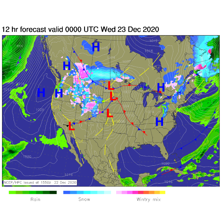 Figure 2: the forecast surface analysis for Tuesday PM from NCEP.
The winds will be very high on the plains and northern mountains starting Tuesday night through most of Wednesday — hence our high wind warning. Sustained northwest winds 30 to 45mph with gusts to 65 mph are possible between 6 p.m. Tuesday and 1 p.m. Wednesday.
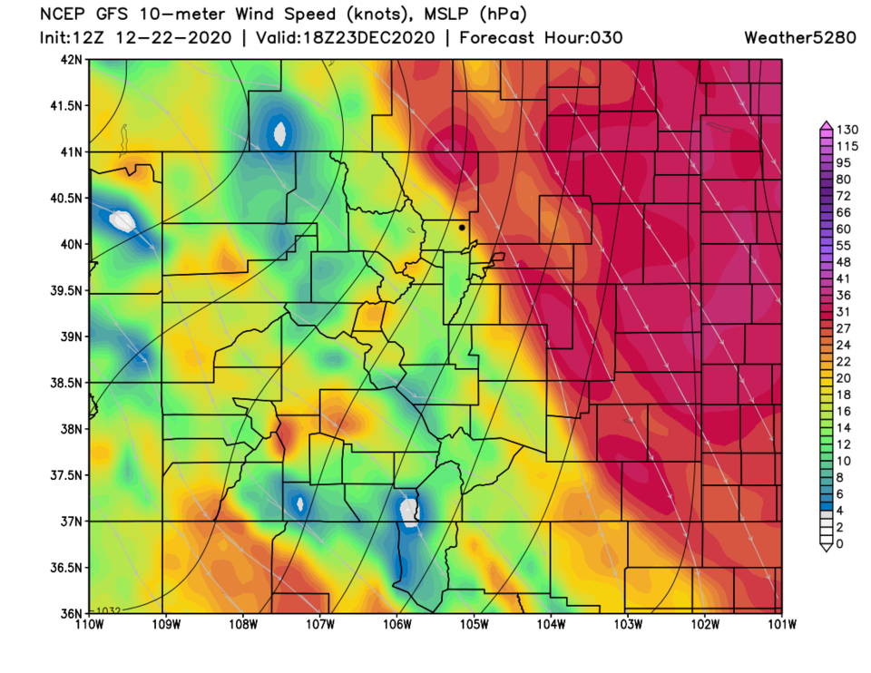 Figure 3: The 10 mph wind speeds around noon Wednesday from weathe5280.com and the GFS.
By Wednesday PM, the front will be making it to the Gulf Coast — that is some serious wind power (Figure 4).
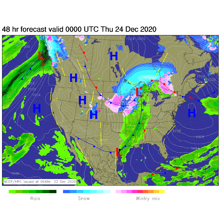 Figure 4: the forecast surface analysis for Wednesday PM from NCEP.
You can clearly see the front in the temperature anomaly map for Wednesday noon (Figure 5).
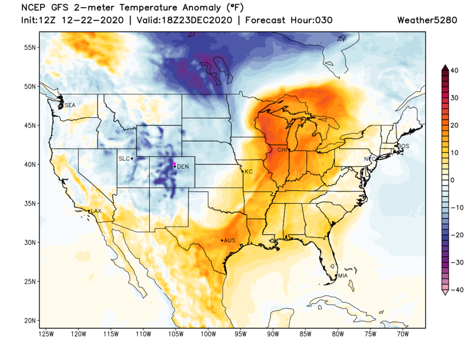 Figure 5: the temperature anomaly (departure from normal) for Wednesday from tropicaltidbits.com
The longer-range forecast:
Once the cold air stops moving in, the downslope will warm us quickly to nearly 50 degrees on Thursday (Christmas Eve Figure 6). Our next significant snow seems to come around Tuesday/Wednesday next week. A big cutoff low might give us real snow totals: 5 to 10 inches on the plains (Figure 7). That is far in the future and can certainly fizzle out of our forecast. (See my note at the bottom, I'm taking Christmas Day off).
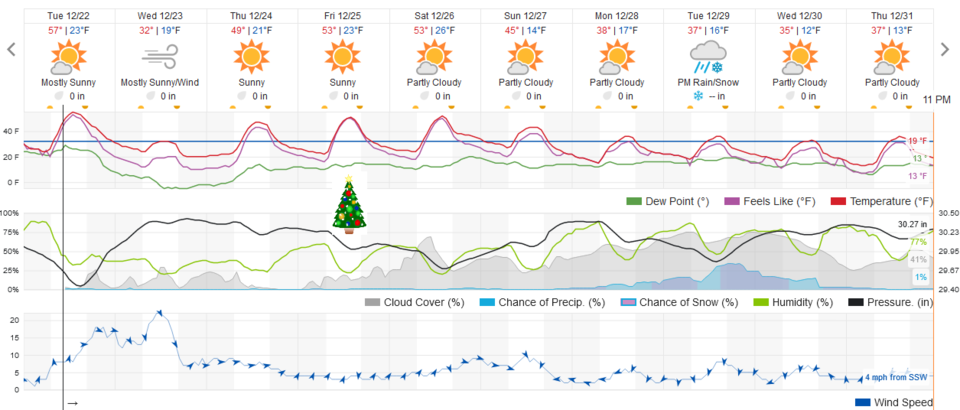 Figure 6: the 10-day graphical forecast from weather5280.com for Longmont, CO.
Christmas Day forecast:
It will be mild with light winds from the southwest with a high in the lower 50s and lows in the mid 20s. There will be a few clouds around.
 Figure 7: the 10-day (10:1 ratio) total snowfall forecast from the GFS and weather5280.com
Note: Unless something crops up, I'm going to take an extra day off for Christmas and return the day after. We should have a good idea what the New Year's storm may do. See you then.


