Skip to content

Friday Update: Longmont Weather Forecast: Very comfortable, small storm mid week

In Brief:

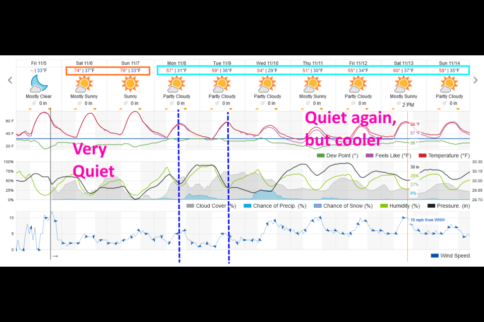
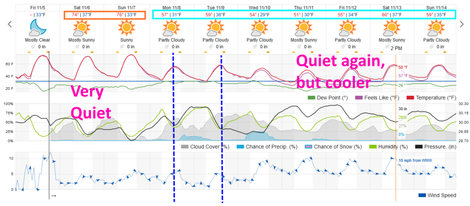
Unusually warm weekend then an early week chill.

Friday Update:

This is just a quick update before the weekend!  Other than a couple of cold fronts Monday/Tuesday next week that "may" bring some showers - we have a FANTASTIC warm dry weekend ahead and quiet weather for the end of next week. Go enjoy!


Figure1u_11052021
Figure 1 update: the 10 day graphical forecast for Longmont from weatherunderground.com

End Friday update.

Forecast Discussion:

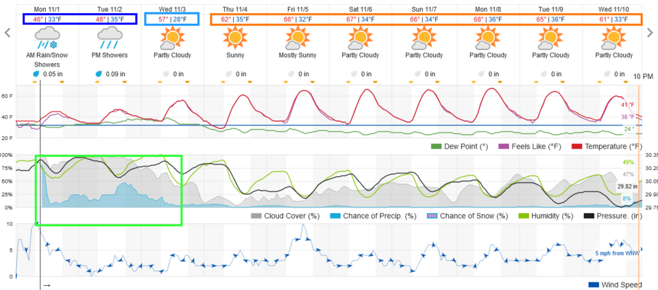
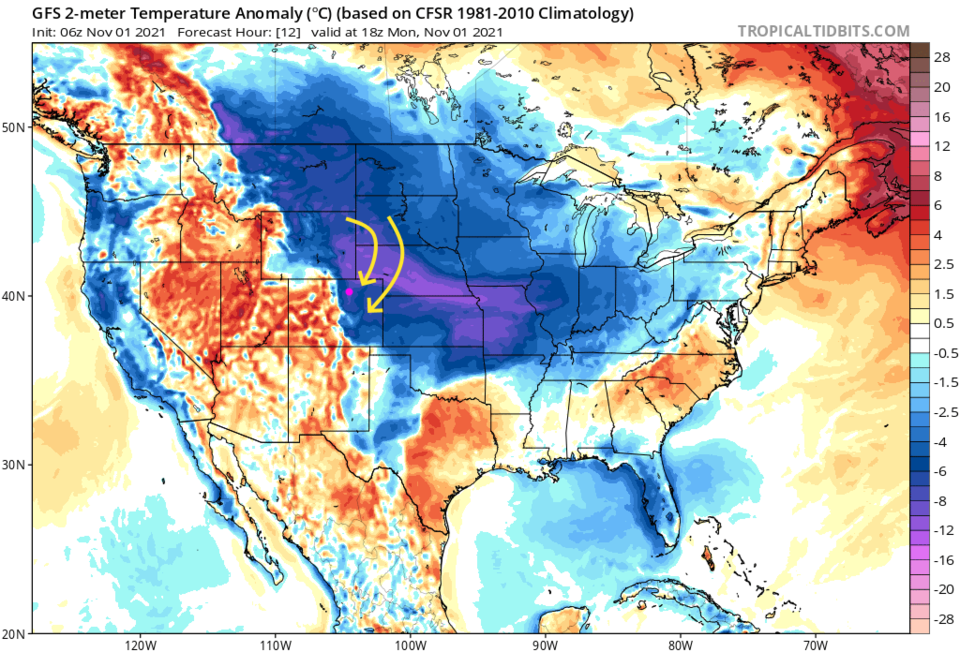
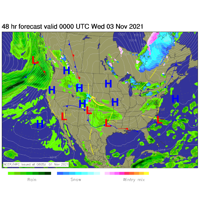
As I type, snow is falling outside on the fairly warm ground (the near 100% chance of precipitation on the left edge of Figure 1). Cold air is flowing down onto the Great Plains (Figure 2) but is too shallow to make it far up into the mountains. Western Colorado is still warm. This cool air is flowing upslope with occasional short waves and "jet maxes" or faster bits of the jet stream kicking of enhanced shower action (Figure 3). It is a nice taste of late fall/early winter.

Figure1_11012021
Figure 1: the 10 day graphical forecast from weatherunderground for Longmont
Figure2_11012021
Figure 2: the national surface temperature departure from normal for Tuesday from the GFS.
Figure3_11012021
Figure 3: the surface map from the NWS fore Tuesday.

The Longer-Range Forecast:

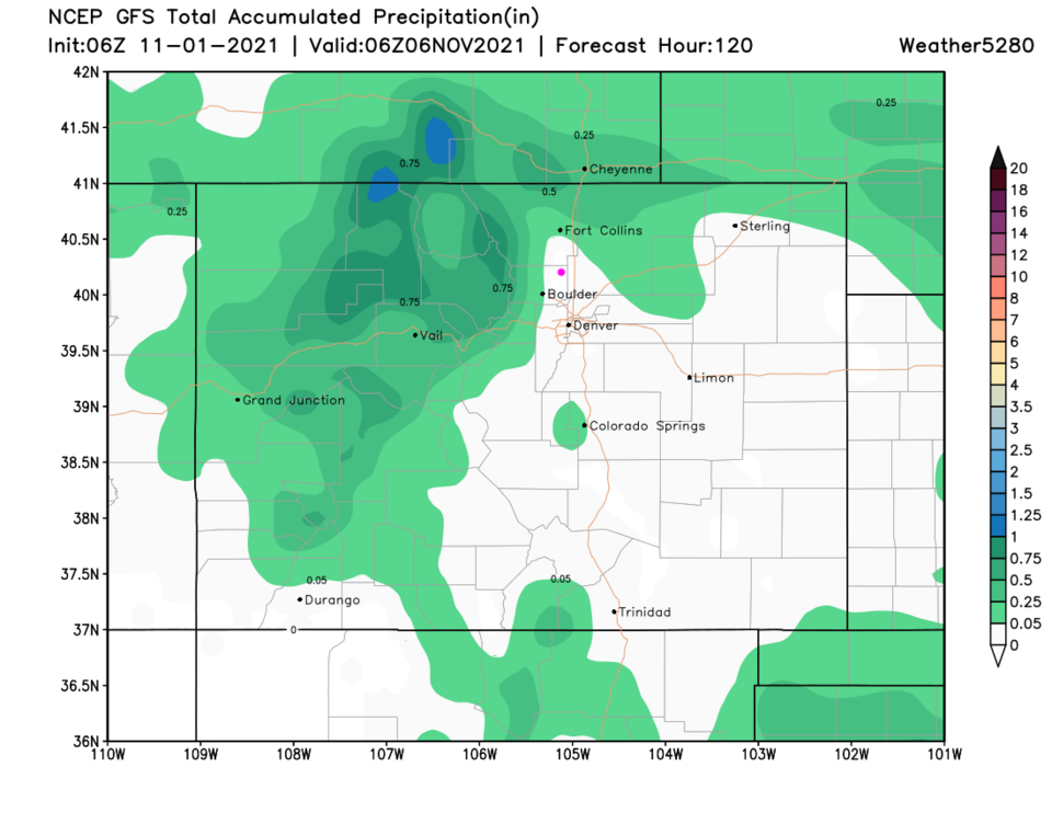
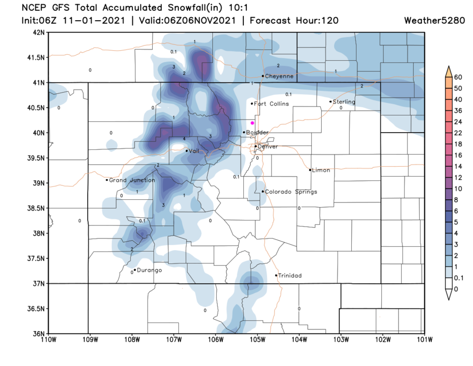
Most of the precipitation that will fall over the next five days (total precipitation Figure 4, total snow Figure 5) will occur Monday and Tuesday before the cold air slides off to the southeast. Next weekend looks very pleasant, at this time.

Figure4_11012021
Figure 4: the 5-day precipitation total map from weather5280.com from the GFS
Figure5_11012021
Figure 5: the 5-day (10:1 ratio) snow total map from weather5280.com from the GFS


About the Author: John Ensworth

John Ensworth used to work from Longmont as the PI for the NASA through the IGES (The Institute for Global Environmental Strategies). He now teaches technology, algebra, astronomy, meteorology, film school, and Lego robotics to middle/high school.
Read more


Comments


Current Weather

Mostly cloudy

Mostly cloudy

50°F

UV Index
0 Low
Pressure
29.92 Falling
Visibility
7 miles
Dewpoint
44 °F
Humidity
80%
Wind
NNW 2.8 mph
Gust
6.2 mph
Wind Chill
50 °F

Hourly Forecast

Today
4 AM
46°F
Clear
Today
5 AM
43°F
Mostly clear
Today
6 AM
41°F
Mostly clear
Today
7 AM
45°F
Partly sunny
Today
8 AM
52°F
Partly sunny
Today
9 AM
59°F
Partly sunny
Today
10 AM
65°F
Intermittent clouds
Today
11 AM
71°F
Intermittent clouds
Today
12 PM
75°F
Intermittent clouds
Today
1 PM
77°F
Intermittent clouds
Today
2 PM
75°F
Thunderstorms
Today
3 PM
73°F
Cloudy

7 Day Forecast

Mostly sunny

Wednesday

75 °F

Mostly sunny, pleasant and warmer


Partly cloudy

Wednesday Night

41 °F

Patchy clouds


Mostly cloudy w/ t-storms

Thursday

77 °F

Turning cloudy, warm; breezy, a stray thunderstorm this afternoon


Thunderstorms

Thursday Night

47 °F

A thunderstorm in spots this evening; otherwise, considerable cloudiness


Thunderstorms

Friday

69 °F

Mostly cloudy and not as warm with a couple of thundershowers


Thunderstorms

Friday Night

44 °F

Cloudy with a couple of thundershowers


Rain

Saturday

46 °F

Chilly with periods of rain and a thunderstorm


Rain and snow

Saturday Night

39 °F

Cloudy with rain, mixed with a little snow late


Mostly cloudy

Sunday

59 °F

Mostly cloudy and warmer; a stray afternoon thundershower


Partly cloudy

Sunday Night

36 °F

Partly cloudy


Sunrise and Sunset

Sunrise
6:08 AM
Sunset
7:49 PM

Based on AccuWeather data