In Brief:
Significant rain fell, hot weather returns.
Monday Update:
The rain arrived! We had about 0.05 inch from overnight rainfall Saturday into Sunday. Sunday gave many locations well over an additional inch of rain (Figure 2 update). My backyard received 0.99 inch of water.
There will be a chance of thunderstorms Tuesday afternoon, then upper 80's are back for later in the week (Friday/Saturday). Enjoy!
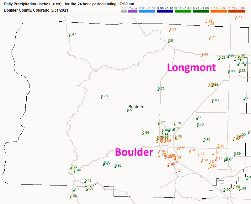 Figure 2 update: the 24 hour rainfall totals up to Monday 7am from CoCoRaHS.
End Monday update.
Sunday Update:
The severe weather remained south and east of Denver Saturday as cool air once again stabilized the atmosphere around Longmont and the northern I-25 cities. Figure 1 update shows the rainfall pattern yesterday. Storms formed north and east of Fort Collins, east of us out on the plains and southeast of Denver. Everyone had fun except the foothills and I-25 folks. This morning (Sunday) up slope flow is picking up rapidly and a steady rain is now expected for much of Sunday. There will be a break in the rain late tonight then begin to pick up again after sunrise Monday for another rainy day. Areas around Longmont should still pick up 1/2 to 1 inch of water. Enjoy some Netflix or Disney+! (This was not a paid ad.)
 Figure 1 update: the NOAA 1 day rainfall totals map for Saturday.
End Sunday update.
Forecast Discussion:
Winds are switching to coming from the north as of 10am Saturday. The cold front is making progress down the Front Range. This will begin a period of much cooler weather, thunderstorm chances (some with severe hail Saturday afternoon), then rain through Monday afternoon (Figure 1). Figure 2 shows the Saturday Marginal risk from Denver northward and into the foothills and the Slight risk to the southeast of Denver. North of Denver, the risk is primarily for severe hail while strong winds and a few tornadoes are possible southeast of Denver.
The setup for this weather event is a large very slow moving trough to our west. It stretches from Canada to Mexico and off into the Pacific (Figure 3). A low to our south and a stalled front will create a long period of up slope flow (Figure 4).
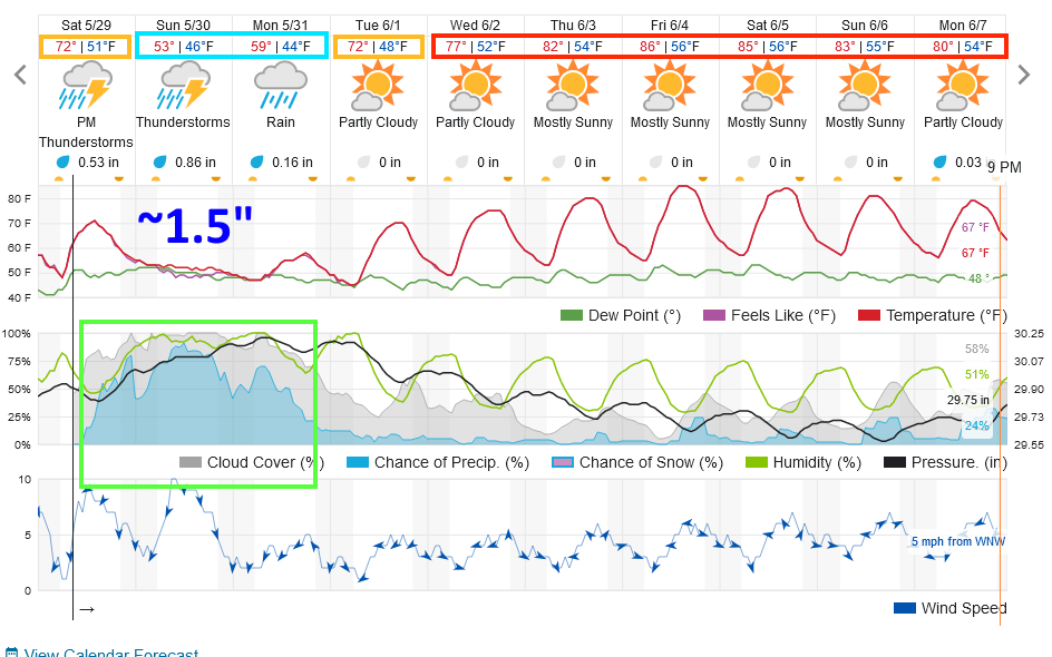 Figure 1: the 10 day graphical forecast from weatherunderground.com for Longmont, CO.
 Figure 2: the risk of severe weather from the Storm Prediction Center, Norman OK for Day 1, Saturday.
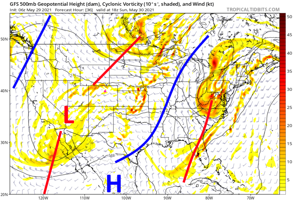 Figure 3: the 500mb upper air forecast map for Sunday noon from the GFS and tropicaltidbits.com
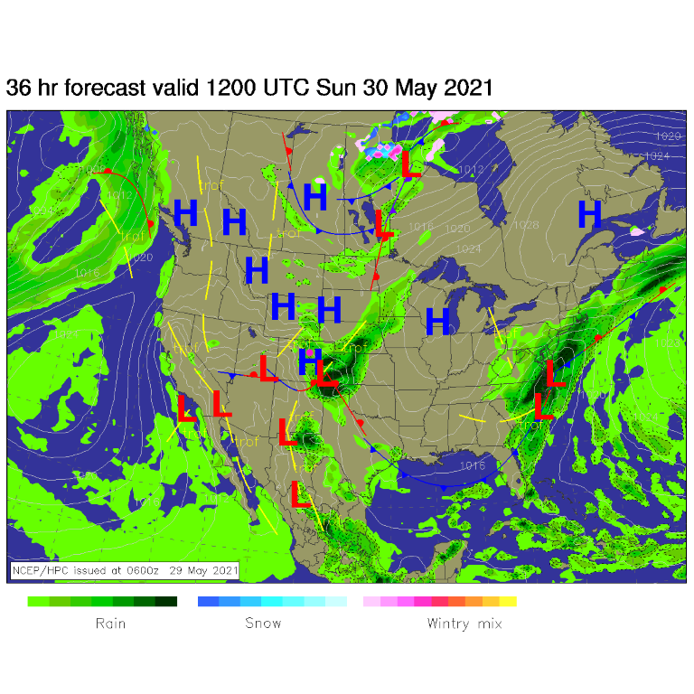 Figure 4: the forecast surface analysis for Sunday AM from NCEP.
The Longer Range Forecast:
On Monday, the trough has moved very little (Figure 5). The surface map looks almost the same as well (Figure 6). The weatherunderground model has rain starting around 2pm Saturday and finally coming to an end around 5pm Monday (Figure 1). It gives us about 1.5 inches of water. The (usually overly) generous GFS gives us between 1.5 inches and 2 inches of rainfall. Summer is coming, just not this long weekend.
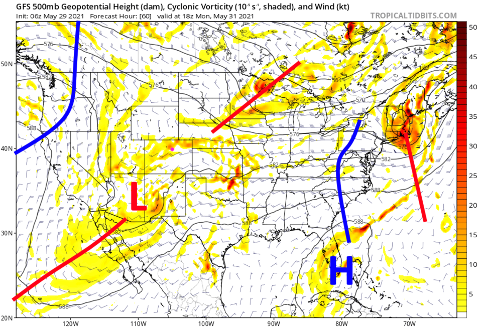 Figure 5: the 500mb upper air forecast map for Monday noon from the GFS and tropicaltidbits.com
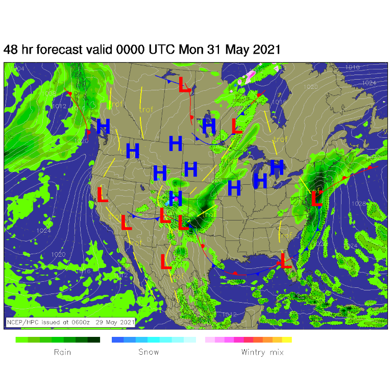 Figure 6: the forecast surface analysis for Sunday PM from NCEP.
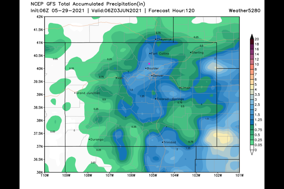
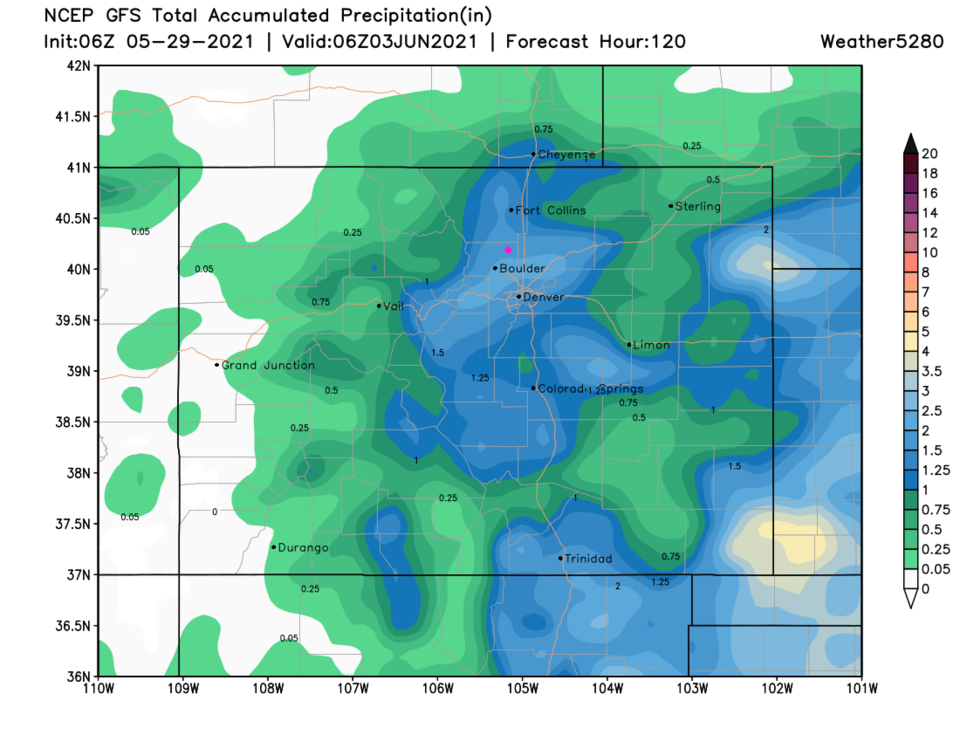 Figure 7: the 5 day precipitation total from the GFS and weather5280.com


