
In brief:
We get a cold front every three to four days this week bringing stiff winds each time and a chance of rain and even snow in the future.
The forecast discussion:
Our next cold front, arriving Saturday afternoon, is sweeping through Wyoming and Utah as of Friday afternoon (Figure 1 below).
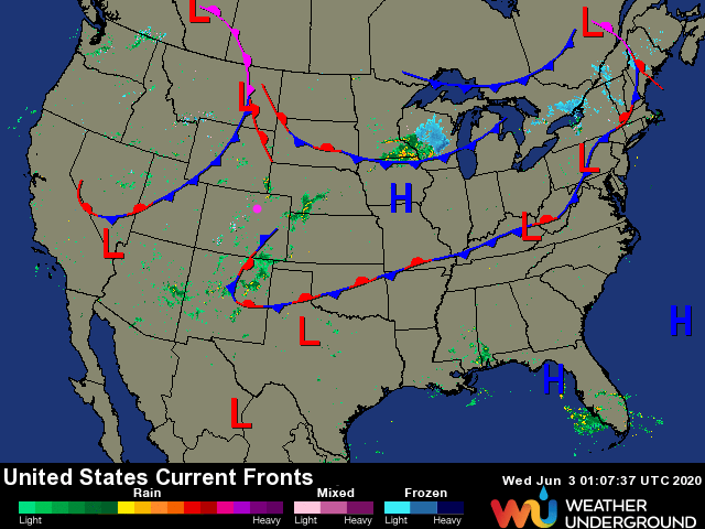 Figure 1: the surface feature analysis from Friday PM from weatherunderground.com
This is driven by our new pattern that features a broad trough over the central U.S. giving us northwest flow aloft (black arrow in Figure 2).
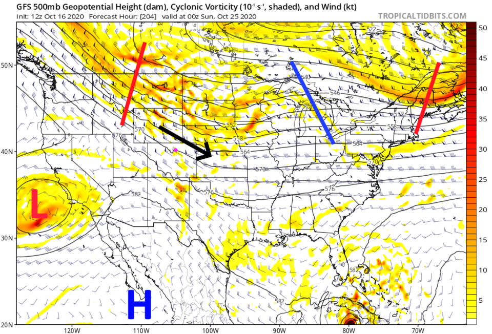 Figure 2: the 500mb forecast upper level map from the GFS and tropicaltidbits.com for Saturday night
Each front will bring some wind to the plains, but serious gusts in the mountains (up to 70 mph into Saturday PM). This will make the Cameron Peak fire flare up again and keep us dealing with smoky conditions downwind of the blaze (Figure 3).
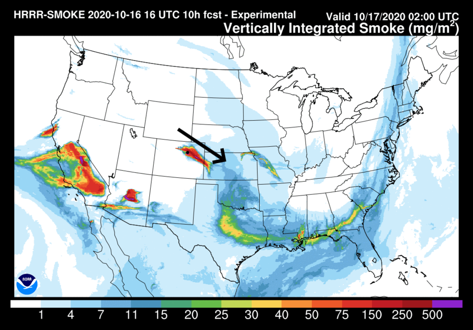 Figure 3: the HRRR smoke at all levels forecast for later Friday night from NOAA
With down slope flow ahead of the trough and a short wave ridge ahead of the next trough, we'll climb to the 70s on Saturday before cooling 20 degrees with the weekend cold front (Figure 4 — fronts are blue dashed lines). There is a chance of showers later Saturday night and Sunday morning with some upslope flow behind the front. It will be very similar to the front that arrived Wednesday night.
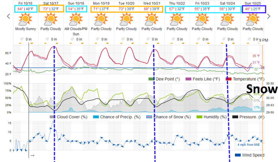 Figure 4: the 10 day graphical forecast for Longmont from weatherundeground.com
The longer-range forecast:
High temperatures will bounce back to seasonable lower 70s Monday through Wednesday, then our next cold front arrives Wednesday afternoon. We drop into the 50s this time. A third cold front hits Saturday morning and we see highs in the 40s and lows in the lower 20s next Sunday (Figure 4). I hope your sprinklers are dry and delicate plants are protected or you've said goodbye to them.
Our midweek front (and the next) is pushed down by another shortwave in that overall northwest flow (Figure 5).
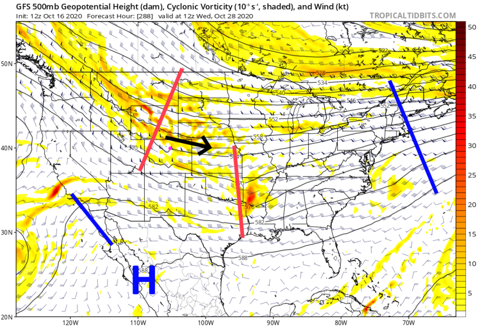 Figure 5: the 500mb forecast upper level map from the GFS and tropicaltidbits.com for Wednesday morning
Precipitation over the next 10 days (coming shortly after each front) will still be very light. The GFS delivers not much more than a sprinkle along Interstate 25 and up in the mountains (Figure 6). Some of that light precipitation may come in the form of snow later next weekend (Figure 7). As always, we'll see if that happens when we get there.
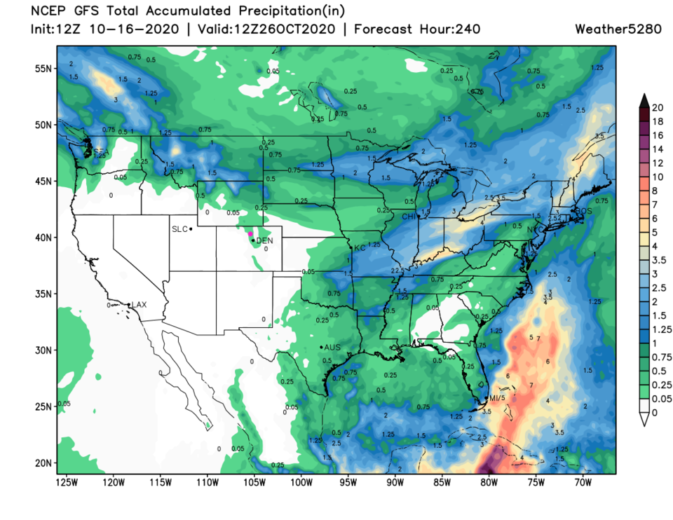 Figure 6: the precipitation total forecast for the next 10 days from the GFS and weather5280.com
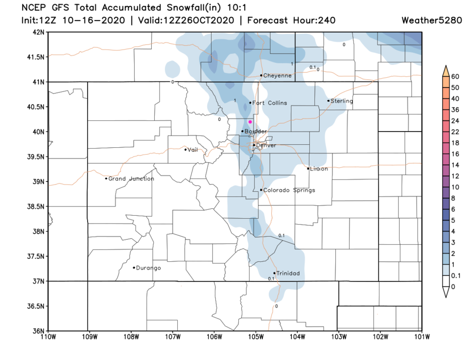 Figure 7: the snowfall total forecast for the next 10 days from the GFS and weather5280.com


