This week's video forecast.
In brief:
Our week begins with typical winter cold and some snow, followed by a rapid warm up to the 50s again.
Wednesday Update:
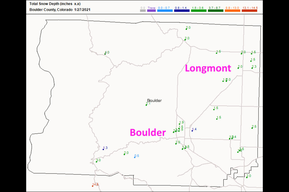
Longmont received between 1.5 and 2.5 inches of snow in our two day snow event. My forecast was a Trace to 2.5 inches. Yea! (Figure 1 update).
After another rather chilly day Wednesday, we warm rapidly to the upper 50's through the weekend. The snow will soon be gone again and it will be fun to take a walk (Figure 2 update).
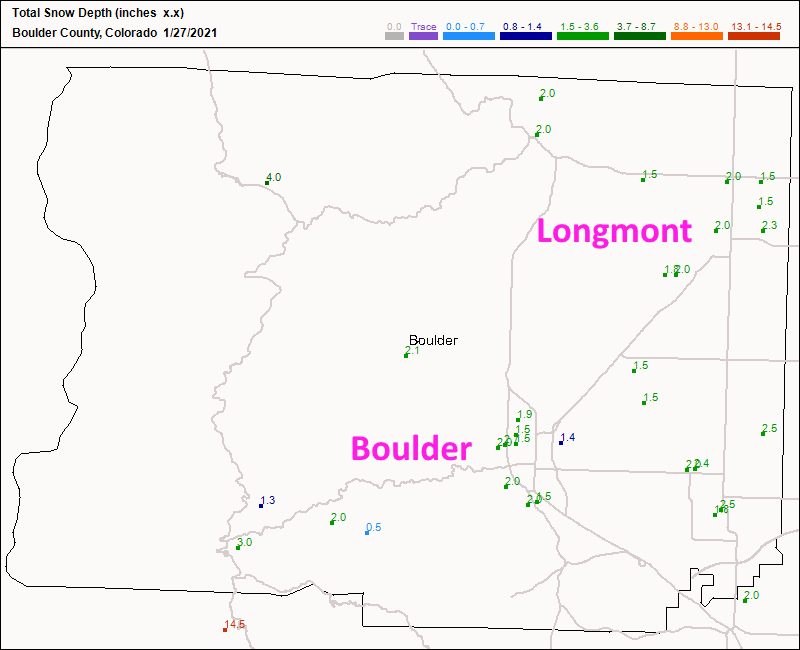 Figure 1 update: the total snow depth as of Wednesday 7am from CoCoRaHS.
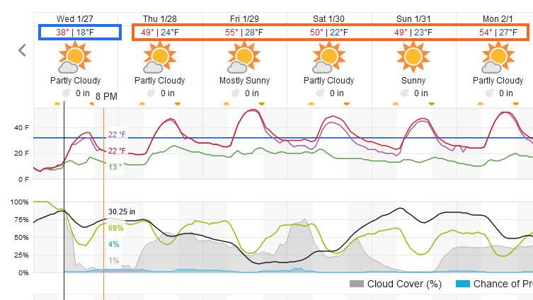 Figure 2 update: a snippet of the 10 day graphical forecast for Longmont from weatherunderground.com
End Wednesday Update.
Forecast discussion:
A very wet and cold weather system is digging deep into the southwestern U.S. (Figure 1). This system is powered by the biggest Western U.S. trough that we've seen in a long time (Figure 2).
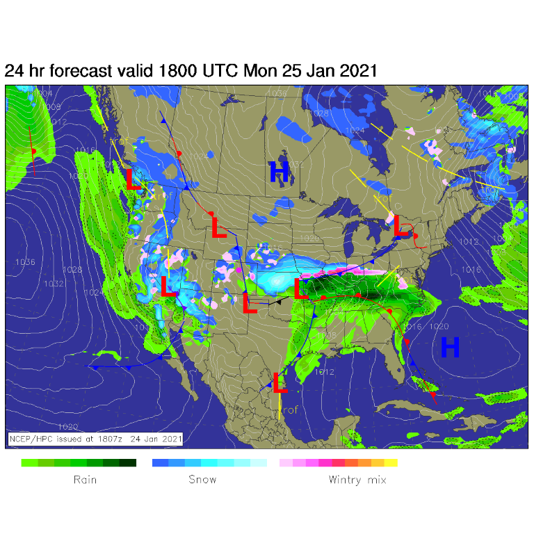 Figure 1: The forecast surface map for Monday noon from NCEP.
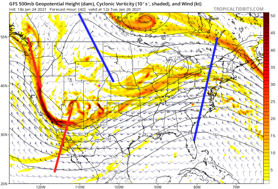 Figure 2: The 500mb upper air map for Tuesday morning from the GFS and tropicaltidbits.com
By Tuesday morning, a complex, wet and cold system is rolling through the southwest (Figure 3). Some upslope snows are forming in northeast Colorado as well.
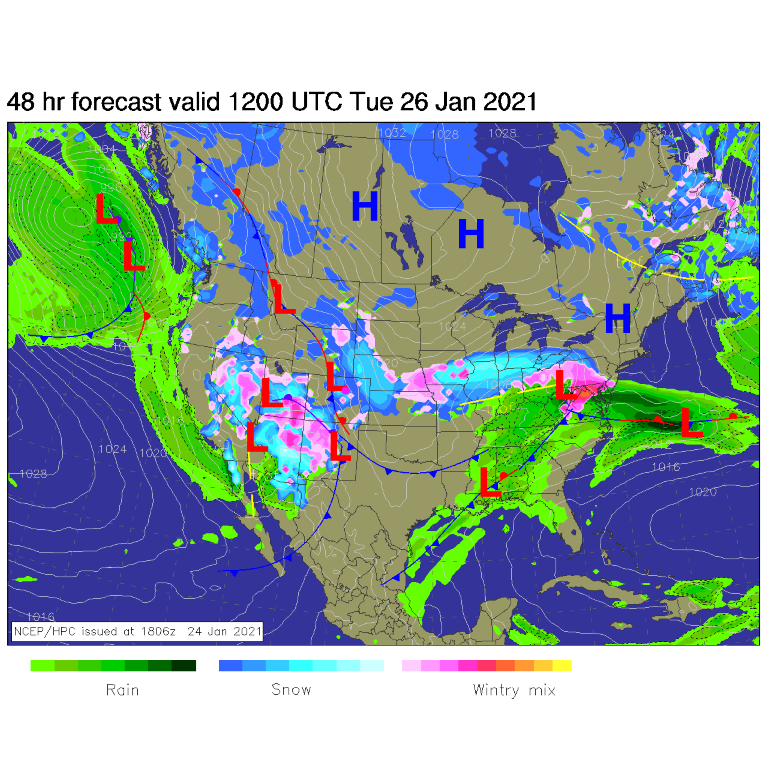 Figure 3: The forecast surface map for Tuesday morning from NCEP.
Snow showers begin Sunday afternoon and continue on and off Monday until more lift and moisture arrives Monday night (Figure 4). Better snow chances remain from about 10 p.m. Monday to 10 p.m. Tuesday as the main trough and surface low passes to our south.
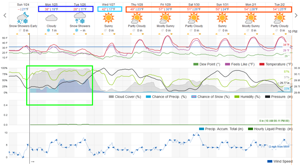 Figure 4: The 10-day graphical forecast for Longmont from weatherunderground.com
Snowfall roundup:
The weatherundrgound model gives us 1 to inches of snow Sunday afternoon to Tuesday afternoon (Figure 4).
The GFS gives us a trace (Figure 5).
The NAM gives us a trace as well (Figure 6).
I'm going to depart from the models and call for more like a trace to 2.5 inches of snow for Longmont.
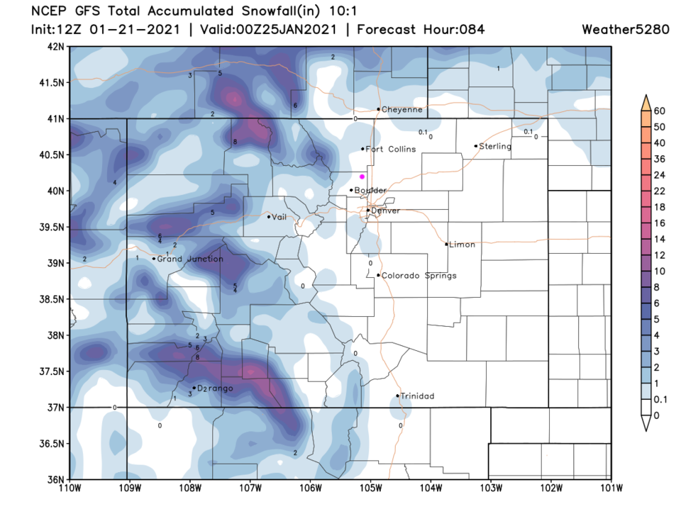 Figure 5: The 3.5-day total 10:1 snowfall forecast from the GFS and weather5280.com
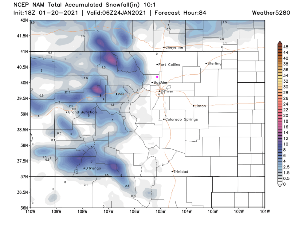 Figure 6: The 3.5-day total 10:1 snowfall forecast from the NAM and weather5280.com
The longer-range forecast:
After this storm pulls out, we might see flurries Wednesday morning, and another system is hinted at in the middle/late portions of next week (Figure 4). The GFS sees a slightly better snowfall total over the next 10 days (Figure 7) with a coating to an inch.
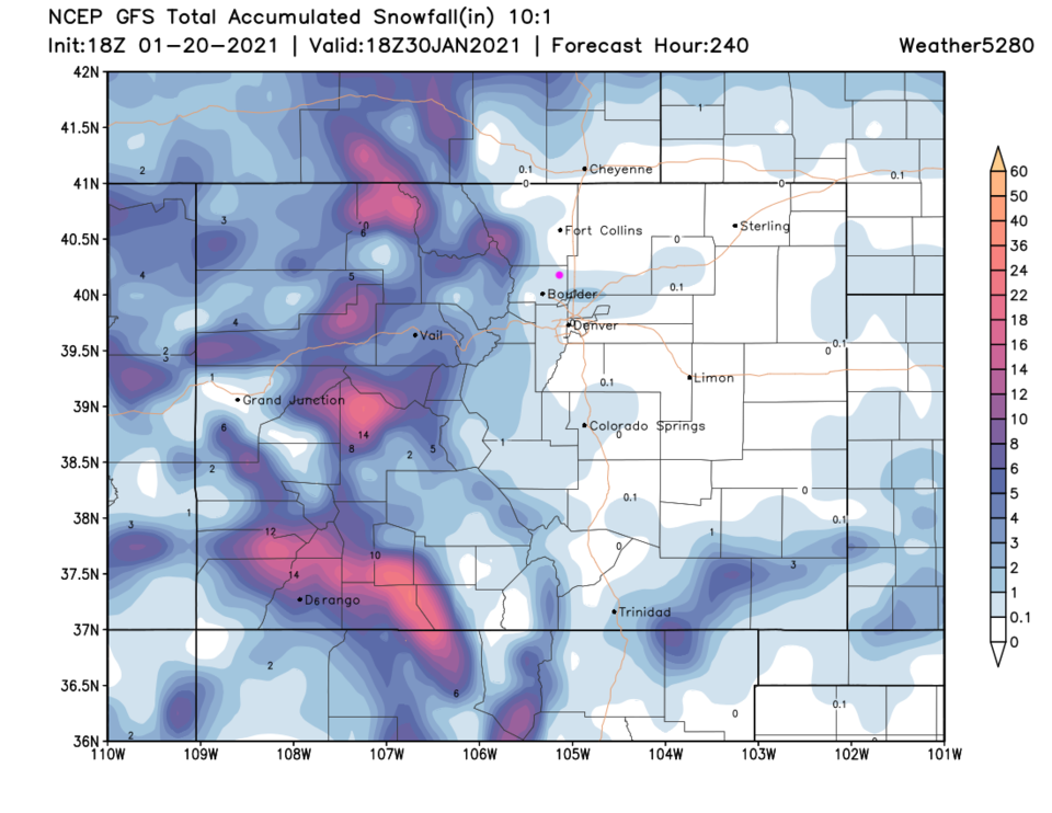 Figure 7: The 10-day total 10:1 snowfall forecast from the GFS and weather5280.com


