The Video Forecast for this Week.
In Brief:
The week ends chilly with Friday rain (maybe snow) showers then becomes a very warm dry weekend and beyond.
Forecast Discussion:
Figure 1 shows the big picture. No really exciting weather is expected over the next 10 days. A trough, moving in Friday, (Figure 2) will bring in another surface storm (Figure 3). The rainfall should be enough to wash some of the salt and sand off the roads.
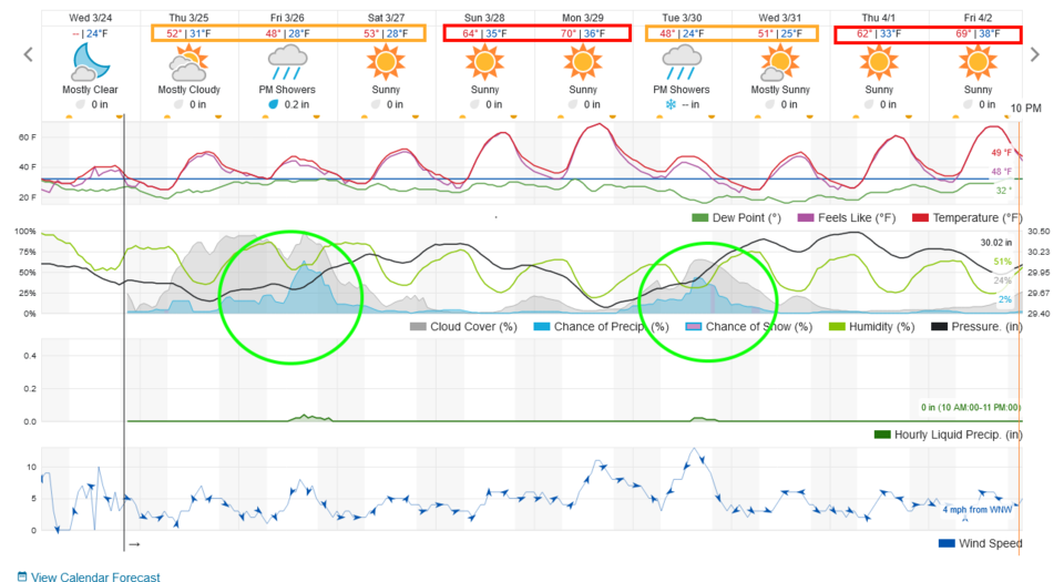 Figure 1: the 10 day graphical forecast from weatherunderground.com for Longmont, CO.
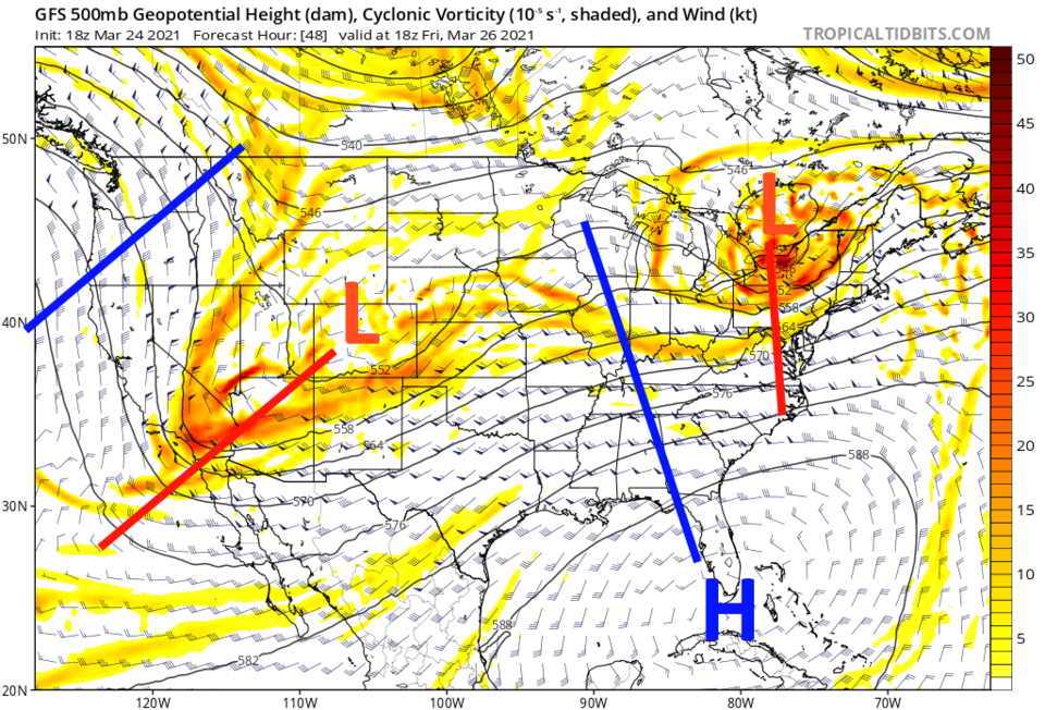 Figure 2: the 500mb upper air forecast map for Friday noon from the GFS and tropicaltidbits.com
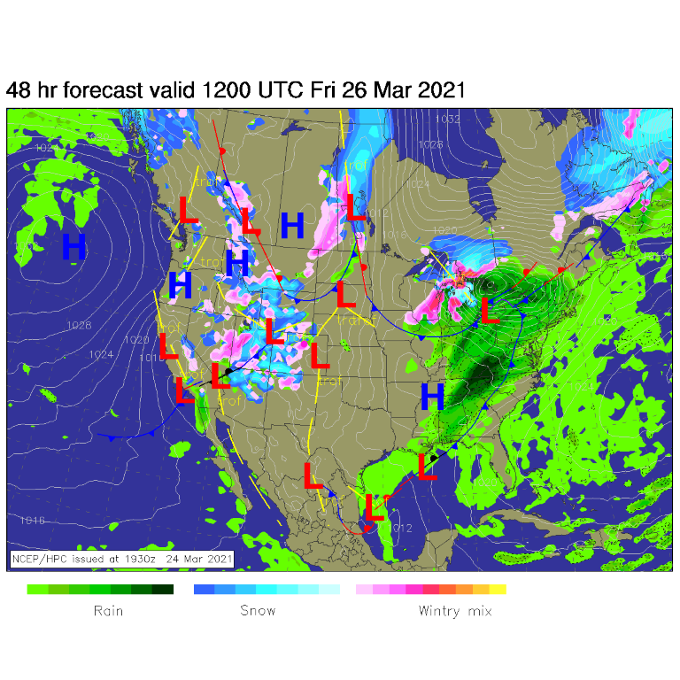 Figure 3: the forecast surface analysis for Friday morning from NCEP.
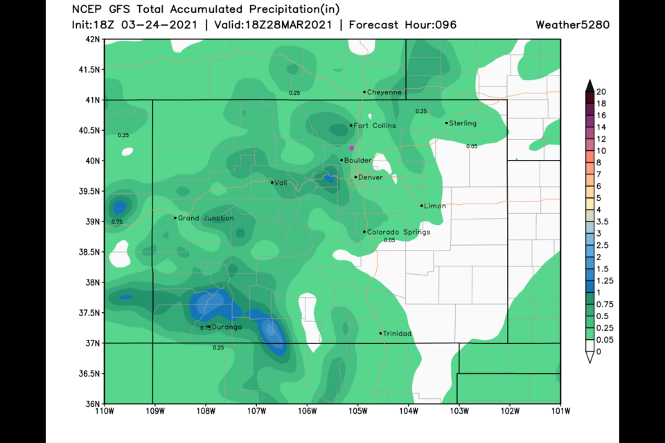
As for precipitation, overnight Friday into Saturday we may pick up a coating to an inch again (Figure 4). The rainfall should be about a quarter inch (Figure 5) and Figure 1).
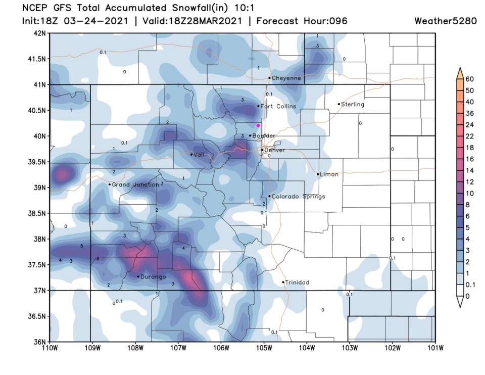 Figure 4: the GEM total snowfall forecast (10:1 ratio) through Saturday noon from tropicaltidbits.com.
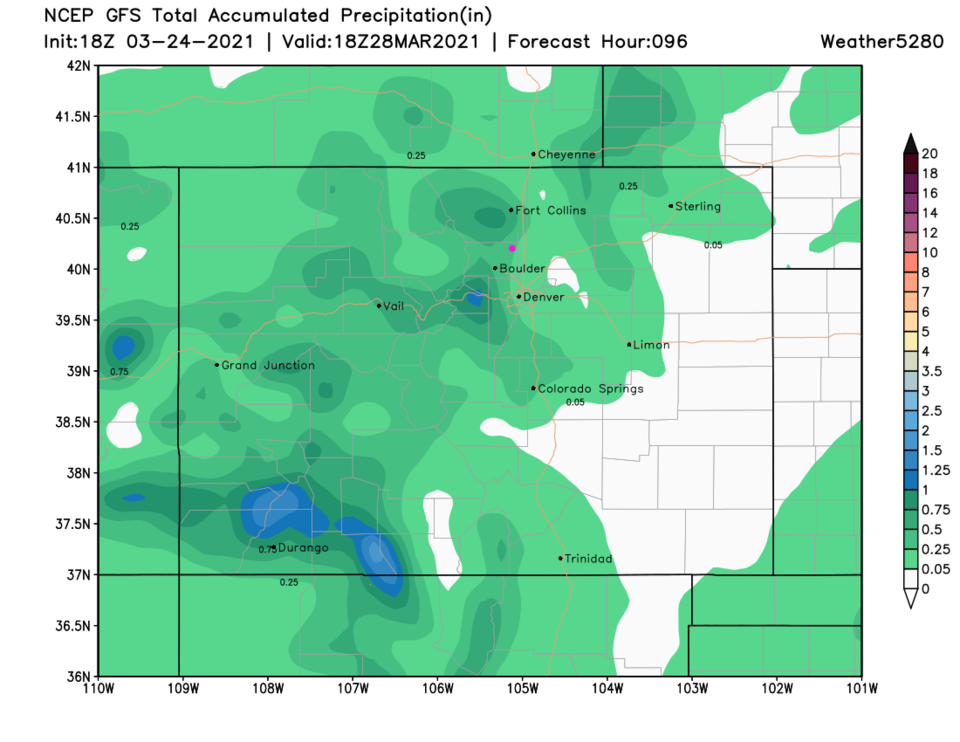 Figure 5: the GEM total precipitation forecast through Saturday noon from tropicaltidbits.com.
The Longer Range Forecast:
After that, temperatures soar to the 60s and may break 70 degrees on Monday (Figure 1). Another system arrives Tuesday evening into Wednesday morning next week. Not much snow gets added to that along I-25 (Figure 6). That one may be more rain than snow on the low lands as well. Enjoy the transition into spring!
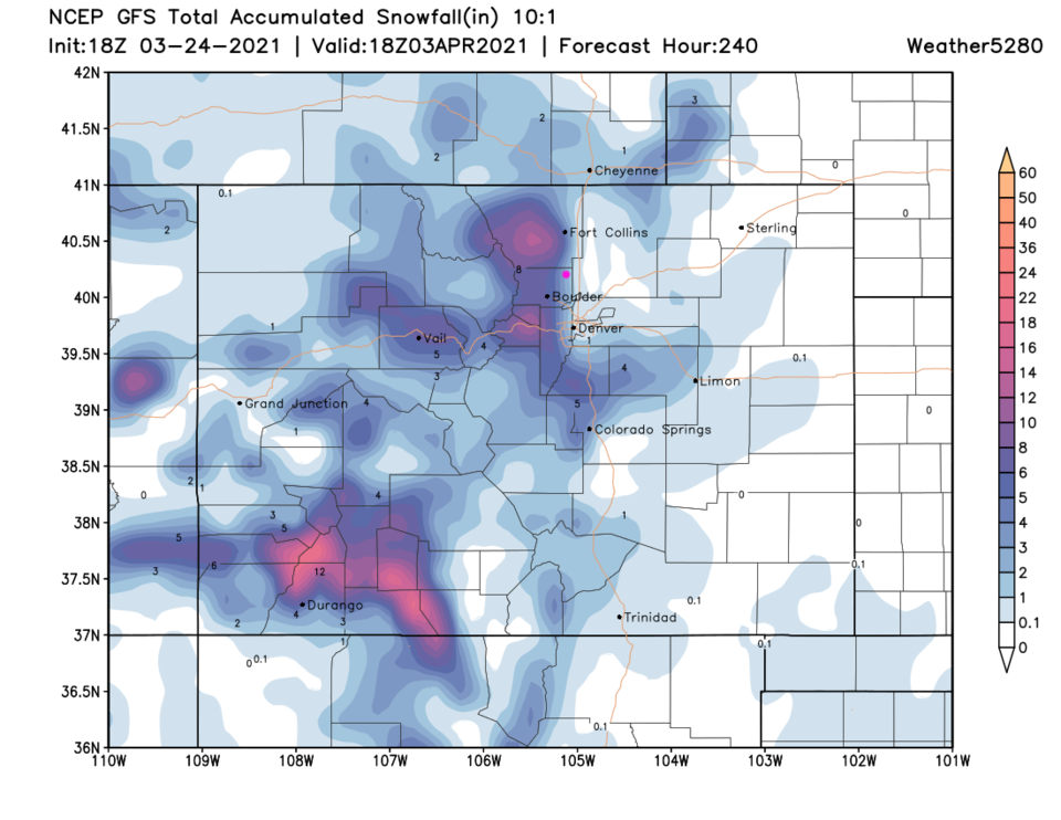 Figure 6: the 10 day (10:1 ratio) total snowfall forecast from the GFS and weather5280.com


