In brief:
After a bit of snow, we stay cool and dry for the next week (but not so much for the mountains).
Forecast discussion:
The snowfall across Longmont stacked up to about an inch and a half. Boulder did better with 2 to 4 inches (Figure 1 below). That is helpful moisture!
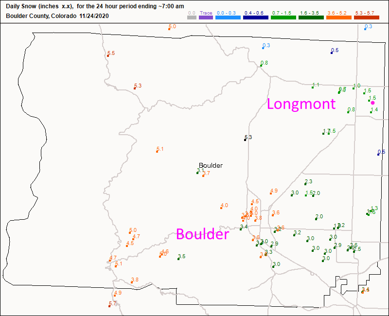 Figure 1: The new snowfall reports from CoCoRaHS as of 7 a.m. Tuesday.
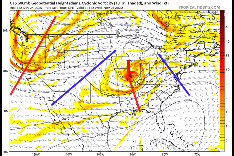
 The nation will be settling into a pattern with pretty quickly moving short waves zipping from west to east. They won't stick around long enough to retain much water. For Wednesday, we'll be pretty warm as a short wave ridge passes (blue line: Figure 2).
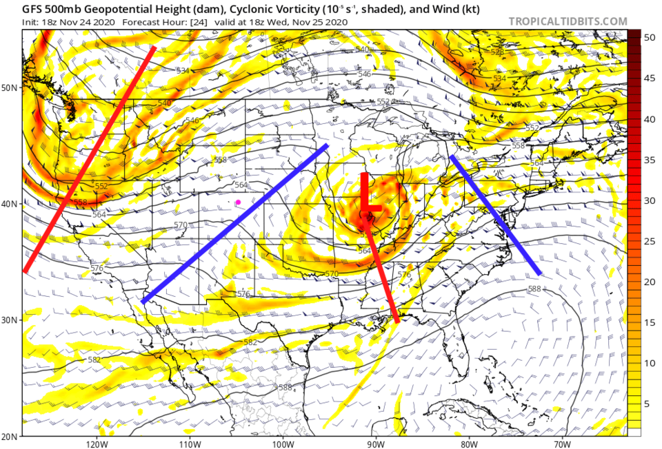 Figure 2: the 500mb upper air forecast map for Wednesday noon from the GFS and tropicaltidbits.com
Temperatures will swing only between the 40s and 50s all week with not much of a snow/rain chance, even on Thanksgiving.
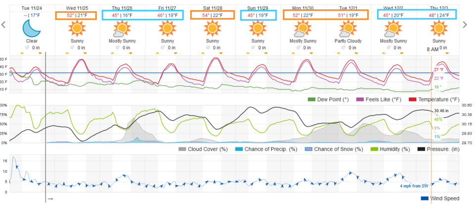 Figure 3: The 10-day graphical forecast from weather5280.com for Longmont.
The longer-range forecast:
Thanksgiving: There will be a little snow in the mountains, but along Intestate 25, it will be very cloudy with a small chance of an evening shower or dusting of snow. Winds will be from the east overall at a breezy 10mph. Highs will be in the mid-40s, with lows dropping into the teens.
The mountain showers will be created by passing upper-level low that will remain somewhat south of the state (Figure 4).
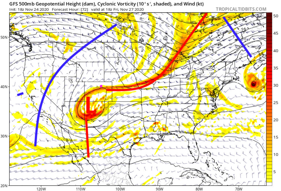 Figure 4: the 500mb upper air forecast map for Friday noon from the GFS and tropicaltidbits.com
The next precipitation will concentrate on the southern and central mountains. Over the next 10 days, we may only pick up a light wetting of less than a tenth of an inch of water (Figure 5). A dusting of snow is possible over this time frame (Figure 6).
 Figure 5: The10-day precipitation total from the GFS and weather5280.com
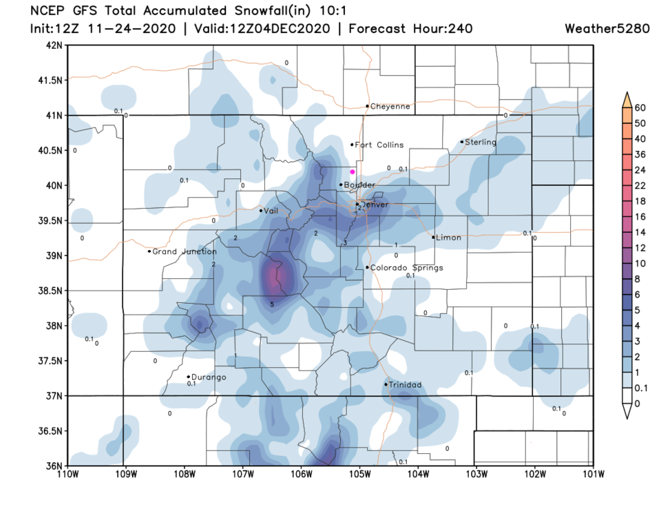 Figure 6: The 10-day 10:1 snowfall forecast total from the GFS and weather5280.com


