Skip to content
Join our Newsletter

Update Monday PM: Longmont Weather Forecast: Cool now, cold with rain (and snow?) later

Figure1u_10112021
Figure 1 update: snippet of the 10 day graphical forecast for Longmont from weatherunderground.com

In Brief:

Our first cold front brings cooler weather and small rain chances, a second on Thursday brings better rains and a dusting of snow?


Update Monday PM:

Our long anticipated cold front arrives around 2pm on Tuesday (Figure 1 update).  With it comes a small chance of on and off showers along I-25. Things remain cooler after that (below normal) until a short wave arrives on Thursday to bring more showers Thursday into Friday.  We might see around a 10th of an inch or rain or two and a dusting to an inch of snow early Friday AM. Keep looking for your coats!

Figure1u_10112021
Figure 1 update: snippet of the 10 day graphical forecast for Longmont from weatherunderground.com

End Monday PM update.

Forecast Discussion:

A front has passed on Saturday kicking off mountain rains and high elevation snow. Sunday and Monday will be very mild/beautiful (Figure 1). A strong cold front arrives midday Tuesday bringing fall/winter weather to much of the state.

Figure1_10092021
Figure 1: the 10 day graphical forecast from weatherunderground.com for Longmont, CO.


The Longer Range Forecast:


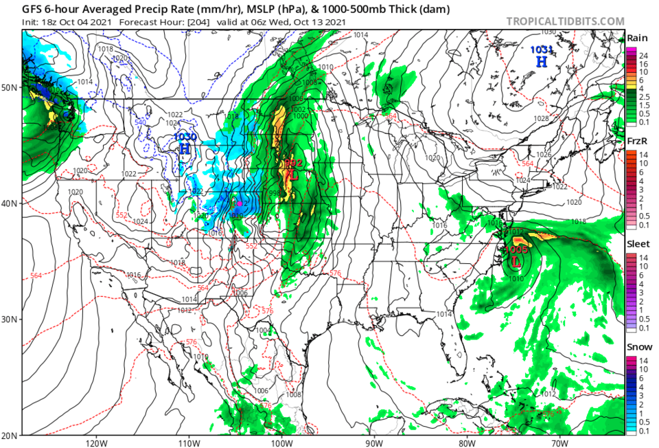
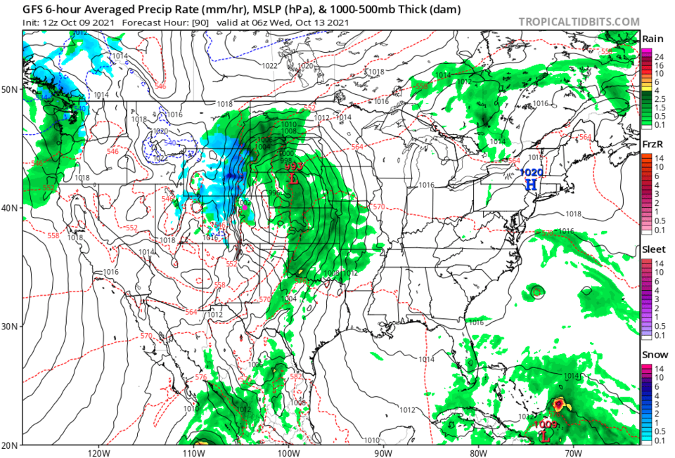
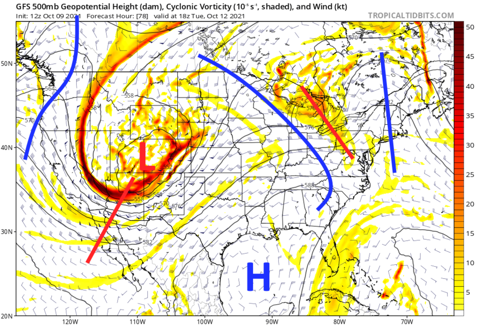
This storm looked like it might bring the first snow to I-25 communities and the eastern plains. Figure 2 is the forecast for midnight Tuesday/Wednesday made on October 4th.  Figure 3 is the forecast for the same moment made on October 9th.  Precipitation along I-25 is rain now, and there is a strong 'dry slot' pulling into eastern Colorado killing many rain/snow chances. What actually will happen will depend on the position, speed and strength of the upper level low/trough (Figure 4) and the position of the resulting surface low on the plains.

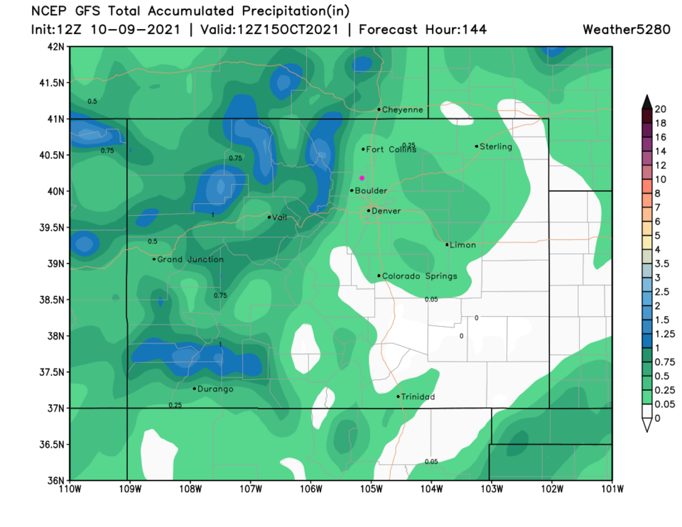
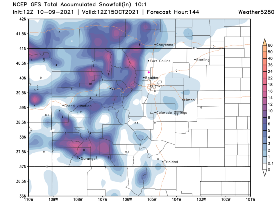
Over the next 6 days, spots in the mountains should get an inch of liquid (Figure 5) while the eastern plains miss out. Snow may fall in Boulder and on the north and west side of Fort Collins, but not much will hit the plains (Figure 6).

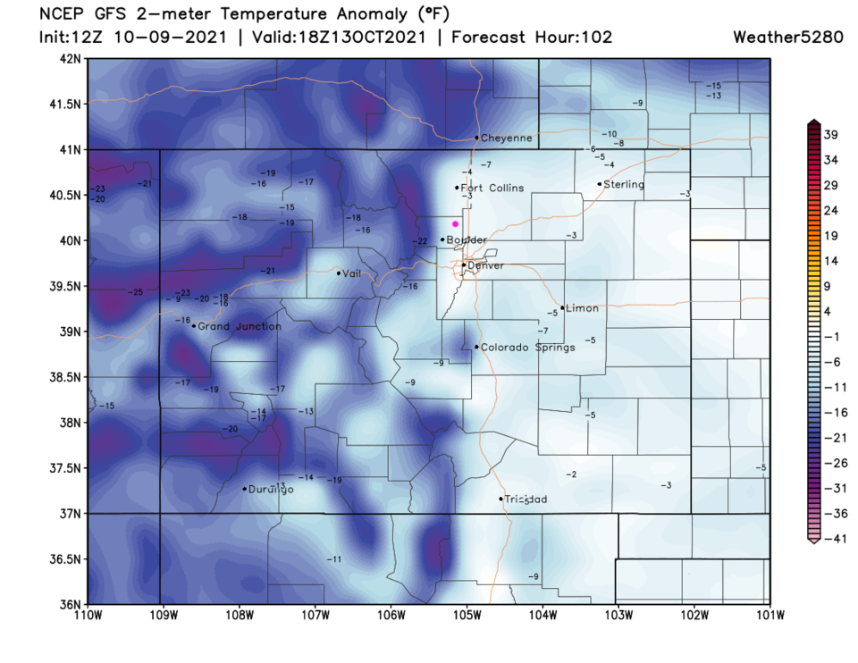
What IS notable is how cold it will get.  We should see below freezing temperatures in the pre-dawn hours Tuesday, Wednesday, and Thursday (Figure 7). Go find your favorite coats!

Figure2_10092021
Figure 2: the 6 hour averaged precipitation around midnight Tue/Wed from the GFS and tropicaltidbits.com made Oct 4


Figure3_10092021
Figure 3: the 6 hour averaged precipitation around midnight Tue/Wed from the GFS and tropicaltidbits.com made Oct 9


Figure4_10092021
Figure 4: the 500mb upper air forecast map for Tuesday noon from the GFS and tropicaltidbits.com


Figure5_10092021
Figure 5: the 6 day total precipitation forecast from the GFS and weather5280.com
Figure6_10092021
Figure 6: the 6 day (10:1 ratio) total snowfall forecast from the GFS and weather5280.com
Figure7_10092021
Figure 7: the temperature anomaly (departure from normal) for Wednesday from weather5280.com


About the Author: John Ensworth

John Ensworth used to work from Longmont as the PI for the NASA through the IGES (The Institute for Global Environmental Strategies). He now teaches technology, algebra, astronomy, meteorology, film school, and Lego robotics to middle/high school.
Read more


Comments


Current Weather

Mostly cloudy

Mostly cloudy

46°F

UV Index
0 Low
Pressure
30.28 Rising
Visibility
8 miles
Dewpoint
42 °F
Humidity
87%
Wind
N 1.6 mph
Gust
2.7 mph
Wind Chill
46 °F

Hourly Forecast

Today
11 PM
45°F
Showers
Tomorrow
12 AM
44°F
Mostly cloudy w/ showers
Tomorrow
1 AM
43°F
Mostly clear
Tomorrow
2 AM
42°F
Mostly clear
Tomorrow
3 AM
41°F
Mostly clear
Tomorrow
4 AM
40°F
Mostly clear
Tomorrow
5 AM
40°F
Mostly clear
Tomorrow
6 AM
39°F
Mostly sunny
Tomorrow
7 AM
42°F
Mostly sunny
Tomorrow
8 AM
47°F
Mostly sunny
Tomorrow
9 AM
52°F
Mostly sunny
Tomorrow
10 AM
56°F
Mostly sunny

7 Day Forecast

Thunderstorms

Wednesday

55 °F

Low clouds and cool; rain and drizzle this morning, then afternoon thunderstorms


Partly cloudy w/ showers

Wednesday Night

39 °F

A couple of brief showers late this evening; clearing


Partly sunny

Thursday

70 °F

Partly sunny, pleasant and milder


Mostly clear

Thursday Night

42 °F

Mainly clear


Thunderstorms

Friday

72 °F

Mostly cloudy with a thunderstorm in spots in the afternoon


Mostly clear

Friday Night

45 °F

Clear to partly cloudy


Mostly sunny

Saturday

78 °F

Sunny to partly cloudy and nice


Clear

Saturday Night

44 °F

Clear


Mostly cloudy

Sunday

79 °F

Mostly cloudy


Mostly clear

Sunday Night

50 °F

Mainly clear


Sunrise and Sunset

Sunrise
5:53 AM
Sunset
8:01 PM

Based on AccuWeather data