The Video Forecast for this Week
In Brief:
Warm air returns and smoke slowly retreats.
Monday Update:
The cold front that brought summer relief also brought unwelcome smoke with it (Figure 1 update). As we warm up through the rest of the week (with small chances of afternoon storms), the smoke will decrease to some extent. Enjoy the cool down while you can!
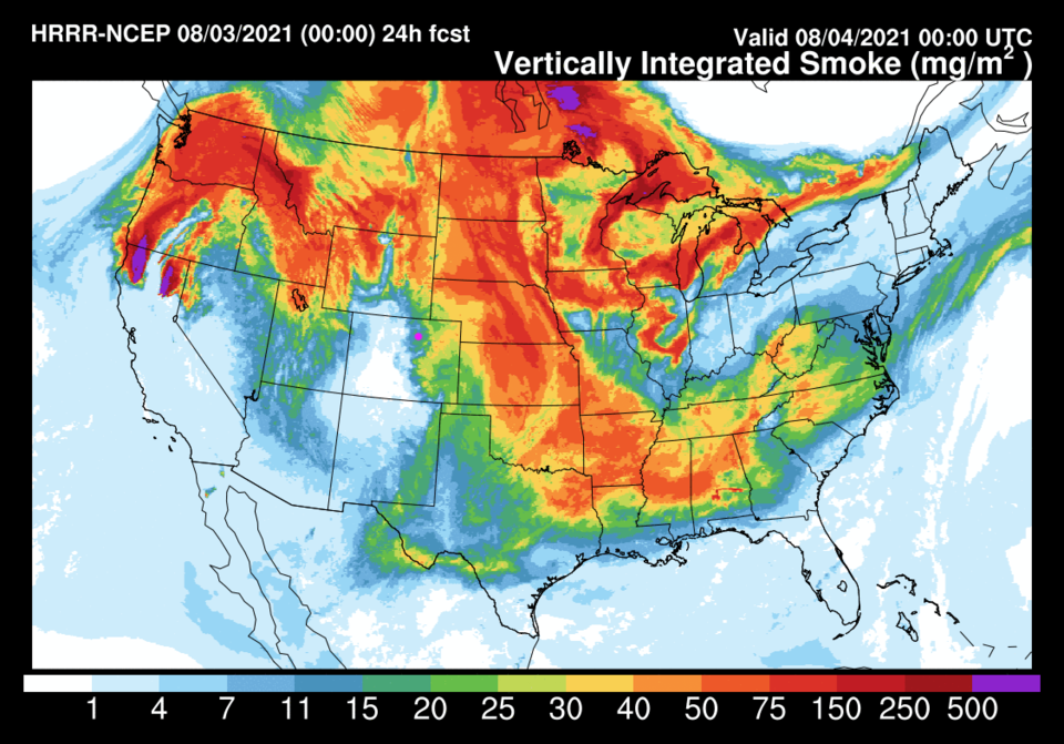 Figure 1 update: the HRRR smoke at all levels forecast for Tuesday PM from NOAA.
End Monday Update.
Forecast Discussion:
The cold front hits Longmont between 3pm and 4pm. Storm chances pick up pretty quickly around that time. Precipitation chances stay elevated through Sunday early morning (Figure 1). There is still a big ridge in the west across Colorado, but embedded short waves (red lines), the surface front (brought down on the eastern side of the ridge) and ample moisture will create this mid-summer break (Figure 2). Storms and areas of rainfall will be widespread Saturday as moisture continues to flow in (Figure 3). A second front on Sunday will keep precipitation going across much of the state. The amount of water in the atmosphere will be pretty high for this time of year (Figure 4). The NWS has issued the following flash flood watch - especially for the recent burn scars in the mountains. Temperatures will remain well below normal this weekend.
...FLASH FLOOD WATCH IN EFFECT FROM 6 PM MDT THIS EVENING UNTIL 9 PM SATURDAY EVENING...
*The National Weather Service in Denver has expanded the Flash Flood Watch to include Portions of central, north central, and northeast Colorado, including the following areas, in central Colorado, Central and Southeast Park County and Jefferson and West Douglas Counties Above 6000 Feet/Gilpin/Clear Creek/Northeast Park Counties Below 9000 Feet. In north central Colorado, Larimer County Below 6000 Feet/Northwest Weld County. In northeast
Colorado, Boulder And Jefferson Counties Below 6000 Feet/West Broomfield County, Central and South Weld County, Elbert/Central and East Douglas Counties Above 6000 Feet and North Douglas County Below 6000 Feet/Denver/West Adams and Arapahoe Counties/East Broomfield County.
* From 6 PM MDT this evening through Saturday evening.
* Scattered thunderstorms will develop late this afternoon or evening, and may then continue overnight with locally heavy rainfall and potential for flash flooding. Rainfall amounts of 1 to 2 inches in less than an hour will be possible from the stronger storms. There is a threat that a few storms with heavy rain will continue overnight into early Saturday morning. Additional rounds of showers and storms can be expected Saturday afternoon and evening.
* Flash flooding will be possible in urban and low lying areas.
PRECAUTIONARY/PREPAREDNESS ACTIONS...
You should monitor later forecasts and be prepared to take action
should Flash Flood Warnings be issued. Never drive through a flooded
area.
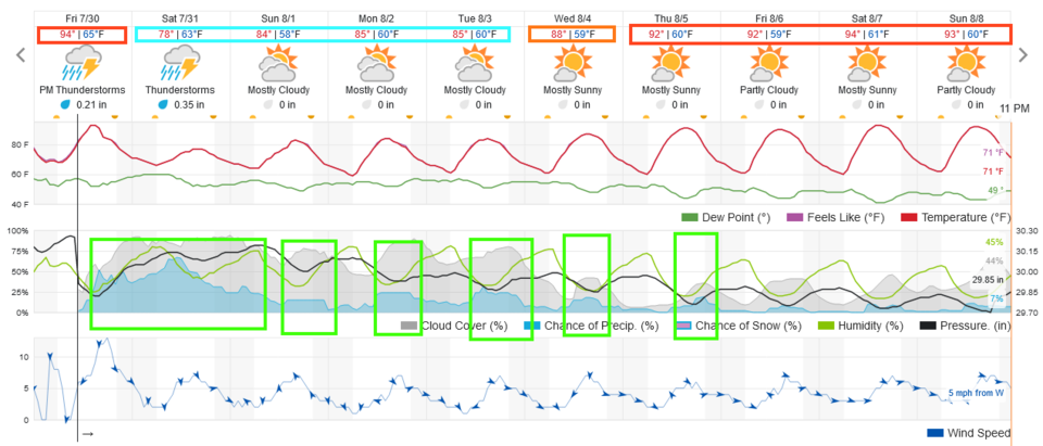 Figure 1: the 10 day graphical forecast for Longmont from weatherunderground.com
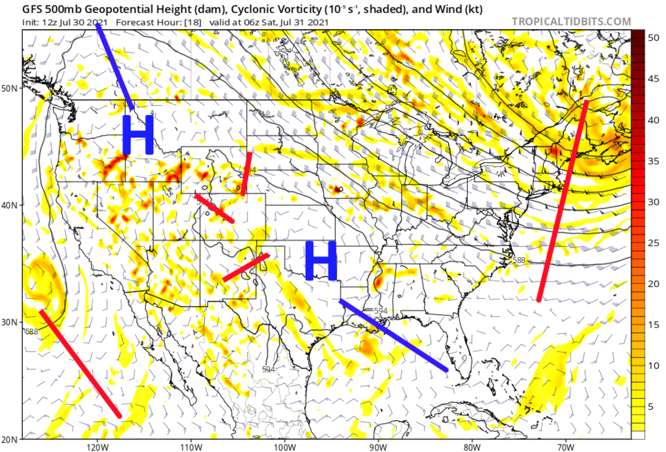 Figure 2: the GFS 500mb upper air pattern forecast for Saturday morning from tropicaltidbits.com
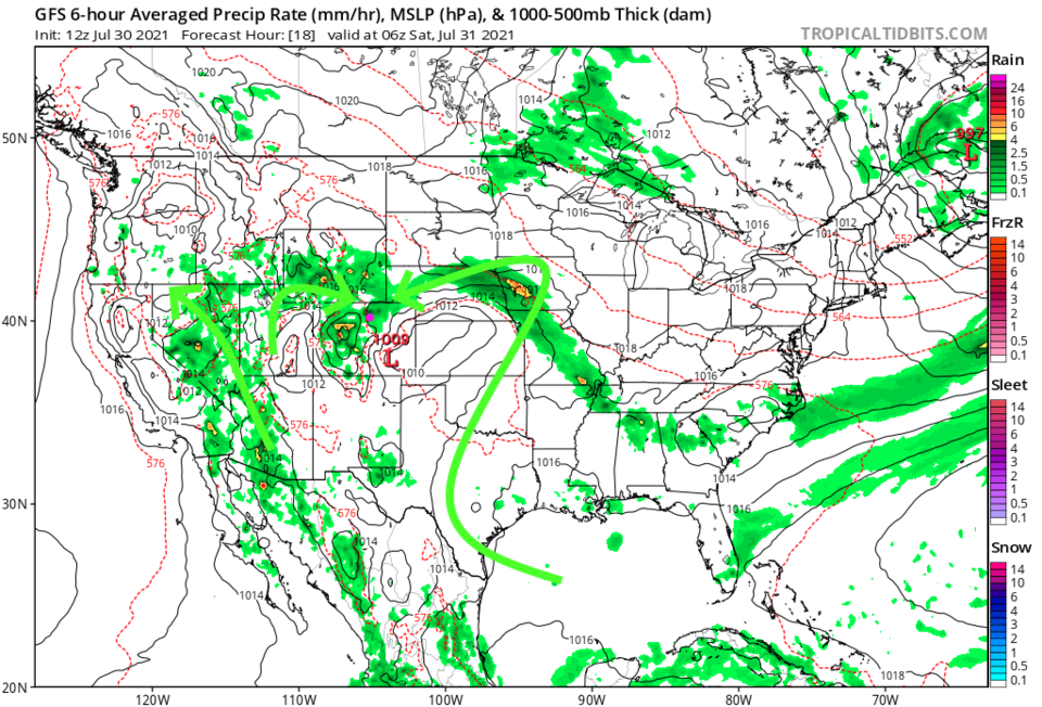 Figure 3: the GFS surface precipitation forecast for Saturday morning from tropicaltidbits.com
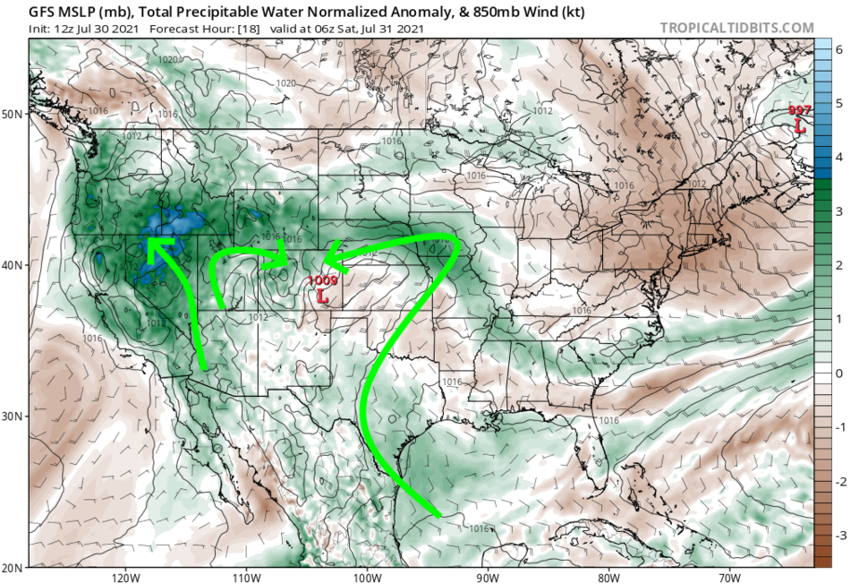 Figure 4: the GFS precipitatable water forecast for Saturday morning from tropicaltidbits.com
The Longer Range Forecast:
Temperatures warm through the upcoming week (Figure 1) and storms return to a mainly afternoon/early evening pattern. 1-3 inches of rainfall is possible for much of western and central Colorado (Figure 5) over the next 5 days.
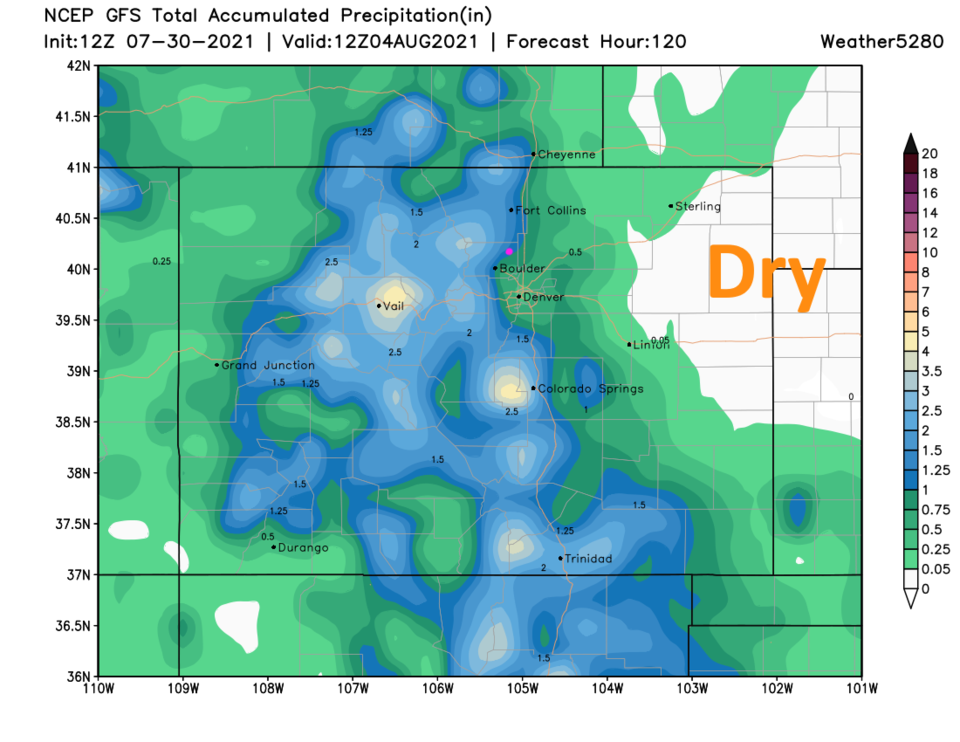 Figure 5: the 5 day precipitation total from the GFS and weather5280.com


