
In Brief:
The cutoff low is drifting toward the four corners region resulting in on-and-off showers through Tuesday, then we see a return to just afternoon storms.
Thursday afternoon update:
The Storm Prediction Center has looked at the morning data and thinks there is enough low level moisture in place (and the upper atmospheric cool air is not too far away to the west) that the Front Range mountains could be enough to trigger stronger thunderstorms producing large hail and strong straight line thunderstorm winds. Keep an eye on the western sky this afternoon! (Storms will be coming from the south-southwest, almost the opposite direction of just a few days ago).
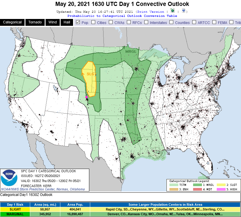 Figure 4 update - the updated SPC thunderstorm forecast for Thursday.
End Thursday afternoon update.
Thursday Update:
We are now settling into a very warm and drier pattern. There is enough moisture around that afternoon thunderstorms are always a possibility. For Thursday, the Marginal and Slight risks of severe weather (hail and high winds) remain out on the eastern and northeastern plains (Figure 1 update). On Friday, a Marginal risk for hail and high winds moves westward and follows I-25 from the Wyoming border down to Denver and eastward (Figure 2 update).
Precipitation may be healthy right under a thunderstorm cell, but most of the region will receive less than 1/4th inch of rain over the next 10 days. Places on the eastern plains and in the mountains may get 1/4th to 1/2 inch of water (Figure 3 update).
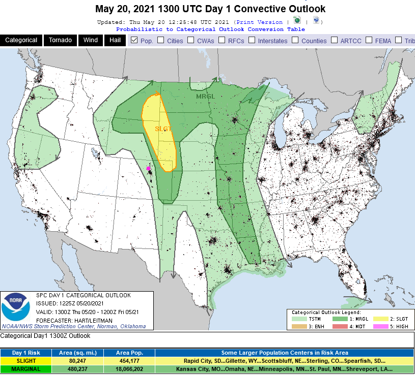 Figure 1 update: the Day 1 (Thursday) SPC severe storm forecast map.
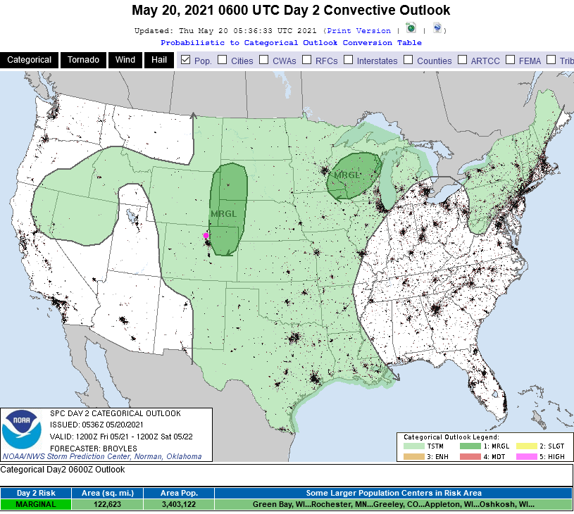 Figure 2 update: the Day 2 (Friday) SPC severe storm forecast map.
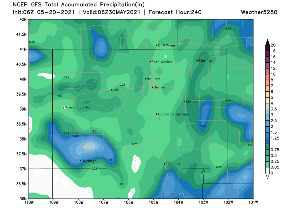 Figure 3 update: the 10 day GFS precipitation forecast from weather5280.com
End Thursday update.
Forecast Discussion:
Another cutoff low is drifting this way (Figure 2) pulling in moisture. Temperatures remain cool at the surface so the up slope flow and afternoon thunderstorms won't create as much rainfall as recent storms. Still, unsettled weather with rain will be in place Monday and Tuesday (Figure 1). The ridge returns later in the week and temperatures return to the upper 70s. Monday will see our last Marginal risk for a bit as the atmosphere stabilizes a bit more (Figure 3). Hail and high winds under a few thunderstorms are the main risks.
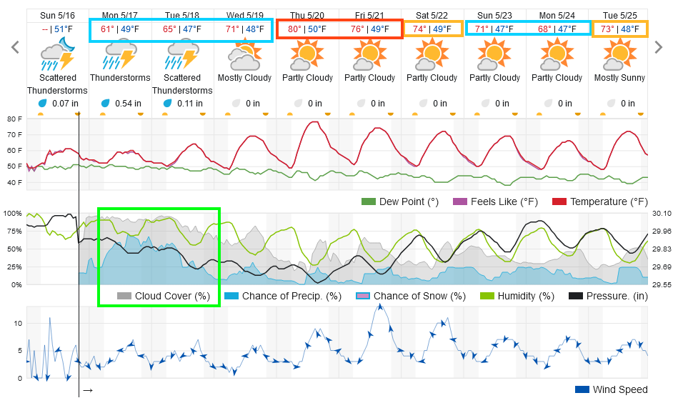 Figure 1: the 10 day graphical forecast from weatherunderground.com for Longmont, CO.
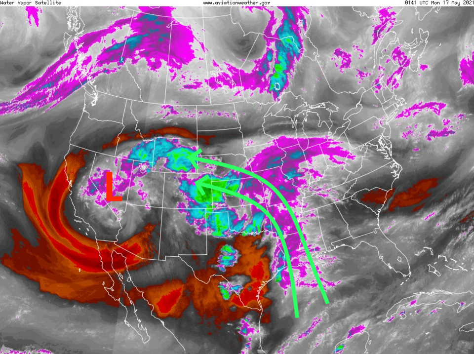 Figure 2: the water vapor satellite image from NOAA from Sunday PM. White/purple is moist air, red/brown is very dry air.
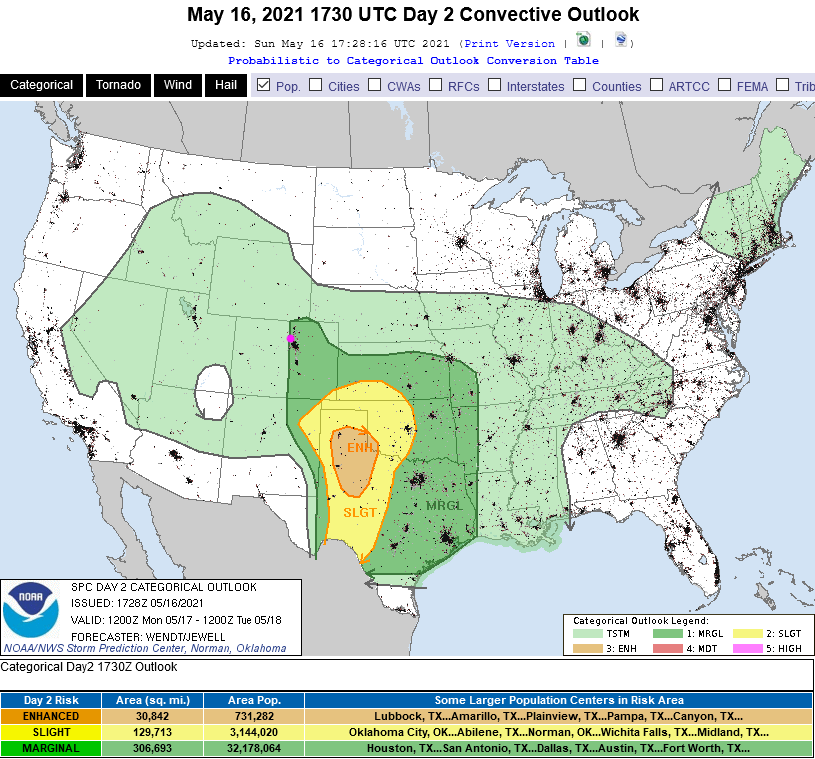 Figure 3: the day 2 (Monday) severe storm forecast from the SPC in Norman, OK.
The Longer-Range Forecast:
That low or trough begins to get absorbed into the broader ridge flow (Figure 4) by Wednesday. We warm up quickly as the background ridge begins to dominate. With some local down slope flow east of the Rockies, we'll only see half to three-quarters of an inch of rainfall while other places around Colorado top 1 to 1.5 inches (Figure 5). Just to check, snowfall is now confined to the highest elevations (Figure 6). Spring marches on!
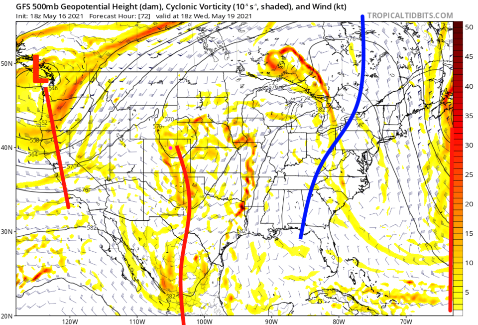 Figure 4: the 500mb upper air forecast map for Wednesday noon from the GFS and tropicaltidbits.com
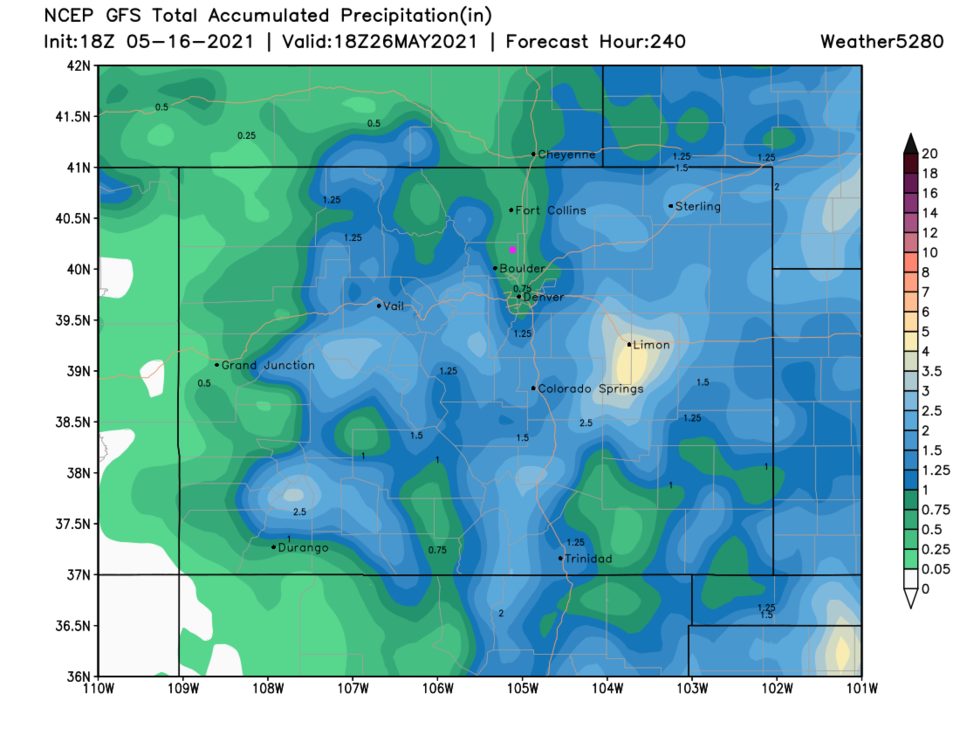 Figure 5: the 10 day total precipitation forecast from the GFS and weather5280.com
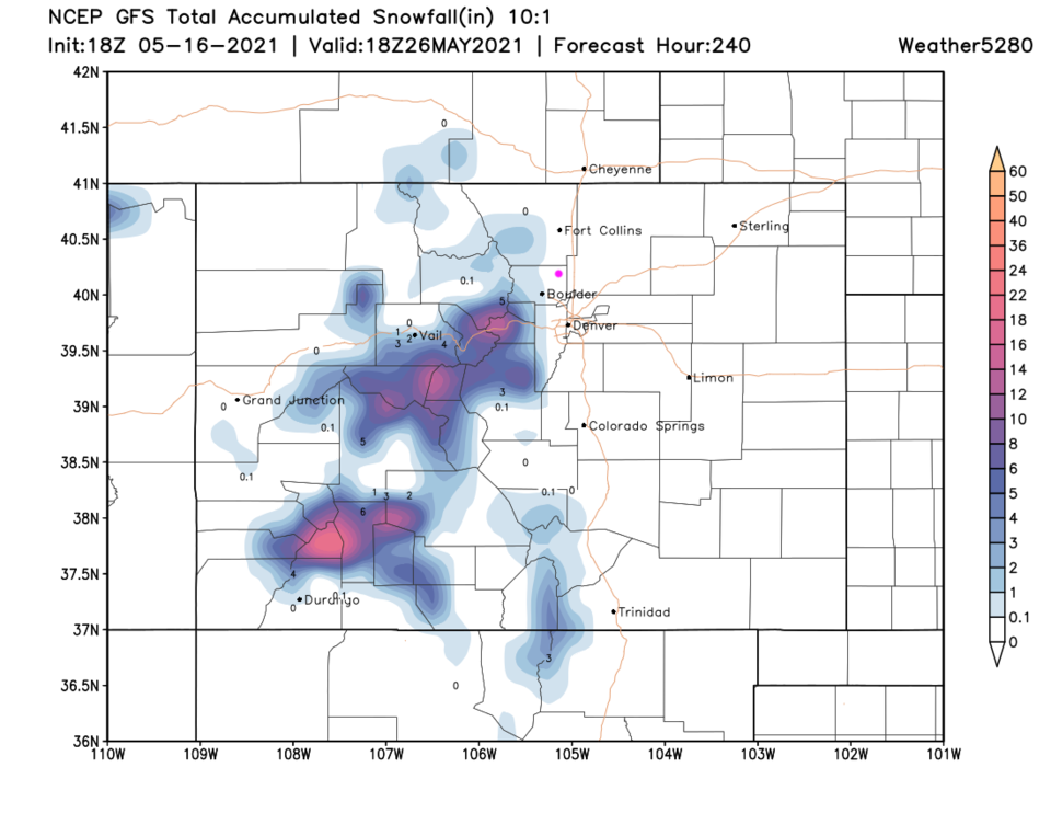 Figure 6: the 10 day (10:1 ratio) total snowfall forecast from the GFS and weather5280.com


