In Brief:
A handful of cold fronts and a forecast of better moisture promises snow and rain twice this week.
Update 11/23/2020 8pm:
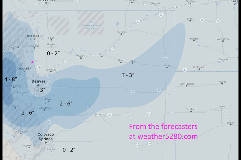
The forecasters at weather5280 have created a snowfall forecast map that I agree with. This storm will favor the Palmer Divide and central Rocky Mountains. Longmont may see a Trace to 2" (They give us about the same a Trace to 3 inches). This isn't a large storm or a cold storm, but the moisture is welcome.
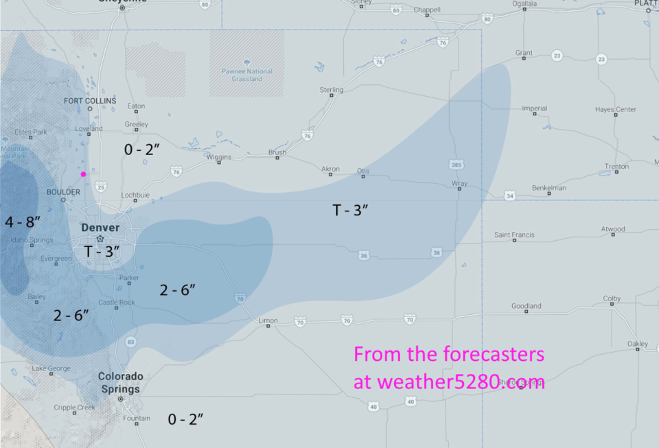 Figure 1 update: the weather5280.com snowfall forecast for Monday to Tuesday.
End 11/23 8pm update.
Forecast Discussion:
We'll start with the 10 day forecast watching the temperatures settle closer to the 40s this week (with an exception on Monday). Cold fronts (blue dashed lines in Figure 1 below) will keep cooling us down Monday, Wednesday and Thursday. The first and last cold front in this series should bring rain and nighttime snow. This weekend will be mild and dry.
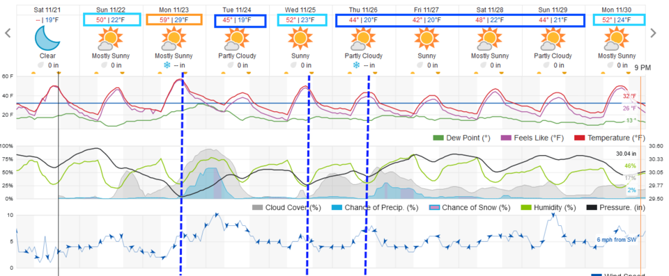 Figure 1: the 10 day graphical forecast from weather5280.com for Longmont, CO.
The Longer Range Forecast:
The next cold front is driven by a deep strong trough approaching Monday and Tuesday (Figure 2). This trough will pull in better moisture than expected a few days ago (Figure 3) with a surface low forming over eastern Colorado. A pretty good up slope flow will create a rain/snow event Monday evening into Tuesday morning (Figure 4).
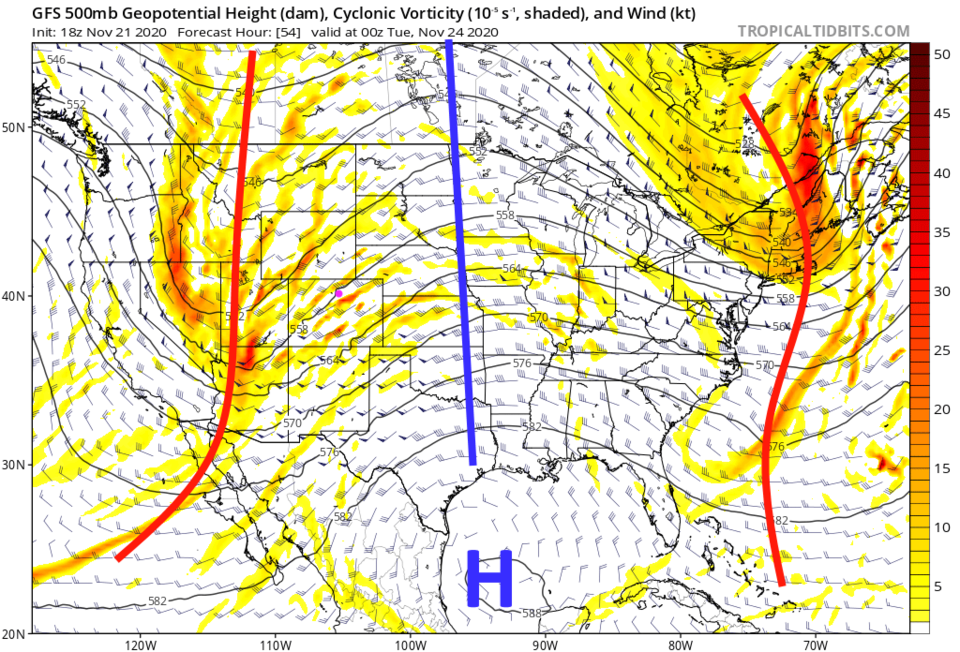 Figure 2: the 500mb upper air forecast map for Monday night from the GFS and tropicaltidbits.com
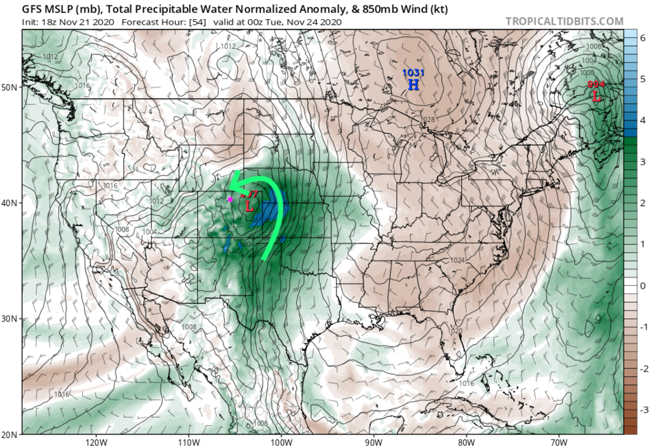 Figure 3: the precipitatable water anomaly (departure from normal) for Monday PM from tropicaltidbits.com
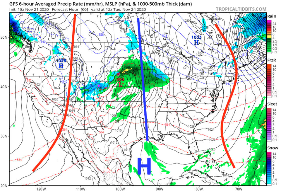 Figure 4: the 6 hour averaged precipitation around Tuesday morning from the GFS and tropicaltidbits.com
Thanksgiving Forecast:
It looks like it will be partly cloudy with a high in the mid-40s with breezy east winds for Thanksgiving Day. A cold front arriving in the late afternoon will bring in a smaller chance of rain and snow than we saw Monday and Tuesday. There is less atmospheric moisture expected with this system (Figure 5) than we saw earlier in the week. The up slope snow shield is expected to be more limited as well (Figure 6).
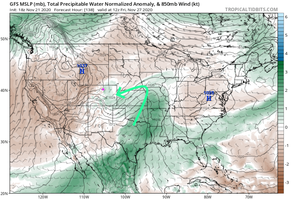 Figure 5: the precipitatable water anomaly (departure from normal) for Friday AM from tropicaltidbits.com
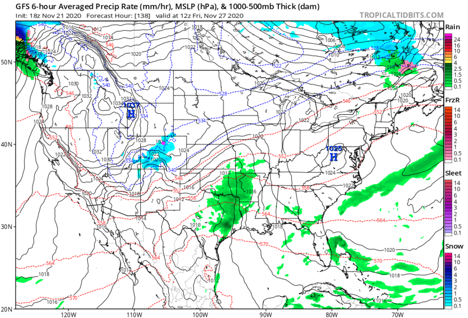 Figure 6: the 6 hour averaged precipitation around Friday morning from the GFS and tropicaltidbits.com
The 10 day snowfall total for Longmont might total near 4-6 inches (Figure 7) with about three quarters of an inch of liquid water (Figure 8). Here's hoping we get that and more!
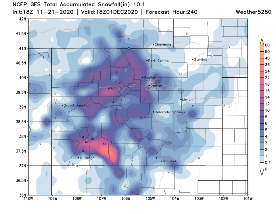 Figure 7: the 10 day 10:1 ratio snowfall total from the GFS and weather5280.com
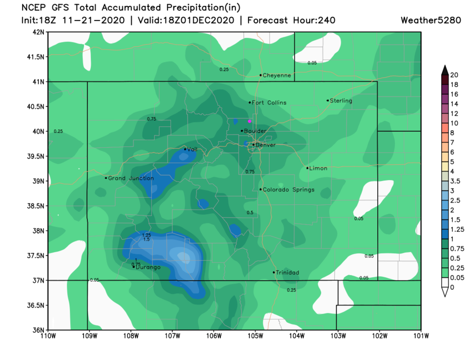 Figure 8: the 10 day precipitation total from the GFS and weather5280.com


