
This Week's Video Forecast
In brief:
Temperatures remain normal for the next 10 days with very low chances of snow along Interstate 25 and out on the plains.
Update New Year's Eve 11am:
The forecast is right on track with seasonable weather (upper 40's to around 50 for highs) and no notable precipitation coming over the next 7-10 days (Figure 1 update). At midnight tonight, it looks like it will be 21F with partly cloudy skies, a nearly full moon, a chance of a flurry, with light west winds. Have a Great New Year!
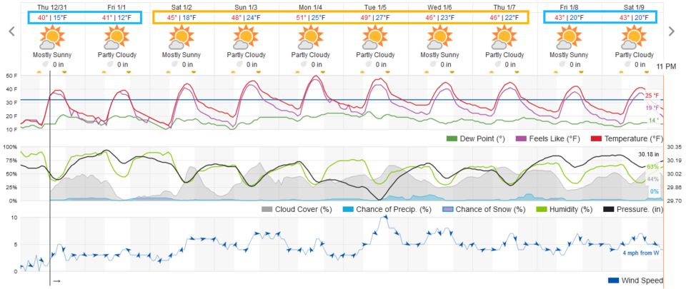 Figure 1 update: the 10 day graphical weather forecast from weatherunderground.com
Update New Year's Eve 11am:
Forecast discussion:
Monday's snowstorm gave Longmont about 1.5 inches of snow while Boulder received a touch less (Figure 1 below). We'll take any moisture we can get.
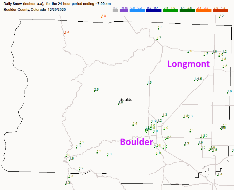 Figure 1: the CoCoRaHS snowfall reports as of Tuesday morning.
 As we start this forecast period, there is a very wet (and snowy in places) storm across the southern U.S. The West Coast also is getting a lot of beneficial precipitation. We are caught in between the two areas with little change expected in the long term (Figure 2). A deep trough just to our east is powering that southern storm and keeping us high and dry (Figure 3).
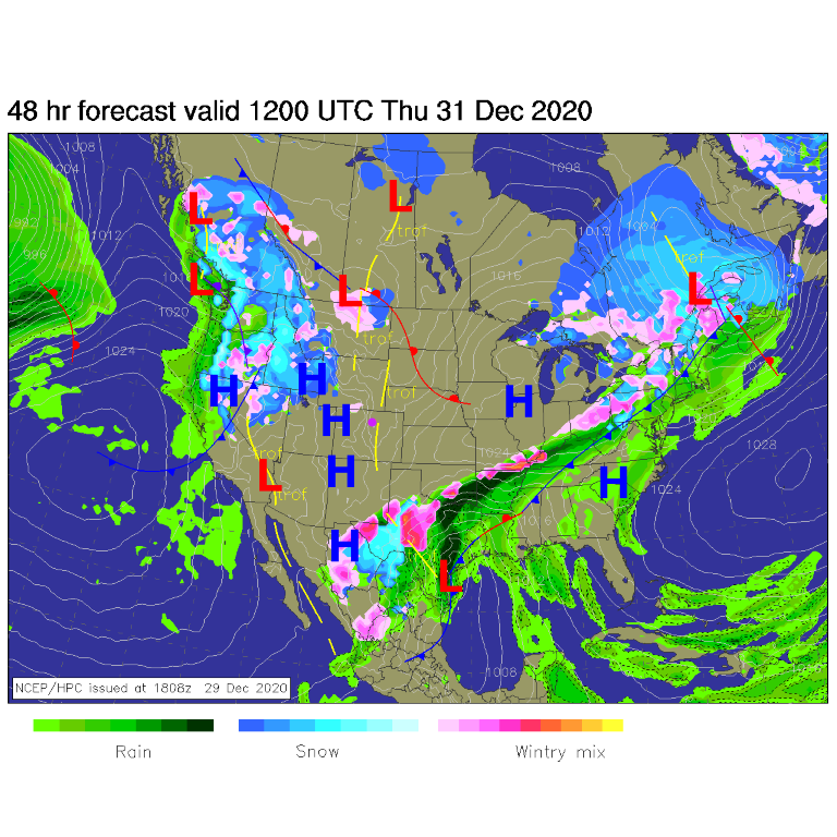 Figure 2: the surface forecast analysis for Thursday morning from NCEP.
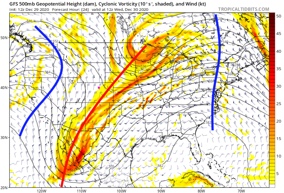 Figure 3: the 500mb upper air forecast map for Wednesday morning from the GFS and tropicaltidbits.com
A large trough remains over the western U.S. for the next few days keeping us cool (actually very normal) as temperatures go (Figure 4).
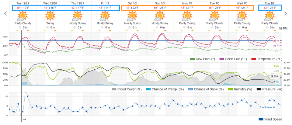 Figure 4: the 10-day graphical forecast from weather5280.com for Longmont.
The longer-range forecast:
By the weekend, there is some ridging forming in the west (blue line in Figure 5) so we warm up to the upper side of normal (Figure 4). You won't notice much change from day to day. Over the next 10 days, areas east of the Rockies remain nearly snow-free while the mountains pick up healthy snow amounts of 1 to 2 feet (Figure 6).
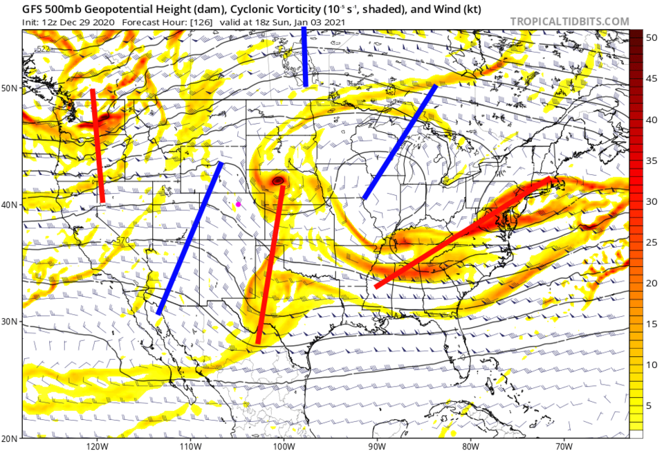 Figure 5: the 500mb upper air forecast map for Sunday noon from the GFS and tropicaltidbits.com
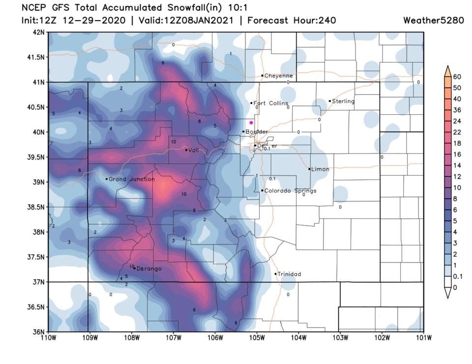 Figure 6: the 10-day (10:1 ratio) total snowfall forecast from the GFS and weather5280.com


