In Brief:
A bit of mid to late spring weather now, followed by much rain, snow and chill for days!
Forecast Discussion:
The short-term forecast is pretty nice even if a cold front will bring snow to the mountains and gusty winds and cooler temperatures Friday. We warm up nicely Saturday then begin to see the "winds of change" on Sunday (Figure 1).
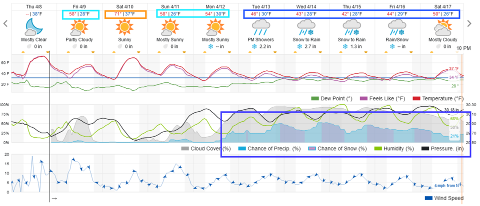 Figure 1: the 10 day graphical forecast from weatherunderground.com for Longmont, CO.
The Longer Range Forecast:
The bad news is that change. You can see starting late Monday night, rain chances, then nighttime snow chances, return, and just don't go away (Figure 1). This is because a giant, slow-moving, cut-off low will settle into the West (Figure 2 on Wednesday). It is still in place by Friday (Figure 3). This thing is in no hurry to leave.
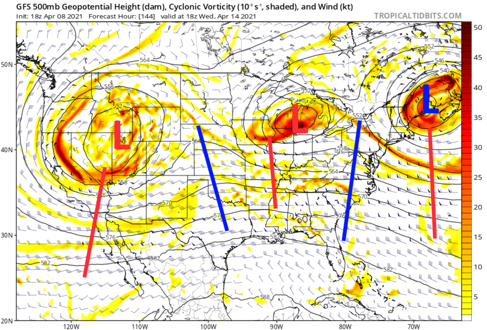 Figure 2: the 500mb upper air forecast map for Wednesday noon from the GFS and tropicaltidbits.com
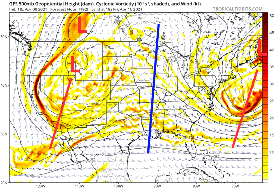 Figure 3: the 500mb upper air forecast map for Friday noon from the GFS and tropicaltidbits.com
It is too early for any reliable picture of snow/rainfall amounts. The weatherunderground model gives us 6-8 inches of snow (Figure 1). The GFS seems to be more in the 10-14 inch area over ten days, not just five. (Figure 4) The amount of water we might get tops two inches over ten days (Figure 5). We'll watch this as the weekend passes! Stay tuned!
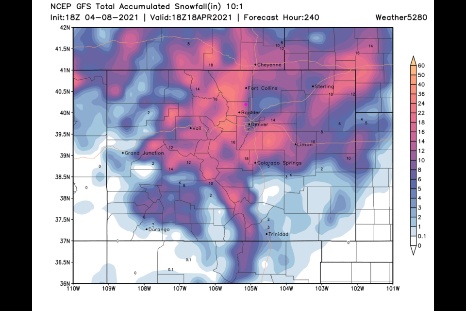
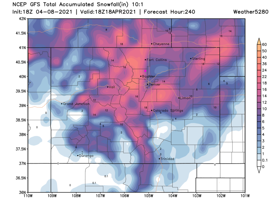 Figure 4: the 10 day (10:1 ratio) total snowfall forecast from the GFS and weather5280.com
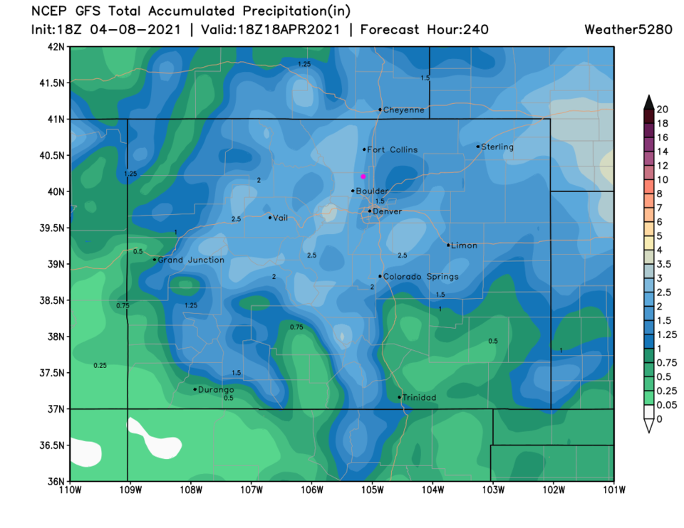 Figure 5: the 10 day precipitation total from the GFS and weather5280.com


