This Week's Video Forecast
In Brief:
We have a beautiful weekend and Monday and ahead with Tuesday springtime showers returning.
Sunday update:
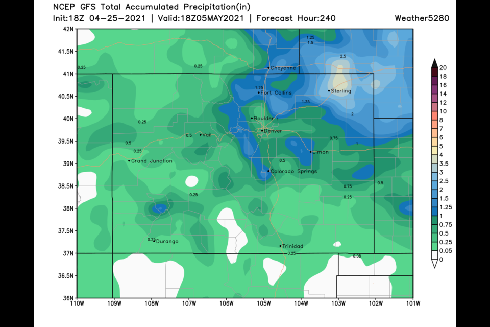
Not much has changed from our last update - incredible weather will continue through Monday. A cold front passing Monday night will cool us to around 60F Tuesday and Wednesday with rain showers moving in. The GFS dos not show snow along I25 over the next 10 days. Weatherunderground gives us about 3/4th of an inch of rain Tuesday/Wednesday (Figure 2 update). The GFS (Figure 3 update) gives us 1/2 to 3/4th inch of rain. Then we warm up and see 80's!! Enjoy!
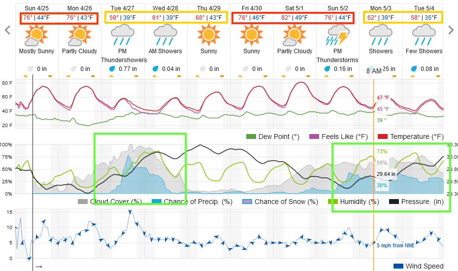 Figure 2 update: the 10 day graphical forecast for Longmont from weatherunderground.com
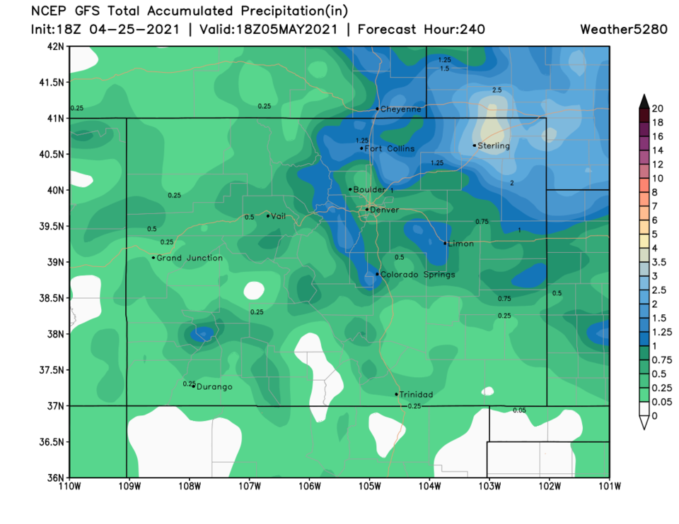 Figure 3 update: the 10 day rainfall total from weather5280 and the GFS.
End Sunday update.
Friday update:
Just a quick Friday PM update: this weekend still looks incredible with warm and dry conditions (Figure 1 update). There is a developing chance of a mainly Tuesday rain storm that might give us 1/2 to 2/3rds of an inch of rain. I say, bring it on! Spring is settling in again. (There were some thunderstorms around the Front Range on Friday, but I didn't hear or see any near Longmont, oh well.)
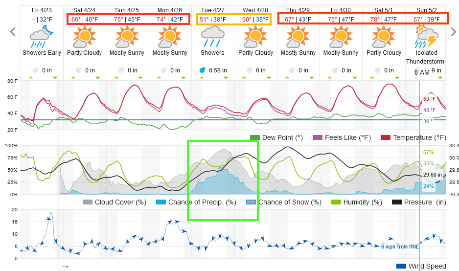 Figure 1 update: the 10 day graphical forecast for Longmont from weatherunderground.com
The end of the Friday update.
Forecast Discussion:
The trough holds on for a couple of more days, as very light flurries fall outside Wednesday night. We stay cool and have rain showers possible Thursday and Friday (Figure 1). This is due to a big trough moving overhead at the end of the week (Figure 2). At the surface, a front will stall across the state and upslope flow may cause light rain and nighttime snow through Friday evening (Figure 3). Storm Prediction Center suggests we might see some thunderstorms Thursday and Friday evenings (Figure 4).
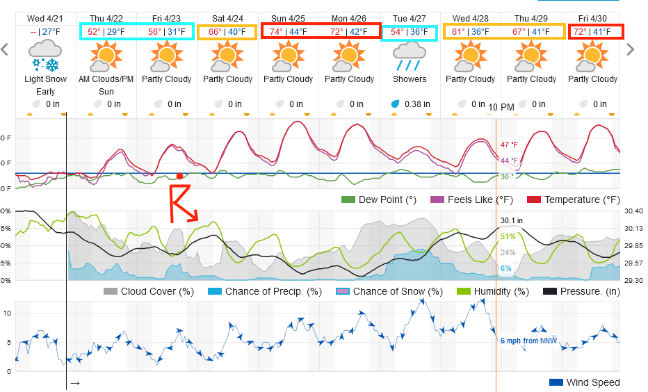 Figure 1: the 10 day graphical forecast from weatherunderground.com for Longmont, CO.
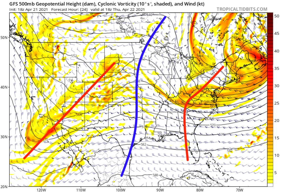 Figure 2: the 500mb upper air forecast map for Thursday noon from the GFS and tropicaltidbits.com
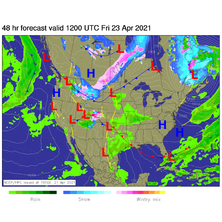 Figure 3: the forecast surface analysis for Friday AM from NCEP.
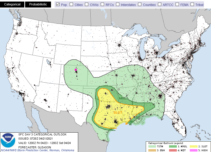 Figure 4: the SPC (Storm Prediction Center) forecast for Friday PM.
The Longer Range Forecast:
In the longer term, the trough moves off and is replaced by a big, dry, warm ridge (Figure 5, blue line). There are some snow and rain chances that return next week, we'll look at those in more detail over the weekend. The GFS gives us only about 1/2-2 inches of snow over the next ten days (Figure 6) and about 0.25 to 0.5 inches of rain over that same stretch of time (not shown). Get out and enjoy the weekend!!!
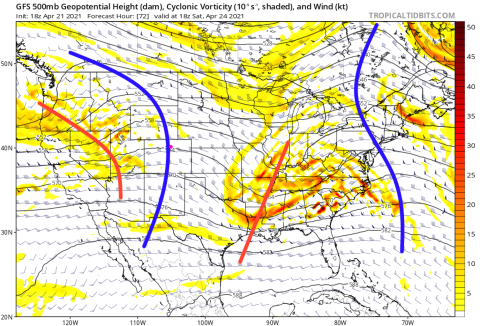 Figure 5: the 500mb upper air forecast map for Saturday noon from the GFS and tropicaltidbits.com
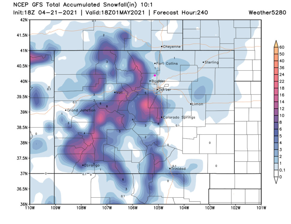 Figure 6: the 10 day precipitation total from the GFS and weather5280.com


