
Update 10/3 4pm:
There is very little change in the overall forecast. The cool front Friday night/Saturday morning cleared the air a bit but the (narrow) plume of (thick) smoke will track nearby or overhead at times through the weekend on continued northwest flow aloft (Figure 1 udpate below).
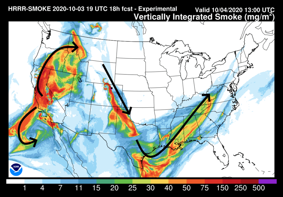 Figure 1 update: the HRRR smoke at all levels forecast for Sunday morning from NOAA
End 10/3 4pm udpate.
In brief:
What you see is what you get — cool to warm weather, then back to cool again, then warm again, with smoke at times and no rain.
Forecast discussion:
I'm going to sound like a broken record but the ridge is holding out west and is beginning to move this way. It is creating persistent northwest flow aloft for Colorado (Figure 1 below).
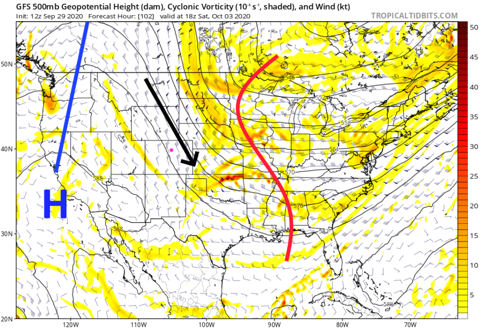 Figure 1: the 500mb upper air map forecast from the GFS for Saturday noon from tropicaltidbits.com
There is a little moisture coming in at the upper levels (Figure 2) but it won't do much more than create mountain sprinkles with our next front (Figure 2). The lower atmosphere is still very dry.
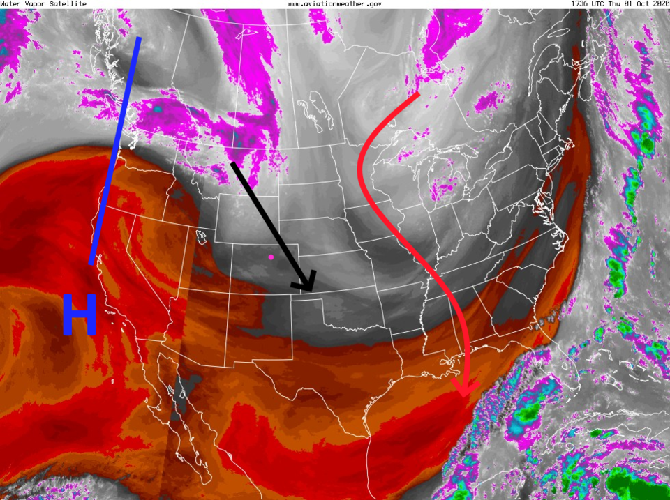 Figure 2: the water vapor satellite image from Thursday afternoon from NOAA
The wind direction is perfect to bring down smoke from the Mullen fire (on the Colorado-Wyoming border) and the Cameron Peak fire (just to its south) to the Front Range communities (Figure 3). A cold front on Wednesday pushed in fresh, clean, cool air from the east under the smoke. There wasn't much mixing so we breathed clean air with a sun-blocking dark smoky sky overhead. The smoke may return in the afternoons and evenings when higher heat and winds in the afternoon make these fires flare up. The cool front on Friday should bring in low-level cool clean air again even if there is smoke overhead.
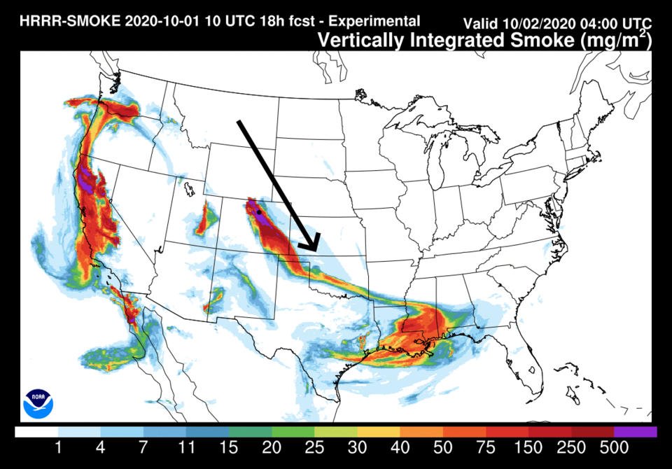 Figure 3: the HRRR smoke at all levels forecast for Friday morning from NOAA.
 The ridge noses eastward, toward Colorado, Friday taking us back to nearly 80 degrees (Figure 4). The next cold front pushes in for Saturday and we drop to the upper 60s, then the ridge takes over again settling us in the 80s for the foreseeable future.
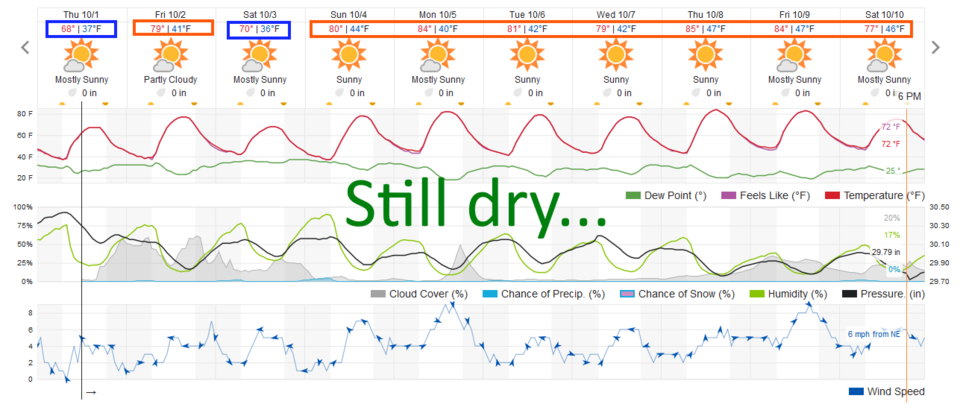 Figure 4: the 10 day graphical forecast for Longmont from weatherunderground.com
The longer-range forecast:
The ridge expands over Colorado for the rest of the week ( Figure 5). As per the Weather Underground model (Figure 4) and the GFS (Figure 6) — we are not expecting any rain for the next 10 days.
On a brighter note: we are done with 90s for highs. The latest high temperature of 90 or greater occurred on Oct. 1, 1892 (yes,1892 not 1982) with a 90-degree day. This is a fall version of summer.
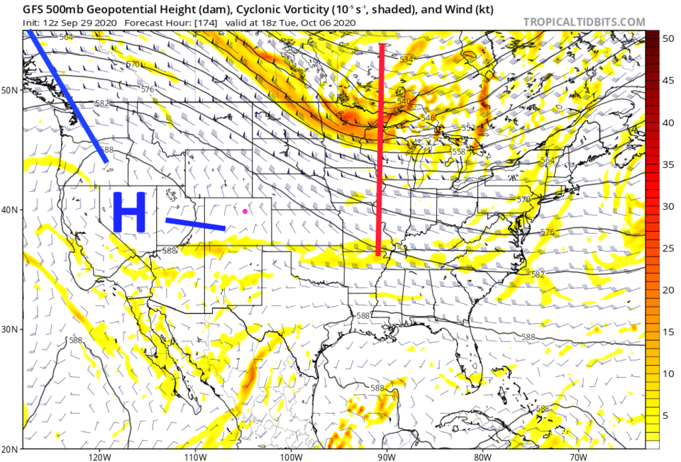 Figure 5: the 500mb upper air map forecast from the GFS for Tuesday noon from tropicaltidbits.com
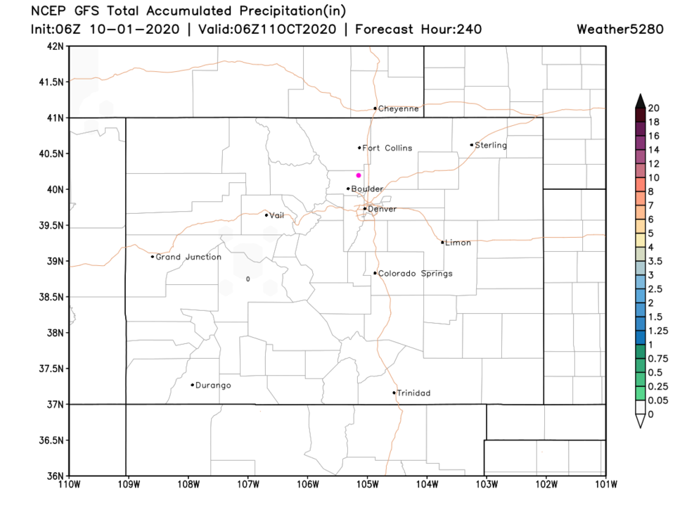 Figure 6: the 10 day precipitation total forecast from the GFS and weather5280.com


