
In Brief:
The weather returns to a dry pattern but with a seasonable slight warm up over the next week.
Forecast Discussion:
Snowfall in our most recent storm was very impressive with many locations receiving nearly a foot of snow north of Longmont and up to 1.5 feet of snow around Red Feather Lakes (and the Cameron Peak Fire - Figure 1). Denver saw more like a half a foot of snow. It was a great dose of moisture that was greatly needed.
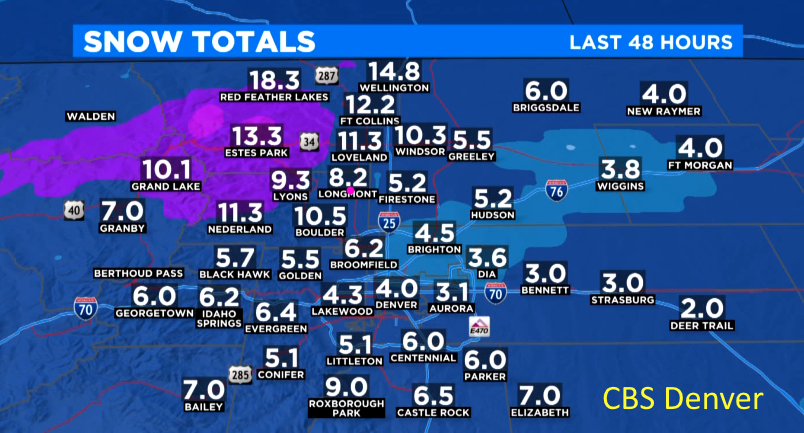 Figure 1: the snowfall total samples for Colorado as of Monday AM from CBS news Denver.
 The smoke over the next day is minimal (Figure 2).
 Figure 2: the HRRR smoke at all levels forecast map for Wednesday afternoon from NOAA.
Our big storm has become a cut-off low down will bring snow and freezing rain to Texas and Oklahoma. We are sitting on the dry, north side of the upper level low (Figure 3).
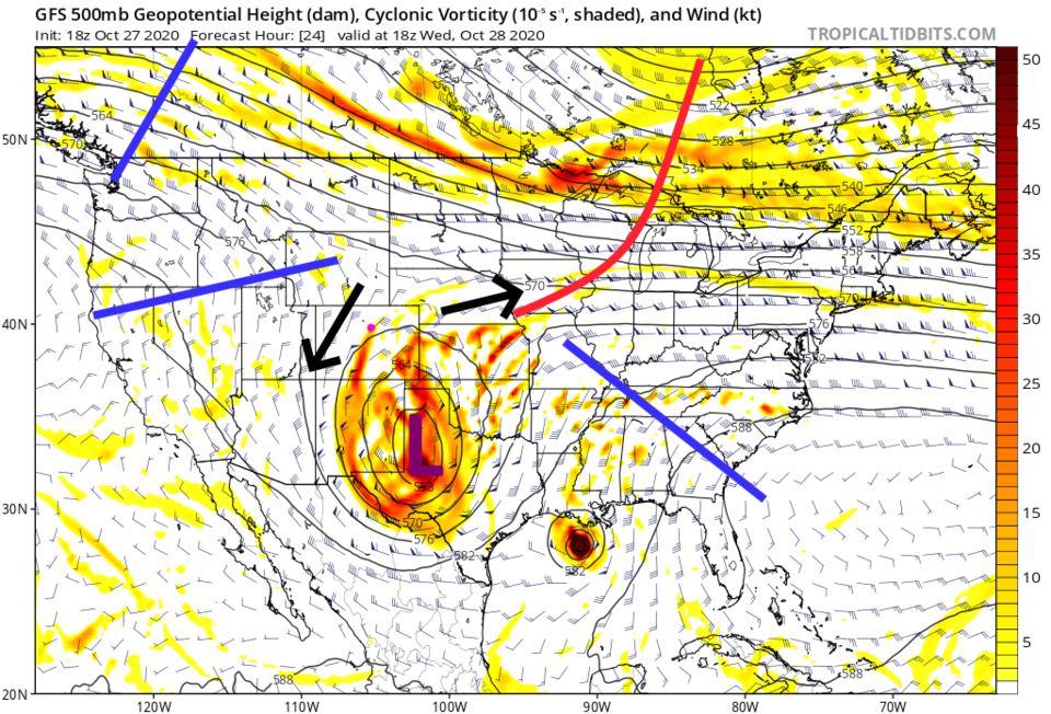 Figure 3: the 500mb upper air forecast map for Wednesday noon from the GFS and tropicaltidbits.com
We warm to the 50s in the short term and watch the snow slowly melt (Figure 4).
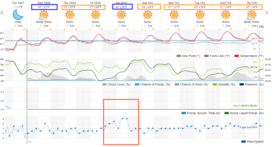 Figure 4: The weather returns to a dry pattern but with a seasonable slight warm up over the next week.
The Longer Range Forecast:
Another trough passes this upcoming weekend. It will kick up winds again (see orange box in Figure 4 and the trough in Figure 5). This will be a dry cold front that will cool us to the 40s for a day.
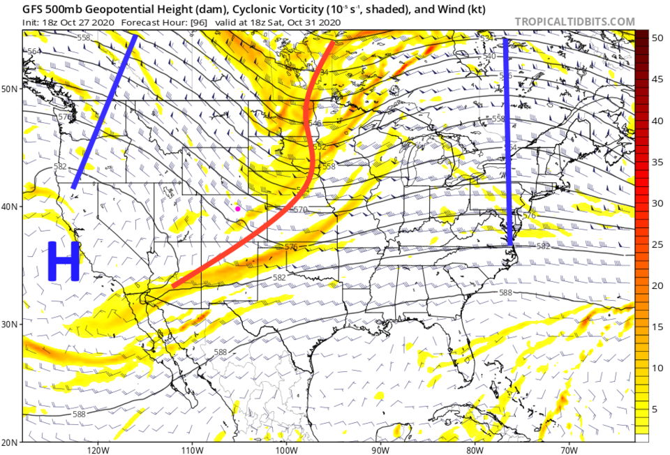 Figure 5: the 500mb upper air forecast map for Saturday noon from the GFS and tropicaltidbits.com
As you can see in Figures 4, 6 and 7, we don't expect any precipitation over the next ten days.
Halloween Forecast:
IF you are going out for any reason on Halloween Night - it looks like it will be clear under a very full moon.
At 6pm the tempreature will be 46F with brisky winds at 10mph out of the west. By 9pm, it will be 36F with light winds out of the east.
There is no precipitation in the forcast.
 Figure 6: the 10 day precipitation total from the GFS and weather5280.com
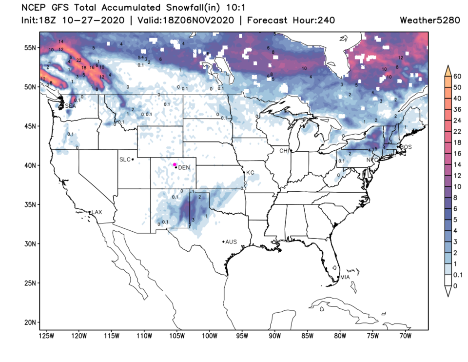 Figure 7: the 10 day snowfall total from the GFS and weather5280.com


