In Brief:
Above normal, but not extreme, heat and increasing smoke levels continue through the weekend with no precipitation.
Forecast Discussion:
Our (weather) lives are still dominated by the persistent high pressure system to our west. It starts this forecast period sitting over northern Arizona. This is allowing the air coming from the fires in the west a somewhat more direct trip into Colroado (black lines). You can also see the remains of Hurricane Sally over northern Georgia by Thursday midday (Figure 1 below).
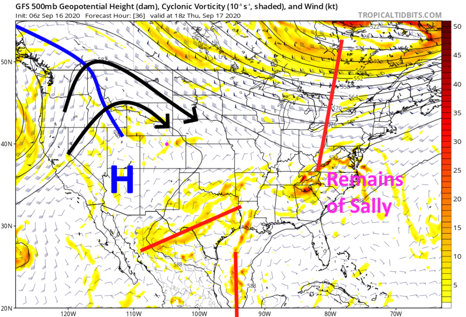 Figure 1: the 500mb upper air forecast map from the GFS and tropicaltidbits.com for Thursday noon.
 The water vapor satellite image shows really dry air to the southwest of the state (red and orange colors in Figure 2). We are still very dry.
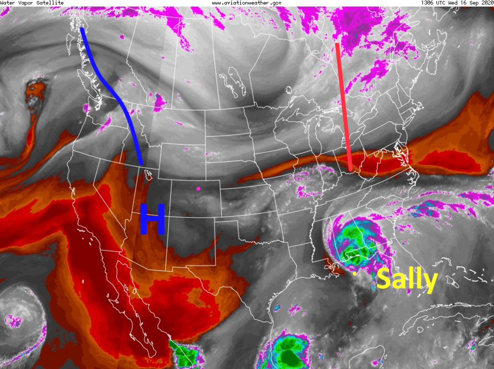 Figure 2: the water vapor satellite image from Wednesday AM from NOAA.
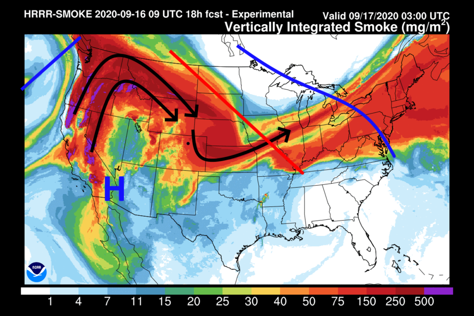
With the high pressure center shifting more towards Yuma, AZ on Thursday, the wind flow aloft is shifting bringing smoke from the western fires our way. The forecst smoke, at all levels, Thursday morning shows significant smoke flowing over Colorado (Figure 3).
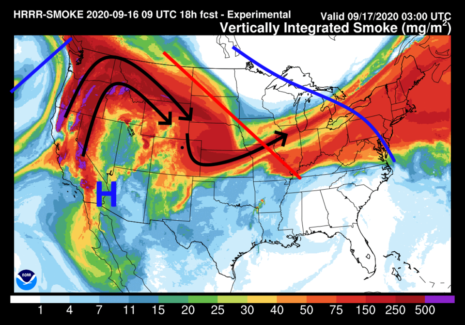 Figure 3: the HRRR forecast of smoke at all levels for Thursday morning from NOAA.
The High-Resolution Rapid Refresh,HRRR, models the smoke at different levels as well. We are more interested with surface smoke since we live down on the ground. Figure 4 shows the ground-level smoke getting farily thick Thursday as well.
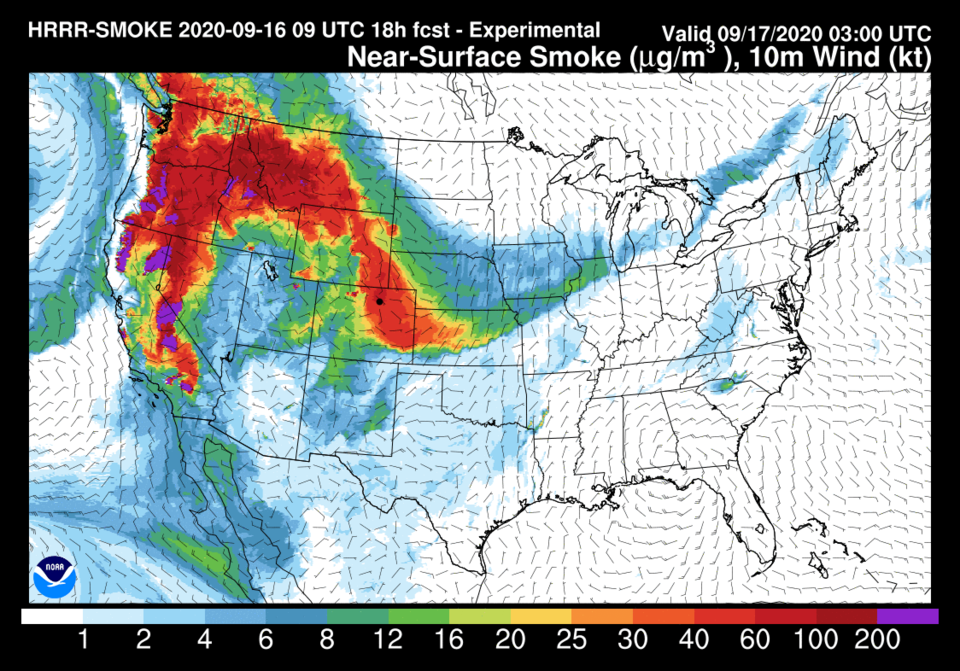 Figure 4: the HRRR forecast of smoke near ground level for Thursday morning from NOAA.
Since the ridge is still so near the four corners area, our temperatures remain above normal, mid-upper 80s F, (Figure 5).
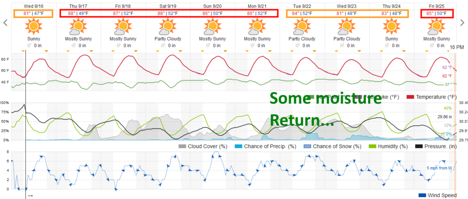 Figure 5: the 10 day graphical forecast for Longmont from weatherunderground.com
The Longer Range Forecast:
Dry air on the east side of the high means no rain for the next 5 days (Figure 5 and Figure 6).
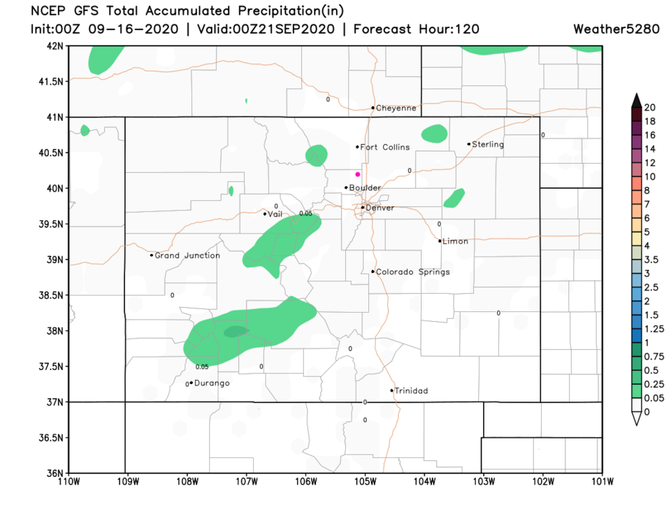 Figure 6: the 5 day precipitation total from the GFS and weather5280.com
Our next change in the weather comes over the weekend as a trough depresses the ridge to the south. The trough itself passes to the north of the state. Temperatures will cool down to the lower 80s F but we will have a more direct fetch of smoke filled air. We might see a bit more moisture with the pattern change and cool down next week. Very small rain chances return (Figure 5 on the right).
There also will be a new hurricane on the map by then - Hurricane Teddy will be threatening the island of Bermuda (Figure 7) this weekend.
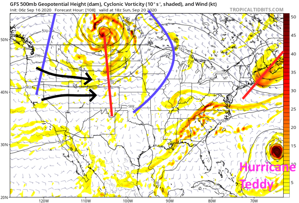 Figure 6: the 500mb upper air forecast map from the GFS and tropicaltidbits.com for Sunday noon.


