Skip to content

Wednesday Update: Longmont Weather Forecast: Hot and dry now, cool and moist at week's end

Figure1u_9012021
Figure 1 update: the 48 hour precipitation forecast from the GFS and weather5280.com

This Weeks Forecast Video!

In Brief:

Hot and dry through Thursday, then cooling showers return.

Wednesday update:

The GFS shows some precipitation across the state Wednesday and Thursday (Figure 1 update). Amounts are expected to be very light along I-25.


Figure1u_9012021
Figure 1 update: the 48 hour precipitation forecast from the GFS and weather5280.com


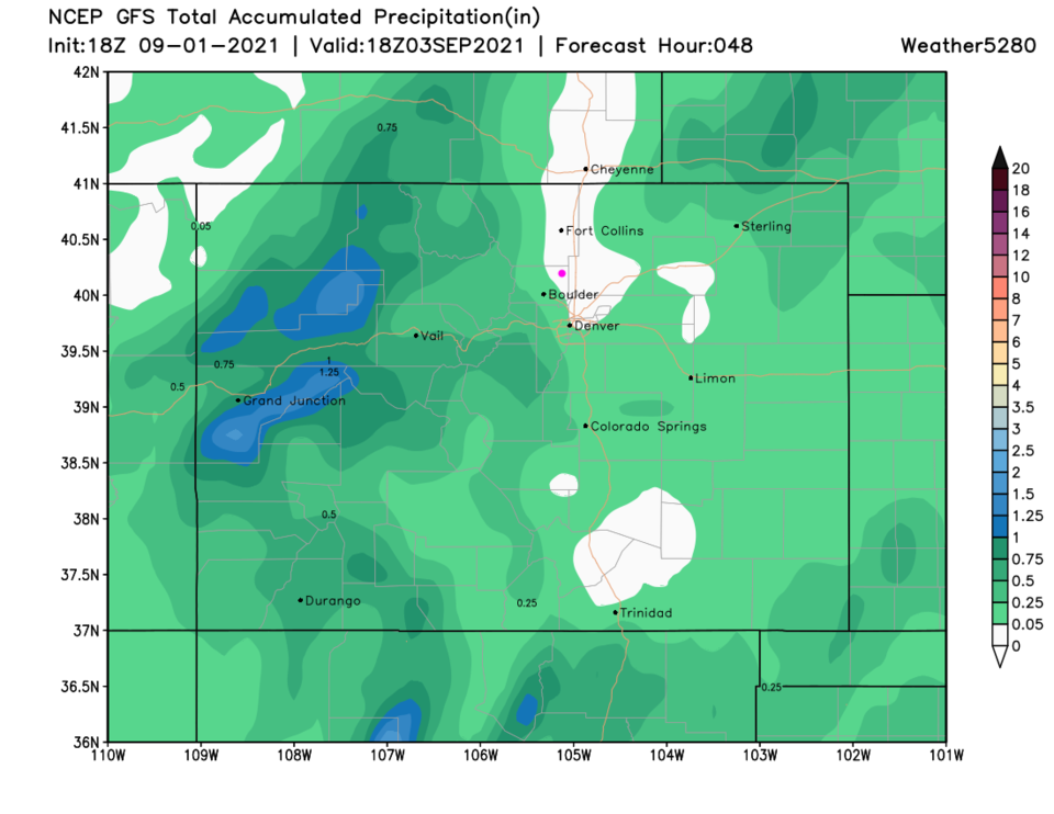
End Wednesday update.

Forecast Discussion:

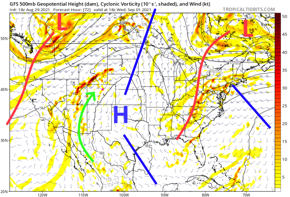
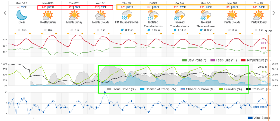
The ridge is holding on for a few more days. We'll see near record heat through Wednesday (Figure 1).  The upper air flow will also bring California smoke directly into Colorado (Figure 2).  Hang on, much more normal weather is returning soon.


Figure1_08292021
Figure 1: the 10 day graphical forecast for Longmont from weatherunderground.com


Figure2_08292021
Figure 2: the smoke forecast for Tuesday morning from the HRRR and NOAA. .


The Longer-Range Forecast:

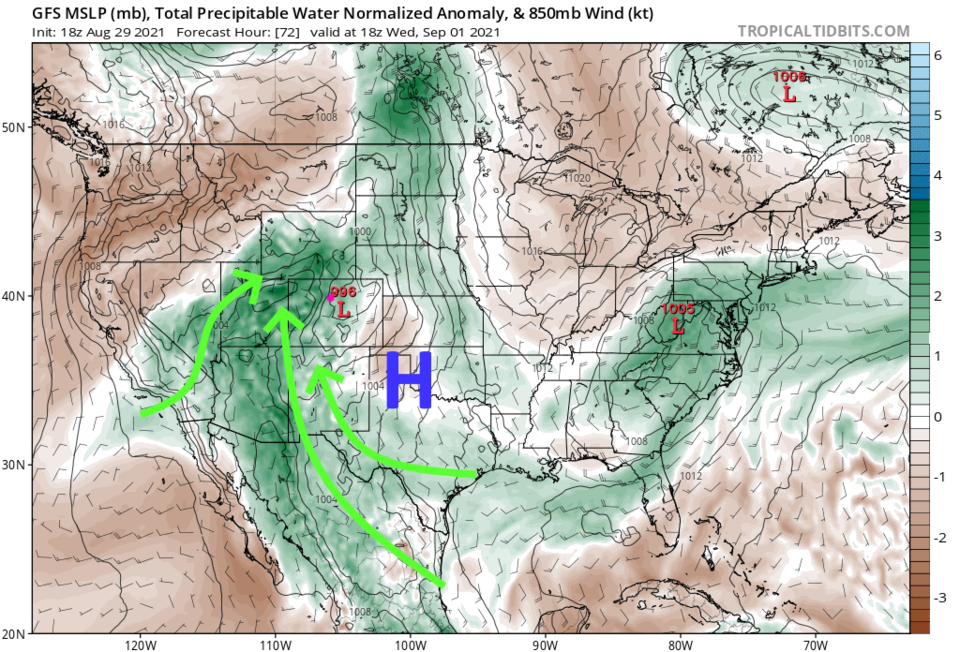
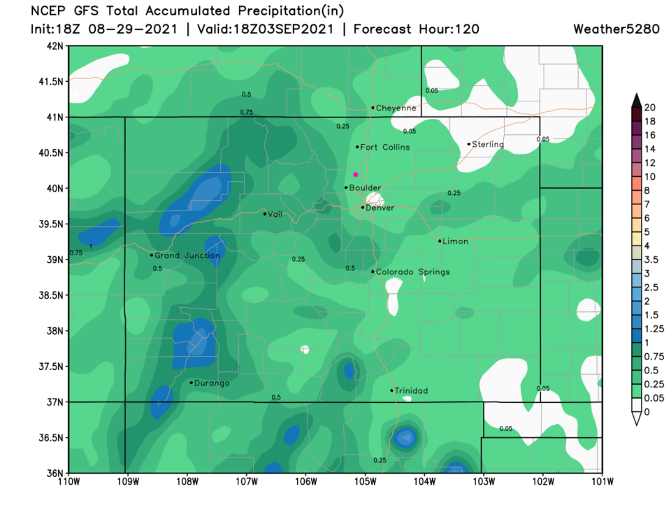
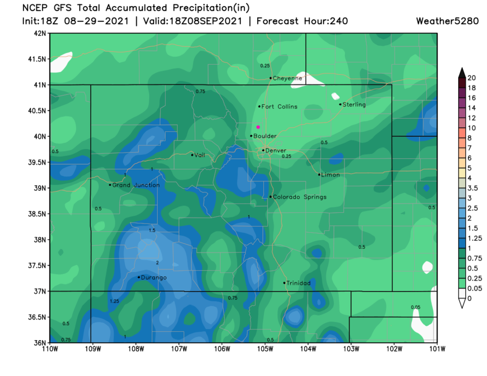
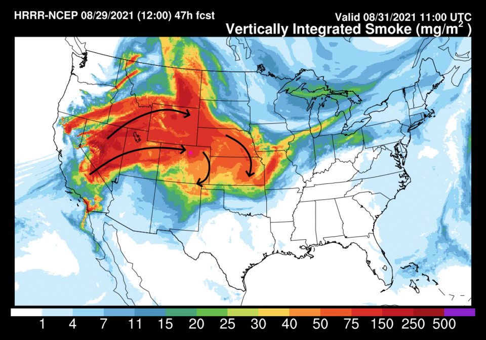
A trough approaches at the end of the week shoving the high off to the east (Figure 3).  A rich flow of tropical moisture returns around the western side of that high center (Figure 4). Over the next 5 (Figure 5) and 10 days (Figure 6) some rain showers will begin to dampen the state. The mountains will get the best rain over the next week. Hold on for the relief!


Figure3_08292021
Figure 3: the 500mb upper air forecast map for noon Wednesday from tropicaltidbits.


Figure4_08292021
Figure 4: the precipitatable water anomaly forecast map for noon Wednesday from tropicaltidbits.


Figure5_08292021
Figure 5: the 5 day precipitation forecast from the GFS and weather5280.com


Figure6_08292021
Figure 6: the 10 day precipitation forecast from the GFS and weather5280.com


About the Author: John Ensworth

John Ensworth used to work from Longmont as the PI for the NASA through the IGES (The Institute for Global Environmental Strategies). He now teaches technology, algebra, astronomy, meteorology, film school, and Lego robotics to middle/high school.
Read more


Comments


Current Weather

Light snow

Light snow

36°F

UV Index
1 Low
Pressure
30.25 Falling
Visibility
3 miles
Dewpoint
32 °F
Humidity
84%
Wind
E 2.8 mph
Gust
5.4 mph
Wind Chill
35 °F

Hourly Forecast

Today
3 PM
39°F
Cloudy
Today
4 PM
40°F
Cloudy
Today
5 PM
41°F
Cloudy
Today
6 PM
40°F
Cloudy
Today
7 PM
40°F
Cloudy
Today
8 PM
39°F
Cloudy
Today
9 PM
38°F
Cloudy
Today
10 PM
38°F
Cloudy
Today
11 PM
38°F
Cloudy
Tomorrow
12 AM
38°F
Cloudy
Tomorrow
1 AM
37°F
Cloudy
Tomorrow
2 AM
37°F
Cloudy

7 Day Forecast

Rain and snow

Thursday

41 °F

Cloudy and much colder


Mostly cloudy

Thursday Night

35 °F

Mostly cloudy


Mostly cloudy w/ showers

Friday

47 °F

Chilly with some sun, then turning cloudy; a little rain in the afternoon


Rain and snow

Friday Night

33 °F

Periods of snow; rain mixed in early, accumulating an inch or two


Flurries

Saturday

43 °F

A bit of morning snow with little or no accumulation; otherwise, cloudy and chilly; storm total snowfall an inch or two


Intermittent clouds

Saturday Night

31 °F

Partly cloudy


Partly sunny

Sunday

69 °F

Pleasant and warmer with partial sunshine


Partly cloudy

Sunday Night

44 °F

Partly cloudy


Intermittent clouds

Monday

79 °F

Very warm with a blend of sun and clouds


Intermittent clouds

Monday Night

36 °F

Increasing clouds


Sunrise and Sunset

Sunrise
6:17 AM
Sunset
7:43 PM

Based on AccuWeather data