In Brief:
Exceptionally warm weather through Monday becomes a chance of showers Tuesday then more seasonable temperatures.
Wednesday Update:
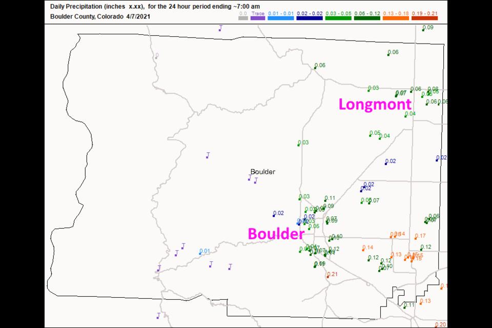
We received less than 1/10th of an inch in Longmont, but any moisture is good (Figure 2 update). We warm up except for a chill on Friday (a mostly dry cold front). Heads up, though... middle next week on through next weekend looks chilly and wet day after day. More on that later!
 Figure 2 update: the CoCoRaHS rainfall total as of 7am Wednesday.
End Wednesday update.
Monday Update:
The front arrives this evening, but rain is delayed. It looks like about a quarter inch of rain will fall between mainly noon and 6pm Tuesday (Figure 1 update). The GFS (Figure 2 update) is more bullish about rainfall and gives us 1/2 to 3/4th inch of rain (Note: that IS the 10 day total, the next 48 hours gives us less than 1/10th inch from the GFS). That would be nice! Enjoy Spring showers!
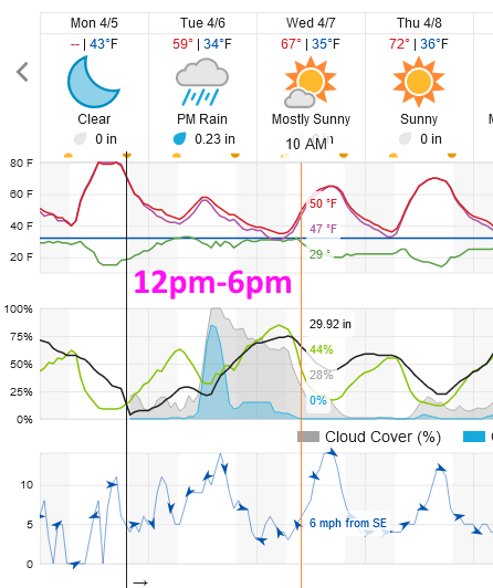 Figure 1 update: snippet of the the 10 day graphical forecast from weatherunderground.com for Longmont, CO.
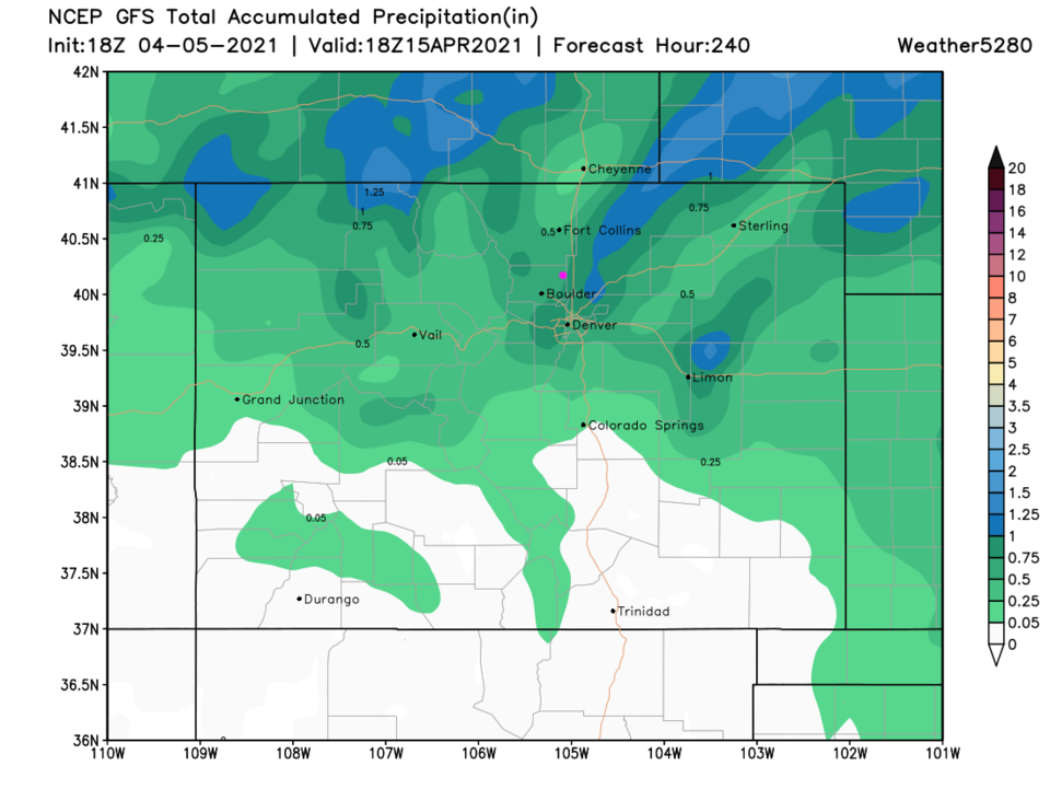 Figure 2 update: the 10 day (10:1 ratio) total precipitation forecast from the GFS and weather5280.com
End Monday Update.
Forecast Discussion:
A giant ridge over the western U.S. (Figure 1) is making much of the nation think thoughts of summer (Figure 2). Temperature anomalies in the second figure are 20-30 degrees above normal from Arizona up into the upper Midwest.
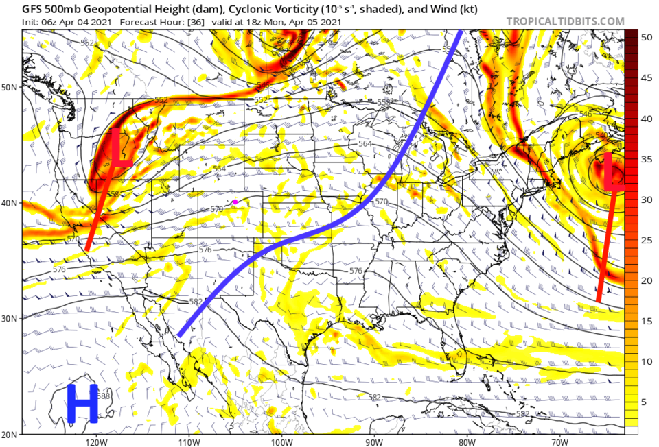 Figure 1: the 500mb upper air forecast map for Monday noon from the GFS and tropicaltidbits.com
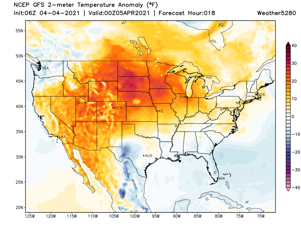 Figure 2: the temperature anomaly (departure from normal) for Sunday PM from weather5280.com
The Longer Range Forecast:
The ripple (trough) on the western side of the ridge is slowly approaching Colorado (Figure 1). That will give us about 1/10th of an inch of rain on Tuesday (Figure 3). The ridge breaks down a bit after this and we remain in the upper 60s and lower 70s for much of the rest of the week, closer to normal. Enjoy and Happy Easter!
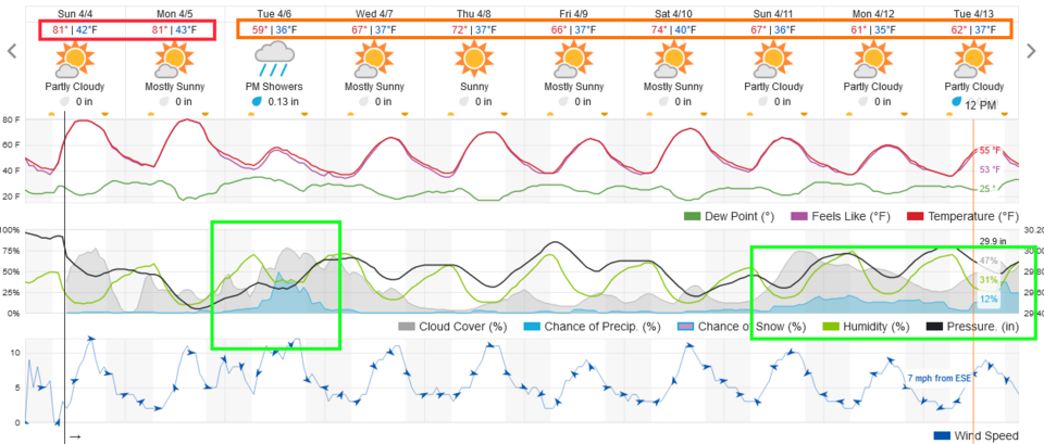 Figure 3: the 10 day graphical forecast from weatherunderground.com for Longmont, CO.


