In Brief:
We start the weekend with dry heat and begin the week wet and chilly, very wet.
Monday update:
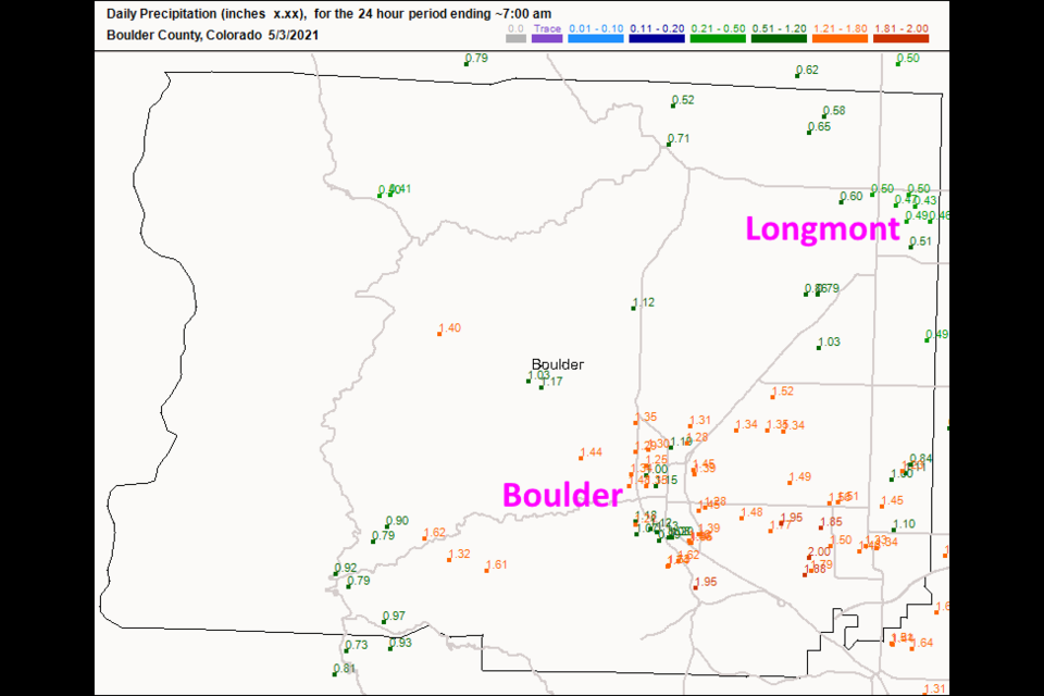
Rain kept falling all day (after 7am) but Figure 2 update shows what fell at first. Longmont received about 1/2 inch of liquid while most of Boulder broke the 1 inch mark and approached the 1.5 inch levels.
The forecast beyond today still looks good with smaller rain chances through Wednesday afternoon. There will be dry periods and a slow warm-up. Stay dry!
 Figure 2 update: the rainfall reports as of 7am Monday (rainfall fell all day- after this) from CoCoRaHS.
End Monday update.
Saturday update:
Before a second front arrives in the evening, we'll have some instability over the region from early afternoon to late afternoon. The Storm Prediction Center in Norman OK has painted us with a Marginal Risk of severe weather for the afternoon - with the primary risk being strong damaging thunderstorm winds and large hail (Figure 1 update). There is a slight risk (an elevated 2 out of a scale of 1-5) for severe weather just to our east. Tornadoes are not a great risk this time, but not impossible. The GFS and other models have backed off on rainfall totals. Longmont is now in the 1 to 1.5 inch zone by Thursday (Figure 2 update).
Overall, not much of a change. Get ready to watch your lawn grow.
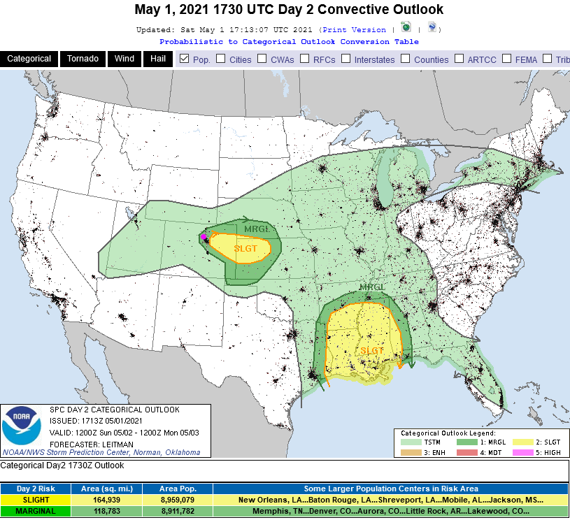 Figure 1 update: the severe weather outlook for Sunday from the SPC in Norman, OK
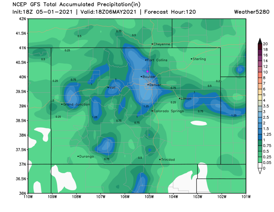 Figure 2 update: the rainfall total through Thursday noon from the GFS and weather5280.com
End Saturday update.
Forecast Discussion:
The two big stories are the extreme warmth Saturday then the potentially significant amount of rain we'll pick up early in the week. Figure 1 shows us reaching the upper 80s on Saturday with downslope winds, surface high pressure (Figure 2) and sinking air ahead of our next system, the trough seen to the west of our state in Figure 3. Temperatures across the state may be up to 20 degrees above normal. Then next cold front arrives Saturday evening, the first blue dashed line in Figure 1.
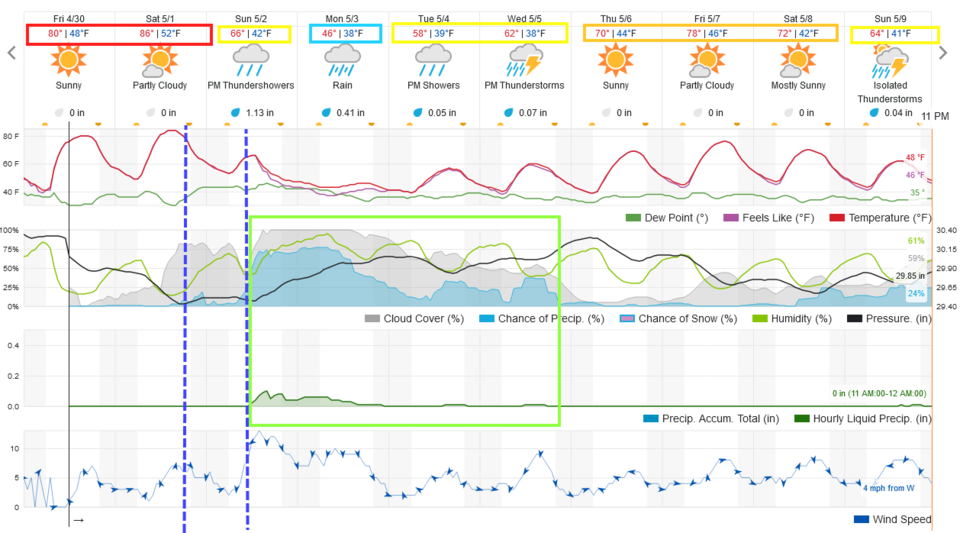 Figure 1: the 10 day graphical forecast for Longmont from weatherunderground
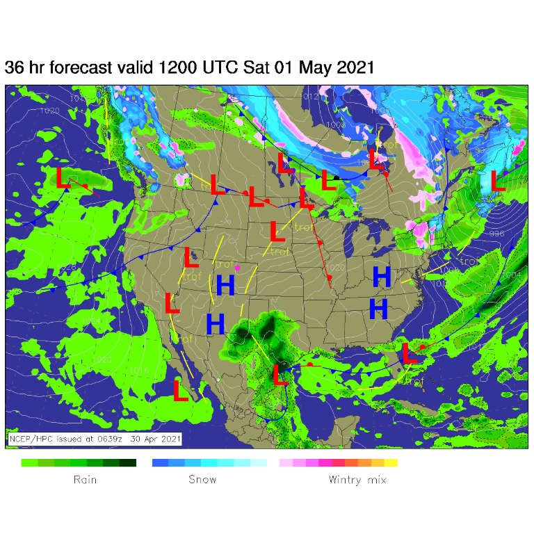 Figure 2: the surface forecast map for Saturday from NCEP.
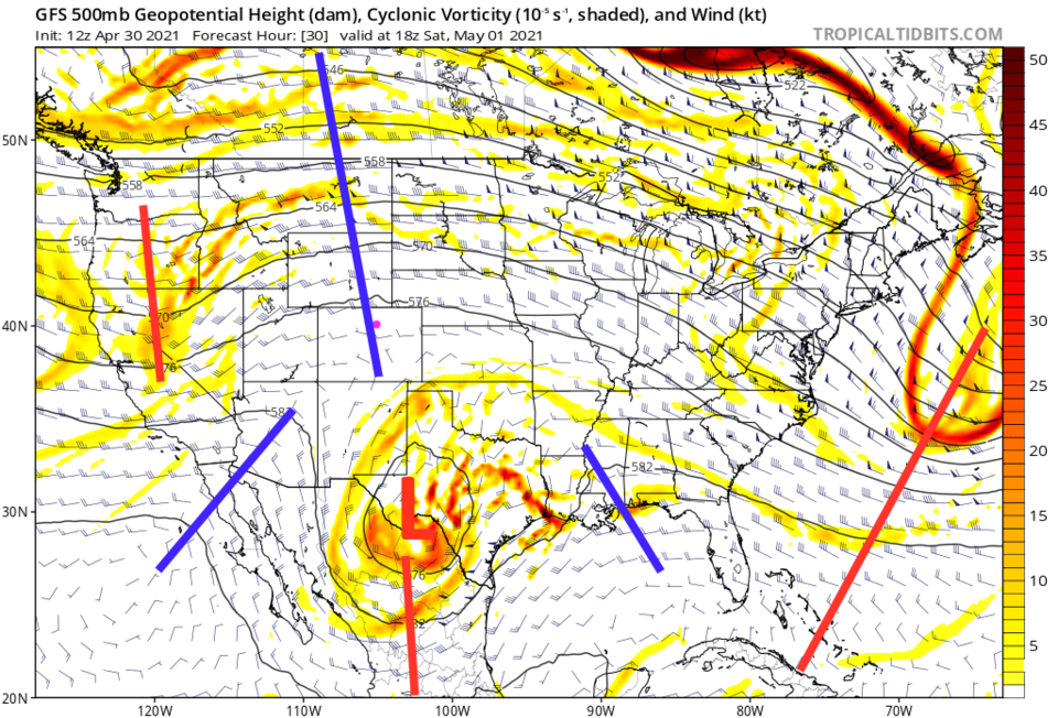 Figure 3: the 500mb upper air map valid Saturday noon from the GFS and tropicaltidbits
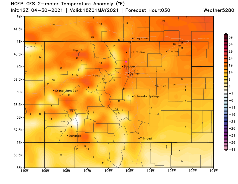 Figure 4: the surface temperature departure from normal map for Saturday from weather5280.com
The Longer Range Forecast:
Saturday evening's cold front is followed by another wind shift and more significant north winds (Figure 1 - second dashed blue line). A cut-off low forms to the west of Colorado, slows down and pulls significant moisture toward us (Figure 5) as it takes about three days to drift across the state. Figure 1 shows rain chances picking up rapidly between 9 a.m. and noon Sunday. They taper off some Tuesday, but some rain will keep falling through Wednesday, with some thunderstorm activity thrown in.
The weatherunderground model in Figure 1 shows about 1.5 inches of rain. But the GFS is hitting us with 2.5-3 inches of water (Figure 6). The mountains may see a foot of snow in the higher elevations. We could see a dusting of snow late Monday night when temperatures cool enough (Figure 7). The GEM model (Figure 8) splits the rainfall difference with about 1.75 to 2 inches of water.
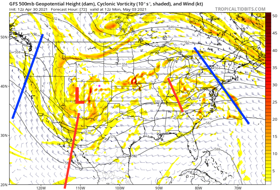 Figure 5: the 500mb upper air map valid Monday AM from the GFS and tropicaltidbits
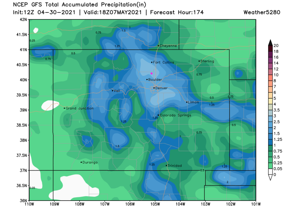 Figure 6: the precipitation forecast from the GFS and weather5280.com through Thursday noon.
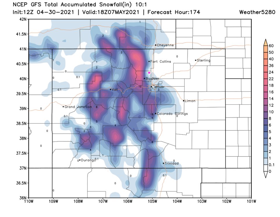 Figure 7: the 10:1 snowfall forecast from the GFS and weather5280.com through Thursday noon.
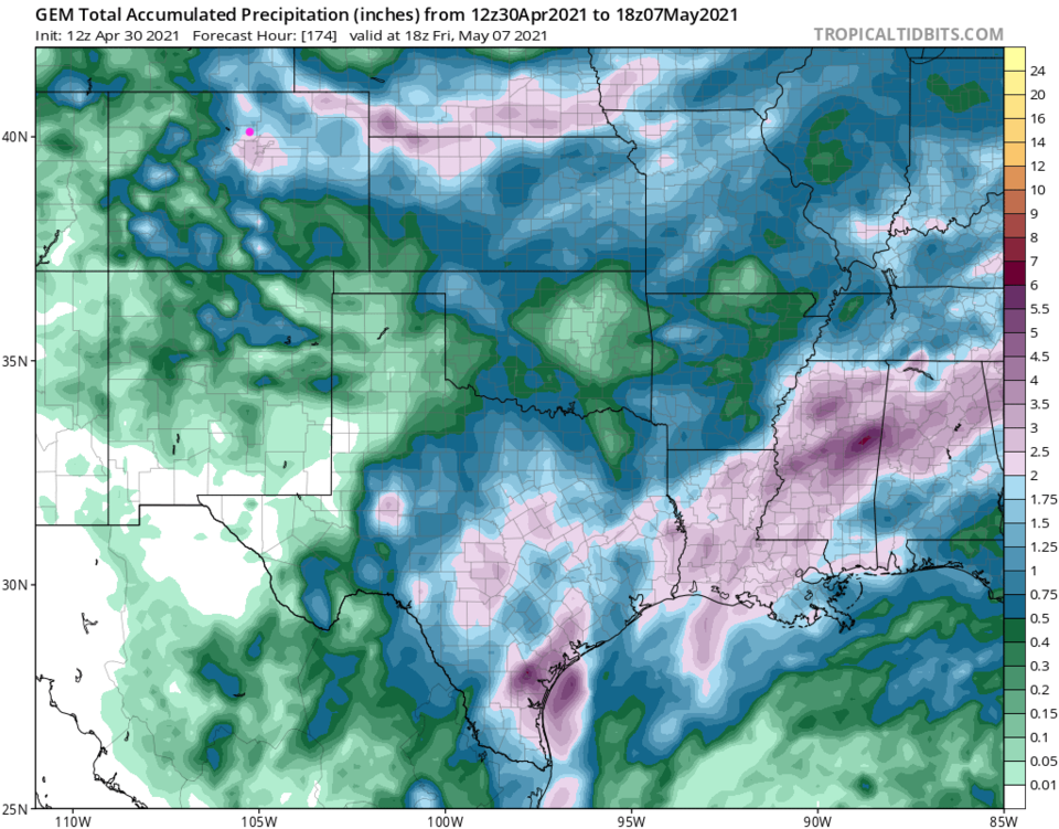 Figure 8: the precipitation forecast from the GEM and tropicaltidbits.com through Thursday noon.


