The Video Forecast for this Week.
In brief:
A couple of inches of snow around Interstate 25 Saturday followed by warm normal temperatures the rest of the week.
Friday Update:
The wind came and is becoming a memory. The Monday/Tuesday snow chances are still quite minimal in the models. We don't get snow along I-25 (or rain) according to the GFS (Figure 2 update below). There is a hint of more snow next Friday/Saturday, but that is a long way out. Temperatures won't vary much either, the highs will be in the 40's each day though the weekend.
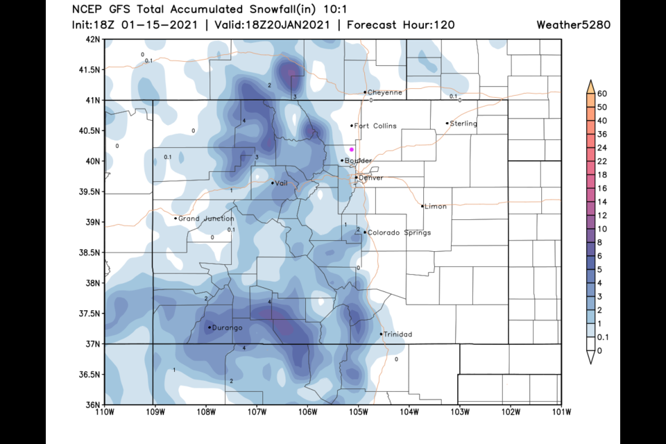
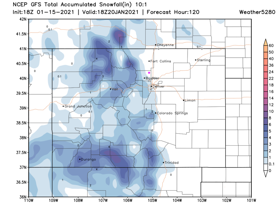 Figure 1 update: the 5 day (10:1 ratio) total snowfall forecast from the GFS and weather5280.com
End Friday Update.
Tuesday Update:
The last storm did over perform my forecast with 3 to 4 inches of snow around Longmont. Hurray for the moisture, boo for my busted forecast.
As we work our way through a new week, there will be strong winds (and warming on Wednesday) as a dry trough passes aloft. Figure 1 update shows the strong winds on the Plains Thursday at noon. The windy periods are also circled in Figure 2 update. In fact, the NWS has issued the following:
...HIGH WIND WATCH IN EFFECT FROM LATE WEDNESDAY NIGHT THROUGH THURSDAY AFTERNOON...
* WHAT...Northwest winds 30 to 40 mph with gusts up to 65 mph possible.
* WHERE...Northeast Weld County, Central and Southern Weld County, Morgan County, Eastern Adams and Arapahoe Counties,
Logan County, Washington County, Sedgwick County and Phillips County.
* WHEN...From late Wednesday night through Thursday afternoon.
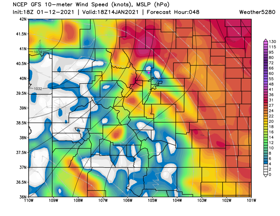 Figure 1 update: the 10m wind speeds around noon Thursday from weathe5280.com and the GFS.
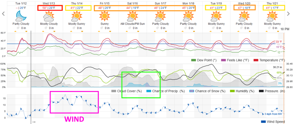 Figure 2 update: the 10 day graphical forecast from weather5280.com for Longmont, CO.
We have pretty mild temperatures ahead (for January at least) and a chance of rain/snow on the weekend (it is not a large storm as it looks now - Figure 2 update). There is a possibility of a coating of snow over the next 6 days (Figure 3 update). But then precipitation might come as light rain with temperatures in the 40's expected over the weekend.
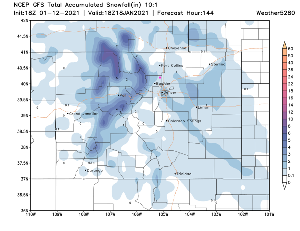 Figure 3 update: the 6 day (10:1 ratio) total snowfall forecast from the GFS and weather5280.com
End Tuesday Update.
Forecast discussion:
The upper air trough has now dug down to the Four Corners area and will be sending a brief shot of up slope flow into the Front Range communities Saturday PM (Figure 1 below).
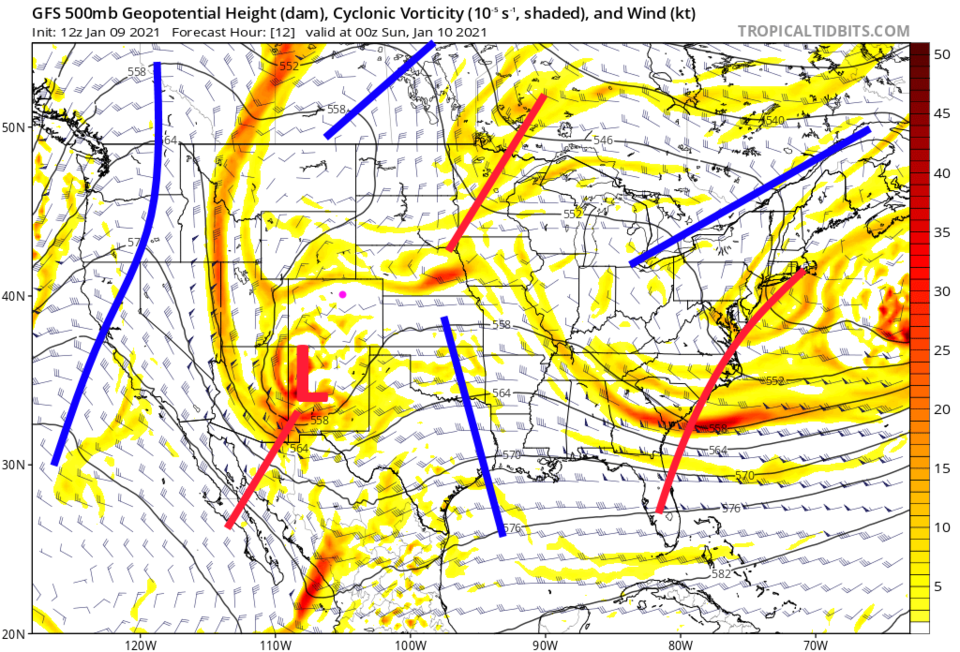 Figure 1: The 500mb upper air forecast map for Saturday PM from the GFS and tropicaltidbits.com
The bulk of the light snow will fall over the south-central counties of Colorado, but some will accumulate around Longmont (Figure 2).
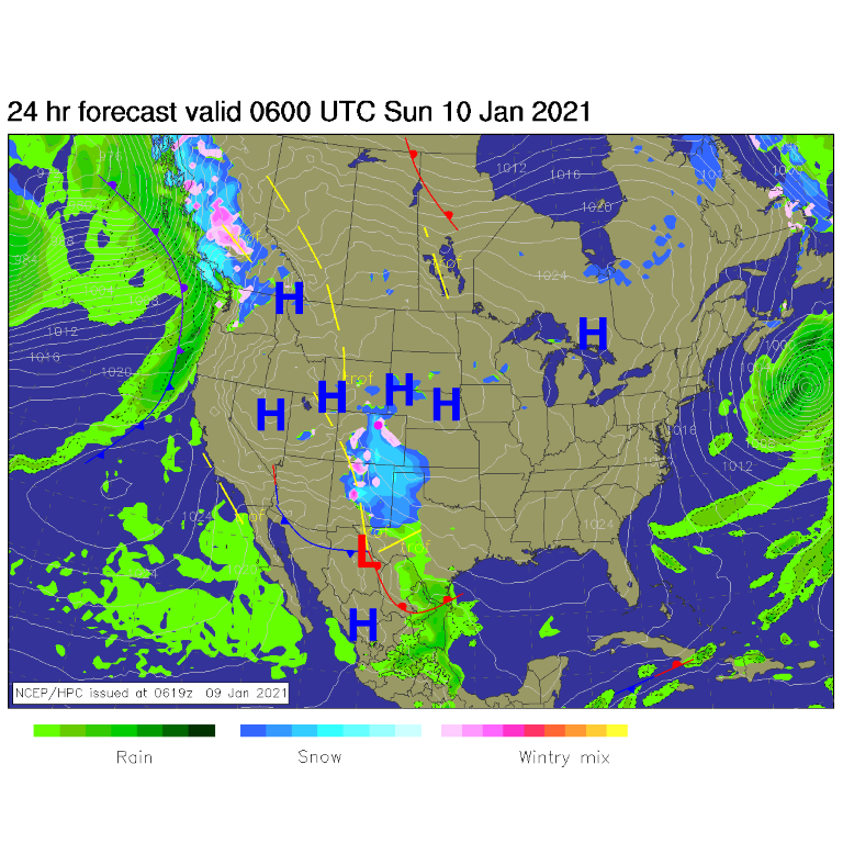 Figure 2: The forecast surface analysis for late Saturday PM from NCEP.
The peak snow chances arrive between 3 p.m. and 2 a.m. (Sunday) with temperatures Saturday remaining near freezing (Figure 3).
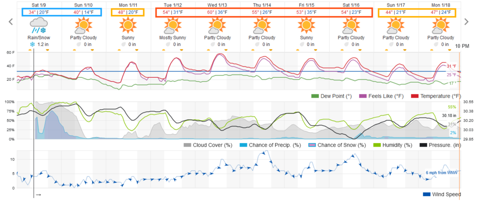 Figure 3: The 10-day graphical forecast from weather5280.com for Longmont.
Snowfall roundup:
The weatherunderground model gives us 1 to 2 inches of snow (Figure 3).
The GFS gives us 2 to 3 inches of snow (Figure 4).
The NAM gives us 1 to 2 inches of snow (Figure 5).
Finally the HRRR — up to 10 p.m. — gives us 0.5 to 1.5 inches of snow (Figure 6).
I'm comfortable with about 1.5 to 2.5 inches around here.
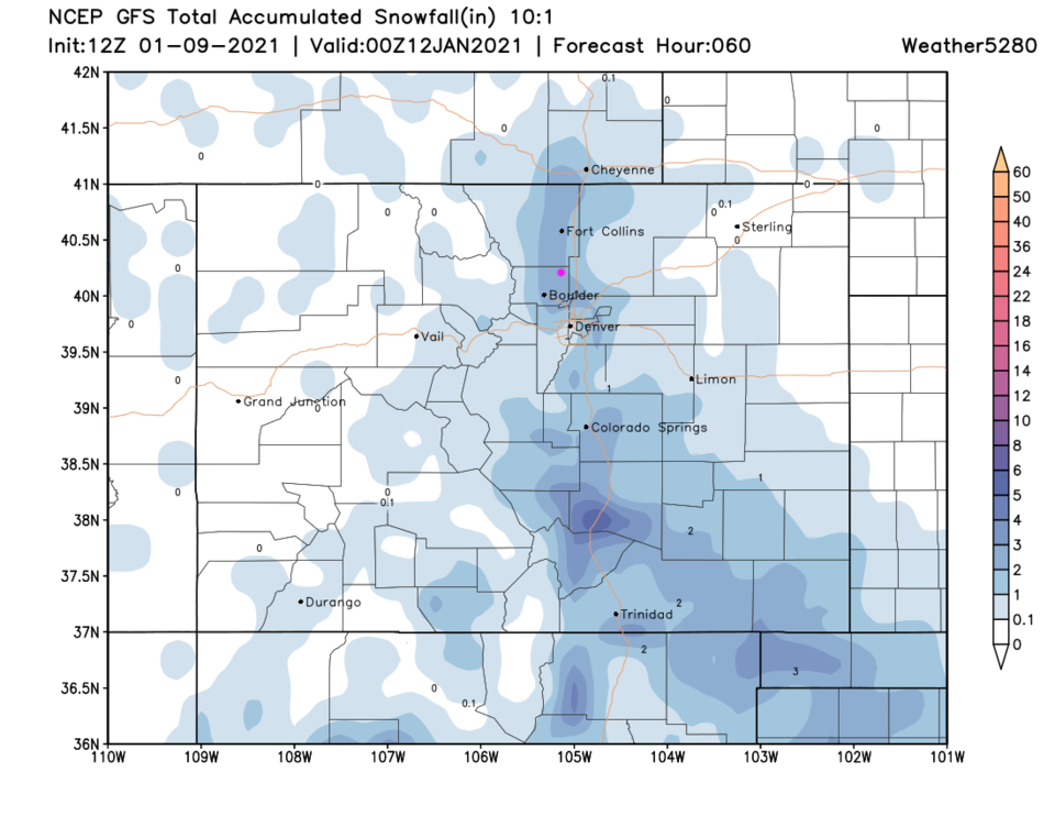 Figure 4: The three-day (10:1 ratio) total snowfall forecast from the GFS and weather5280.com
 Figure 5: The three-day (10:1 ratio) total snowfall forecast from the NAM and weather5280.com
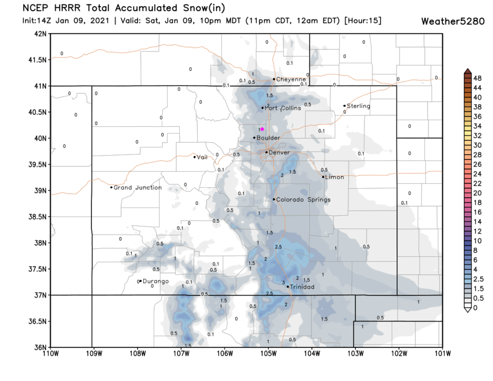 Figure 6: The 15-hour (to 10 p.m.) (10:1 ratio) total snowfall forecast from the GFS and weather5280.com
The longer-range forecast:
The weather becomes quiet again next week. Temperatures trend toward the high end of normal for this time of year. There are no suspicious storms to watch for in the models — yet!


