Skip to content
Join our Newsletter

Longmont Weather Forecast: Mild and dry for a long time

Figure6_10212021
Figure 6: the 16 day precipitation total from the GFS and tropicaltidbits

The Video Forecast for the End of October

In Brief:

A long stretch of mild, dry weather is the story into November. The mountains will get snow and rain.

Forecast Discussion:

Programming note:  I'm taking my first vacation from this column through about November 2nd.  If a big storm materializes, I'll post updates here.  If not, I'll see you in a week and a half!

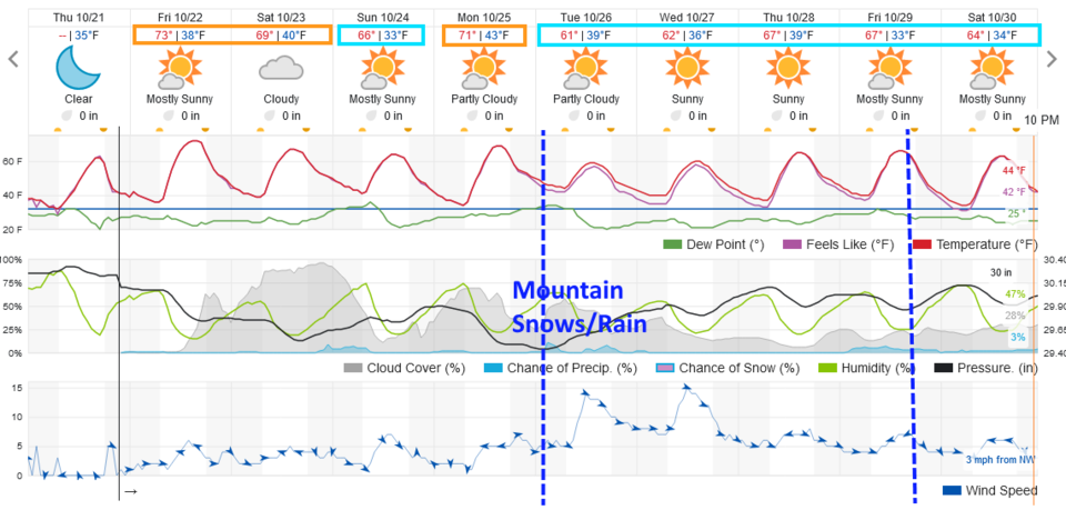
Things do look very quiet in northeastern Colorado for the foreseeable future (Figure 1). There is a cold front arriving early Tuesday that will bring snow and rain to the mountains. Another front will do the same for the western slopes around Friday.

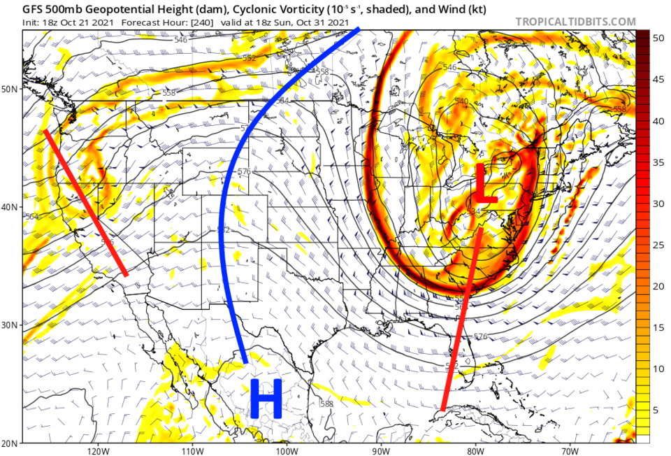
The big picture involves a ridge that will remain over the West (except when those fronts pass (Figure 2)). Halloween Night, this far out, looks to be just above freezing with a low of 24F occurring by sunrise after a high of 54F and partly cloudy skies.


Figure1_10212021
Figure 1: the 10 day graphical forecast from weatherunderground.com for Longmont, CO.

 
Figure2_10212021
Figure 2: the 500mb upper air forecast map for Sunday noon from the GFS and tropicaltidbits.com

The Longer Range Forecast:

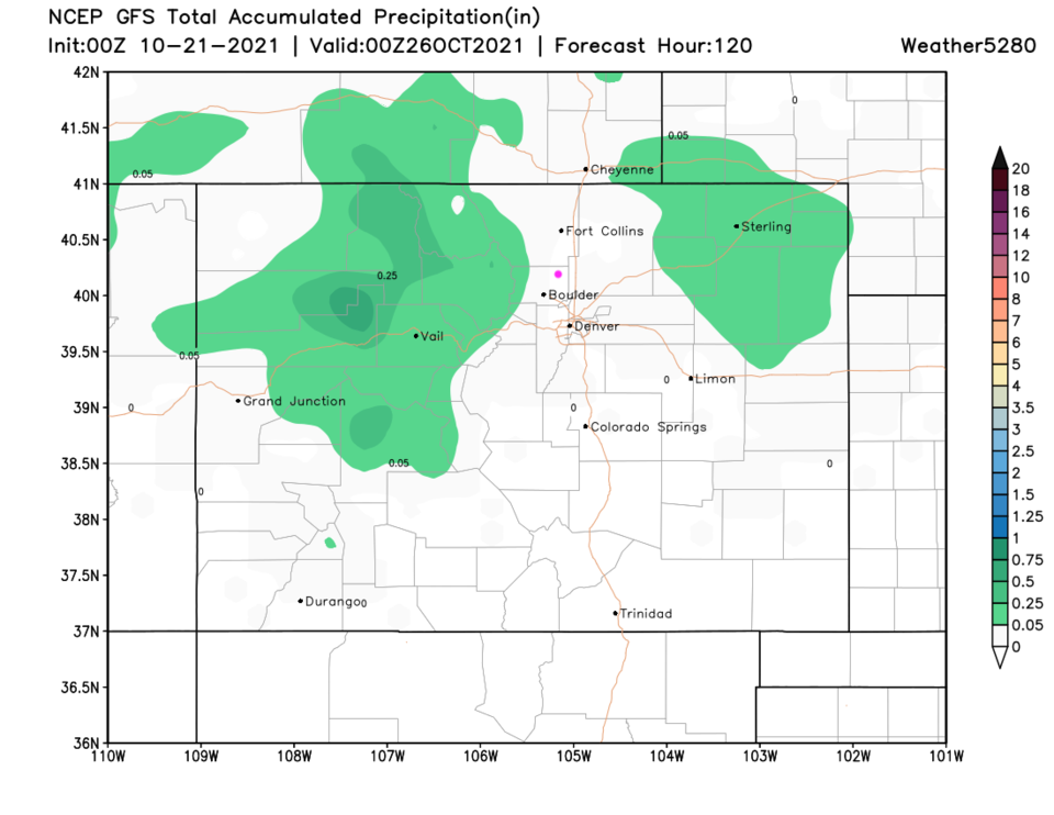
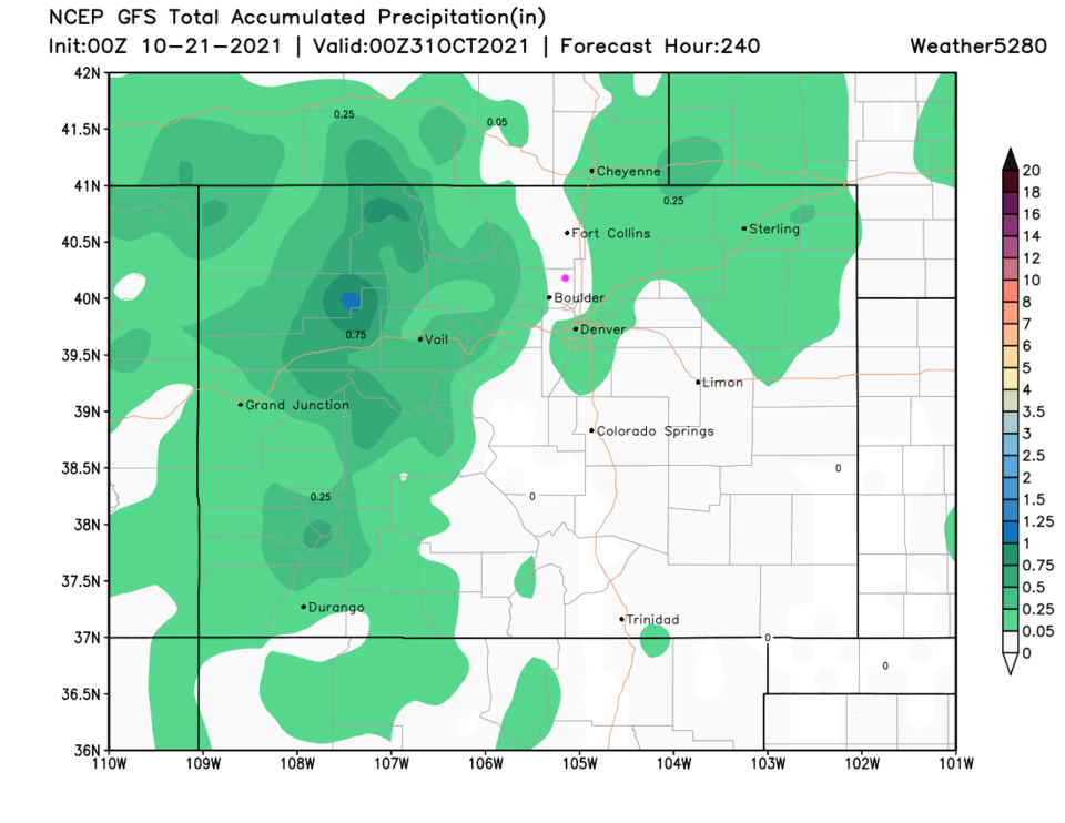
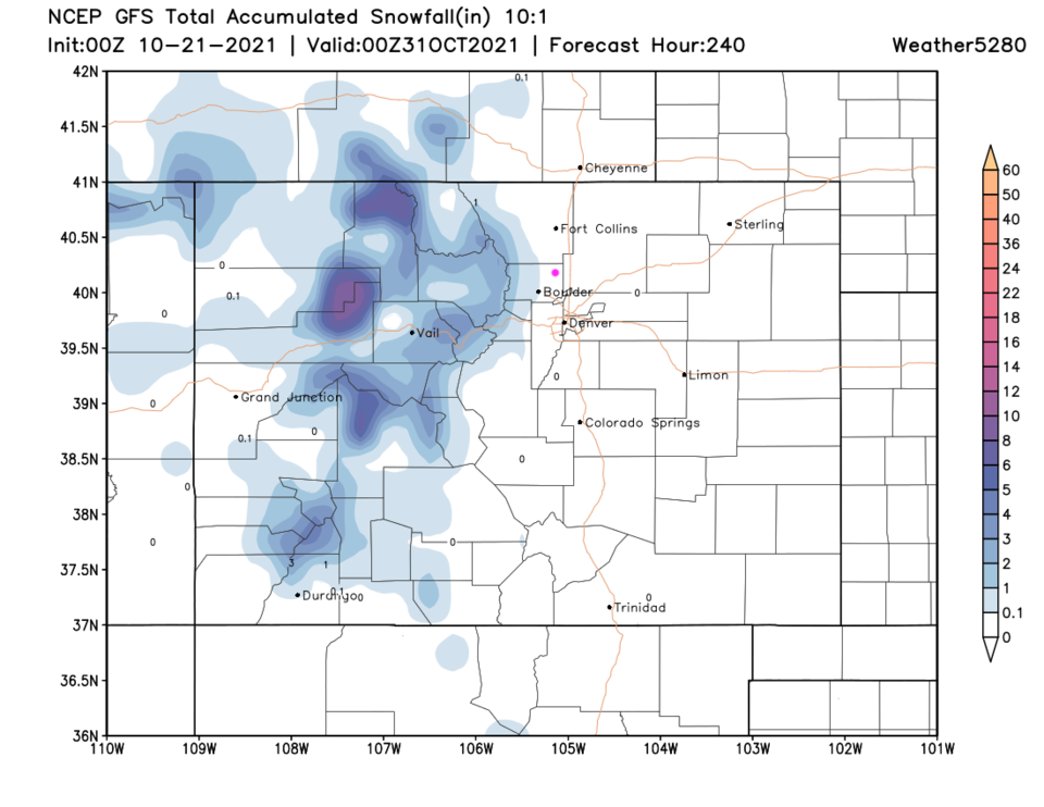
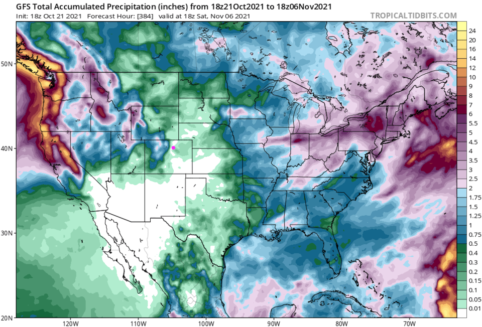
Over the next five days, only very light precipitation will fall in the mountains and northeastern plains (Figure 3). Over the next 10 days, I-25 folks still get largely skipped as downslope flow off the mountains with the overall westerly flow will kill rain/snow chances (Figure 4). The snow over the next 10 days will also be limited and not too deep and only in the mountains (Figure 5).  Drawing on the GFS and tropicaltidbits (Figure 6) the next 16 days still looks very dry over the eastern half of the state except for the mountains to our west.  It is a great time for me to take a break!  See you in November.

Figure3_10212021
Figure 3: the 5 day precipitation total from the GFS and weather5280.com
Figure4_10212021
Figure 4: the 10 day precipitation total from the GFS and weather5280.com
Figure5_10212021
Figure 5: the 10 day (10:1 ratio) total snowfall forecast from the GFS and weather5280.com
Figure6_10212021
Figure 6: the 16 day precipitation total from the GFS and tropicaltidbits


About the Author: John Ensworth

John Ensworth used to work from Longmont as the PI for the NASA through the IGES (The Institute for Global Environmental Strategies). He now teaches technology, algebra, astronomy, meteorology, film school, and Lego robotics to middle/high school.
Read more


Comments


Current Weather

Mostly sunny

Mostly sunny

94°F

UV Index
2 Low
Pressure
29.88 Falling
Visibility
8 miles
Dewpoint
39 °F
Humidity
14%
Wind
ESE 3.3 mph
Gust
6.5 mph
Wind Chill
94 °F

Hourly Forecast

Today
6 PM
92°F
Intermittent clouds
Today
7 PM
90°F
Intermittent clouds
Today
8 PM
86°F
Intermittent clouds
Today
9 PM
82°F
Intermittent clouds
Today
10 PM
79°F
Intermittent clouds
Today
11 PM
75°F
Intermittent clouds
Tomorrow
12 AM
72°F
Intermittent clouds
Tomorrow
1 AM
69°F
Intermittent clouds
Tomorrow
2 AM
68°F
Intermittent clouds
Tomorrow
3 AM
67°F
Intermittent clouds
Tomorrow
4 AM
66°F
Intermittent clouds
Tomorrow
5 AM
65°F
Intermittent clouds

7 Day Forecast

Partly sunny

Thursday

95 °F

Very warm with sunshine mixing with some clouds


Intermittent clouds

Thursday Night

64 °F

Partly cloudy


Partly sunny w/ t-storms

Friday

89 °F

Partly sunny with a thundershower in spots in the afternoon


Clear

Friday Night

61 °F

Clear


Partly sunny

Saturday

93 °F

Partly sunny


Clear

Saturday Night

56 °F

Clear


Partly sunny

Sunday

89 °F

Partly sunny with a stray thunderstorm


Clear

Sunday Night

57 °F

Clear


Partly sunny

Monday

93 °F

Partly sunny


Clear

Monday Night

57 °F

Clear


Sunrise and Sunset

Sunrise
5:36 AM
Sunset
8:33 PM

Based on AccuWeather data