Skip to content

Tuesday Update: Longmont Weather Forecast: Mild and dry for another week...

Figure5_11272021
Figure 5: the 10 day (10:1 ratio) total snowfall forecast from the GFS and weather5280.com

In Brief:

Abnormally warm weather and abnormally dry weather continues.

Tuesday update:

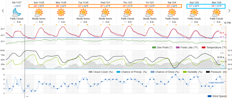
Things continue abnormally dry and fantastically warm (it would be in the 120'sF if this were the peak of summer). There IS a hint of a snowstorm arriving Tuesday to set our new latest snowall and longest snow-free period at DIA.  More later!

End Tuesday Update.

Forecast Discussion:

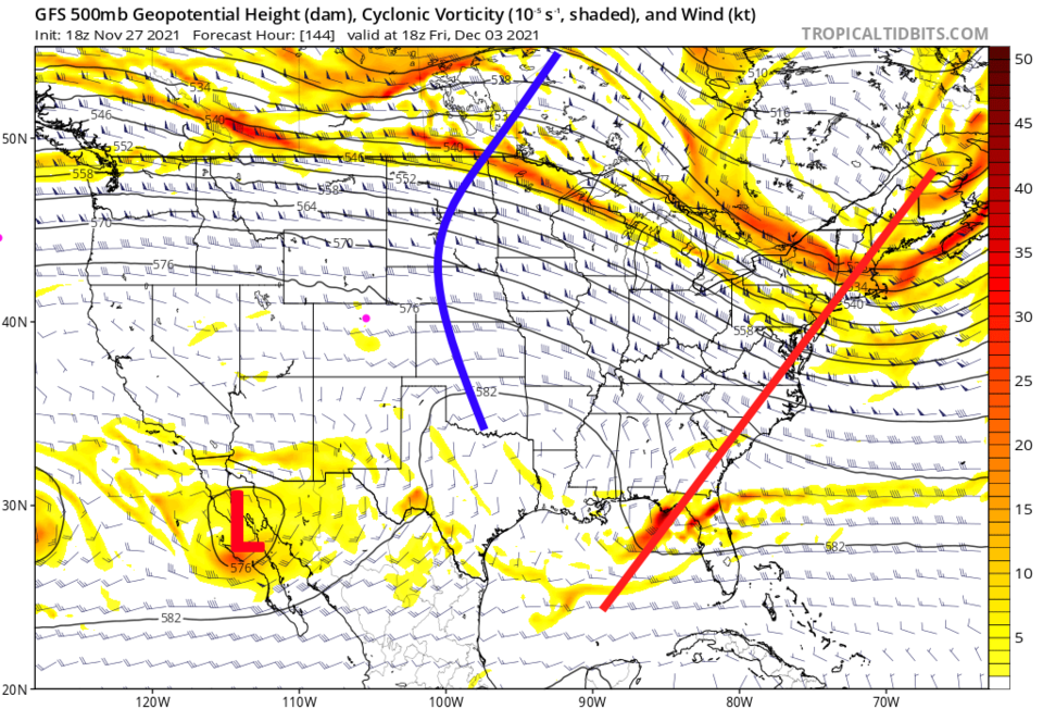
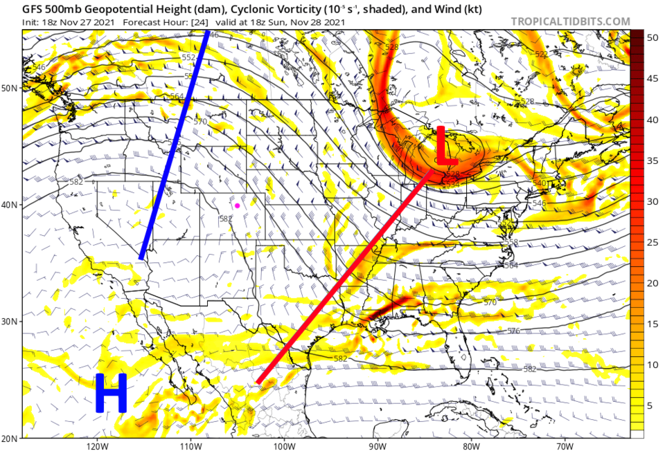
Sorry, we still don't have rain or snow coming for the I-25 corridor. Temperatures will remain about 20 to 25 degrees above normal (Figure 1).  No significant precipitation is expected over the next 7 days (Figure 1).  This is due to a persistent western U.S. ridge (blue line in Figure 2).

Figure1_11272021
Figure 1: the 10 day graphical forecast from weatherunderground.com for Longmont, CO.
Figure2_11272021
Figure 2: the 500mb upper air forecast map for Sunday noon from the GFS and tropicaltidbits.com

The Long Range Forecast:

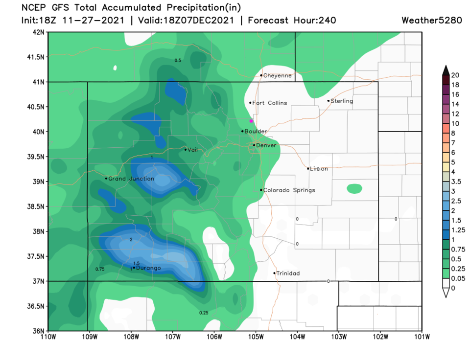
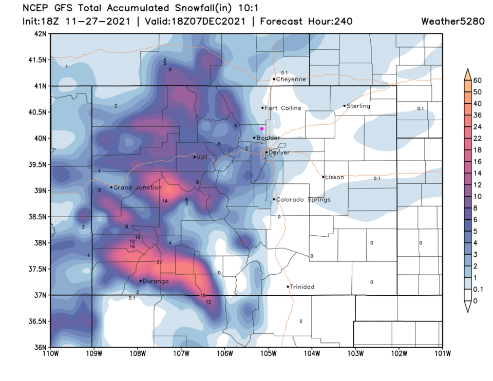
The ridge is still somewhat dominant even a week out (Figure 3). The western slopes should get some precipitation (Figure 4) and snow (Figure 5). Not much is expected along I-25 for the next 10 days. 

Figure3_11272021
Figure 3: Figure 1: the 500mb upper air forecast map for Friday noon from the GFS and tropicaltidbits.com
Figure4_11272021
Figure 4: the 10 day precipitation total from the GFS and weather5280.com
Figure5_11272021
Figure 5: the 10 day (10:1 ratio) total snowfall forecast from the GFS and weather5280.com


About the Author: John Ensworth

John Ensworth used to work from Longmont as the PI for the NASA through the IGES (The Institute for Global Environmental Strategies). He now teaches technology, algebra, astronomy, meteorology, film school, and Lego robotics to middle/high school.
Read more


Comments


Current Weather

Mostly cloudy

Mostly cloudy

38°F

UV Index
0 Low
Pressure
29.81 Steady
Visibility
8 miles
Dewpoint
29 °F
Humidity
68%
Wind
N 2.2 mph
Gust
4.4 mph
Wind Chill
38 °F

Hourly Forecast

Today
6 AM
38°F
Showers
Today
7 AM
37°F
Mostly cloudy
Today
8 AM
38°F
Intermittent clouds
Today
9 AM
41°F
Intermittent clouds
Today
10 AM
44°F
Intermittent clouds
Today
11 AM
47°F
Intermittent clouds
Today
12 PM
49°F
Intermittent clouds
Today
1 PM
51°F
Intermittent clouds
Today
2 PM
52°F
Intermittent clouds
Today
3 PM
52°F
Intermittent clouds
Today
4 PM
51°F
Intermittent clouds
Today
5 PM
50°F
Intermittent clouds

7 Day Forecast

Partly sunny w/ showers

Friday

52 °F

Cooler with times of clouds and sun; a couple of showers late this afternoon


Showers

Friday Night

34 °F

A couple of showers this evening; otherwise, cloudy


Mostly cloudy

Saturday

60 °F

Mostly cloudy


Intermittent clouds

Saturday Night

34 °F

Partly cloudy


Intermittent clouds

Sunday

62 °F

Periods of clouds and sun


Mostly cloudy

Sunday Night

33 °F

Becoming cloudy


Showers

Monday

52 °F

Cloudy and cooler with occasional rain; windy in the afternoon


Intermittent clouds

Monday Night

29 °F

Windy in the evening; partly cloudy


Mostly sunny

Tuesday

61 °F

Mostly sunny and milder


Clear

Tuesday Night

29 °F

Clear


Sunrise and Sunset

Sunrise
6:48 AM
Sunset
7:23 PM

Based on AccuWeather data