Skip to content

Thursday Update: Longmont Weather Forecast: Mild and Dry for the Next Week

Figure2_11222021
Figure 2: the 500mb upper air map for Tuesday noon from tropicaltidbits.com

In Brief:

Dry mild weather continues for the next week.

Thursday/ Black Friday Update:

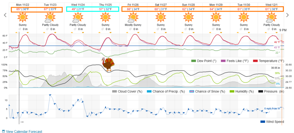
Friday will be VERY mild with highs in the upper 60's and lows around freezing.  The next week still looks warm and quiet.  Have fun Christmas shopping!

End Update.

Forecast Discussion:

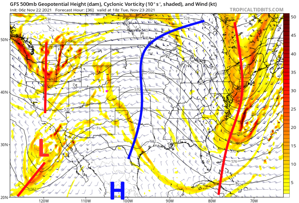
Things continue to remain calm and unusually warm for the next 10 days (Figure 1). A cold front pushes down Tuesday afternoon with gusty winds (prompting elevated fire danger) and will cool us down to just a few degrees above normal instead of the almost 20 degrees above normal weather we have for the rest of the forecast period. A big ridge over the western states is to blame for all this dry warmth (Figure 2).

Thanksgiving Forecast:

We will be warming up after the cold front passage and will have dry clear weather with highs approaching 60F again with only near freezing temperatures at night. No travel problems at all!

Figure1_11222021
Figure 1: the 10 day graphical forecast for Longmont from weatherunderground.com


Figure2_11222021
Figure 2: the 500mb upper air map for Tuesday noon from tropicaltidbits.com

The Longer-Range Forecast:

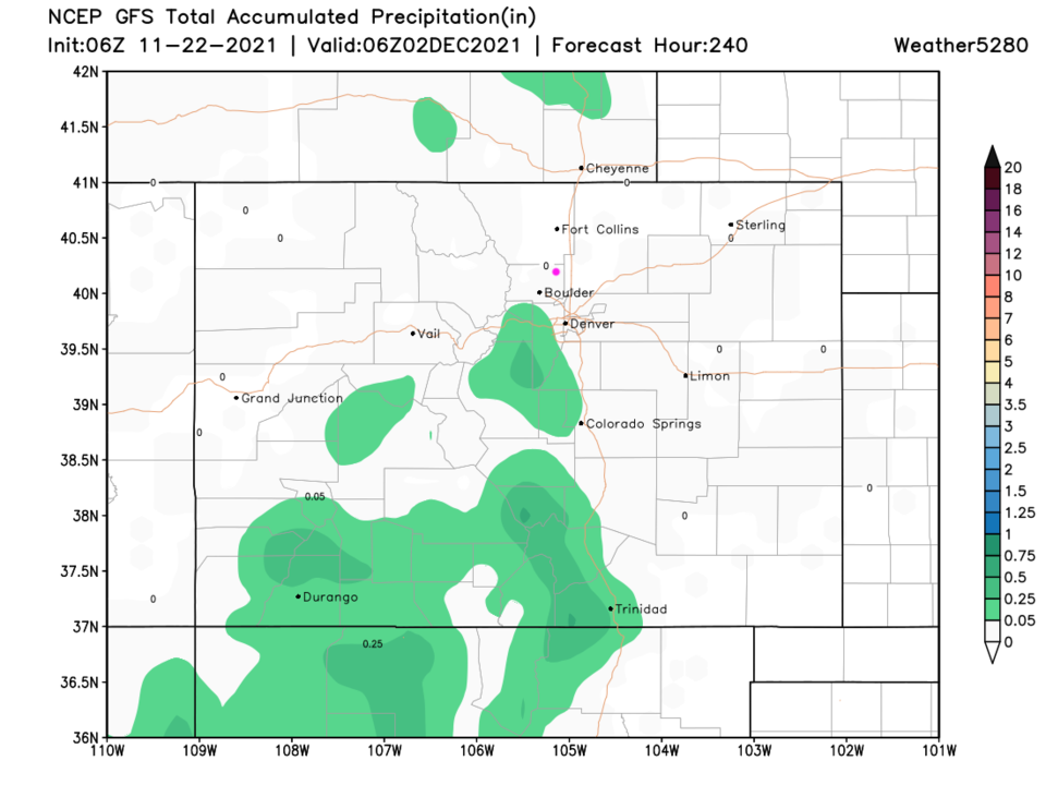
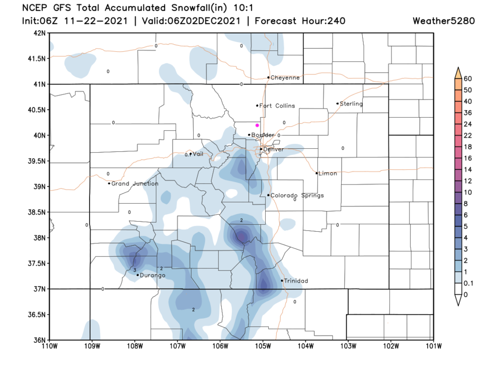
Over the next 10 days, very little rain or snow is expected to fall on Colorado, however, a major winter storm with a few days of heavy snow and bitter cold temperatures is appearing around Dec. 4-6 on the long range models.  I won't map it out until we get closer (a model storm that far out can completely vanish by the time the date approaches). We are now setting the record for the latest recorded measurable snowfall in Denver.


Figure3_11222021
Figure 3: the 10 day precipitation total for Colorado from weather5280.com
Figure4_11222021
Figure 4: the 10 day snow total (10:1 ratio) total for Colorado from weather5280.com


About the Author: John Ensworth

John Ensworth used to work from Longmont as the PI for the NASA through the IGES (The Institute for Global Environmental Strategies). He now teaches technology, algebra, astronomy, meteorology, film school, and Lego robotics to middle/high school.
Read more


Comments


Current Weather

Mostly cloudy

Mostly cloudy

41°F

UV Index
0 Low
Pressure
29.8 Rising
Visibility
8 miles
Dewpoint
30 °F
Humidity
64%
Wind
N 3.3 mph
Gust
5.9 mph
Wind Chill
39 °F

Hourly Forecast

Today
5 AM
36°F
Showers
Today
6 AM
34°F
Intermittent clouds
Today
7 AM
36°F
Intermittent clouds
Today
8 AM
38°F
Intermittent clouds
Today
9 AM
41°F
Intermittent clouds
Today
10 AM
44°F
Intermittent clouds
Today
11 AM
47°F
Intermittent clouds
Today
12 PM
49°F
Intermittent clouds
Today
1 PM
51°F
Intermittent clouds
Today
2 PM
52°F
Intermittent clouds
Today
3 PM
52°F
Intermittent clouds
Today
4 PM
51°F
Intermittent clouds

7 Day Forecast

Partly sunny w/ showers

Friday

52 °F

Cooler with times of clouds and sun; a couple of showers late this afternoon


Showers

Friday Night

34 °F

A couple of showers this evening; otherwise, cloudy


Mostly cloudy

Saturday

60 °F

Mostly cloudy


Intermittent clouds

Saturday Night

34 °F

Partly cloudy


Intermittent clouds

Sunday

62 °F

Periods of clouds and sun


Mostly cloudy

Sunday Night

33 °F

Becoming cloudy


Showers

Monday

52 °F

Cloudy and cooler with occasional rain; windy in the afternoon


Intermittent clouds

Monday Night

29 °F

Windy in the evening; partly cloudy


Mostly sunny

Tuesday

61 °F

Mostly sunny and milder


Clear

Tuesday Night

29 °F

Clear


Sunrise and Sunset

Sunrise
6:48 AM
Sunset
7:23 PM

Based on AccuWeather data