In Brief:
Summer warmth remains, a few afternoon storms for some, and increasing smoke.
Sunday update:
We've enjoyed a few days of only light smoke. A bit more moisture has kicked off widely scattered storms in the afternoons. Sadly, a large shield of smoke is on its way. Figure 1 update shows the progress of the stuff by Monday afternoon. The surface level smoke, though (Figure 2 update), won't be as bad as the smoke at all levels implies. The smoke may take a few degrees off of the high temperatures we would normally expect, and diminish the coverage of storms as a result.
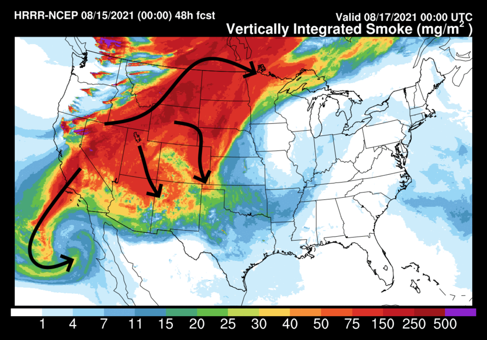 Figure 1 update: the HRRR smoke at all levels forecast map for Monday afternoon from NOAA.
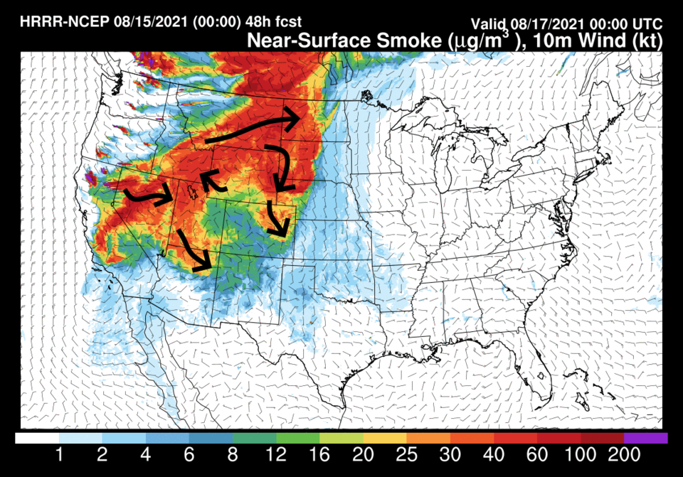 Figure 2 update: the HRRR smoke at the surface forecast map for Monday afternoon from NOAA.
End Sunday update.
Forecast Discussion:
The big picture is moisture is slow to return, but better chances of rain and cooler temperatures don't arrive until Wednesday next week (Figure 1). Currently, we have an upper-level high-pressure center over Nevada/Utah that gives us northerly flow aloft (Figure 2). In the short term, we are experiencing less smoke (Figure 3) but that flow will bring more smoke in over the weekend (Figure 4). A bit more "monsoonal" moisture is creeping northward (Figure 5). Afternoon storm chances exist but are low each day through the start of next week (Figure 1).
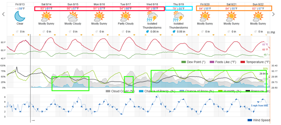 Figure 1: the 10 day graphical forecast from weatherunderground.com for Longmont, CO.
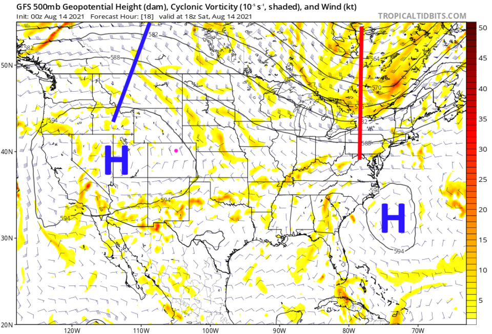 Figure 2: the 500mb upper air forecast map for Saturday noon from the GFS and tropicaltidbits.com
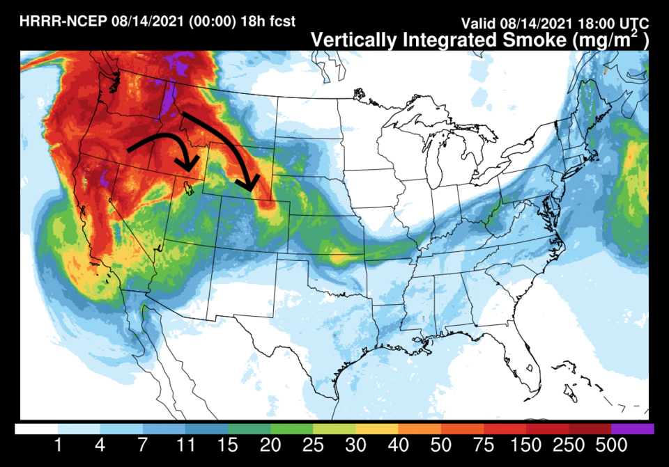 Figure 3: the HRRR smoke at all levels forecast map for Saturday noon from NOAA.
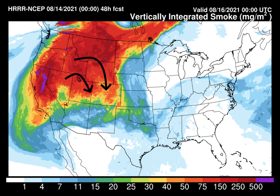 Figure 4: the HRRR smoke at all levels forecast map for Sunday afternoon from NOAA.
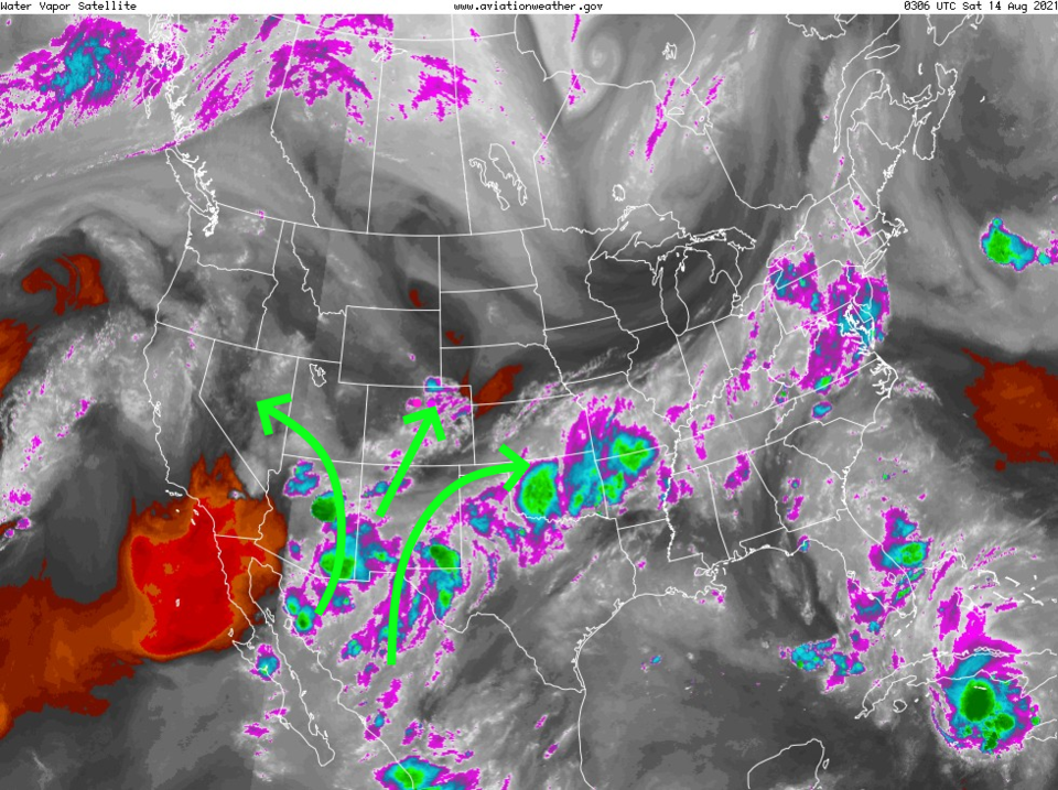 Figure 5: the water vapor satellite image from NOAA from Friday PM. White/purple is moist air, red/brown is very dry air.
The Longer-Range Forecast:
A big trough moves in next week, finally giving us a break in the streak of summer weather days (Figure 6). Not much rain hits the I-25 corridor over the next five days (Figure 7), but once the big trough begins to approach, we might see better rainfall around town (Figure 8). We'll keep a watch on it here!
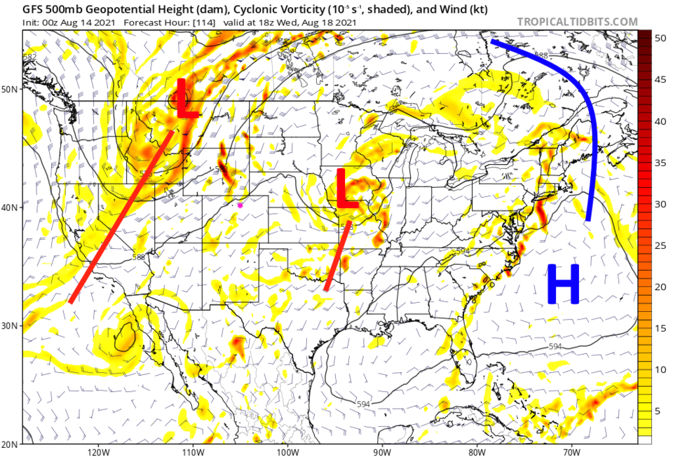 Figure 6: the 500mb upper air forecast map for Wednesday noon from the GFS and tropicaltidbits.com
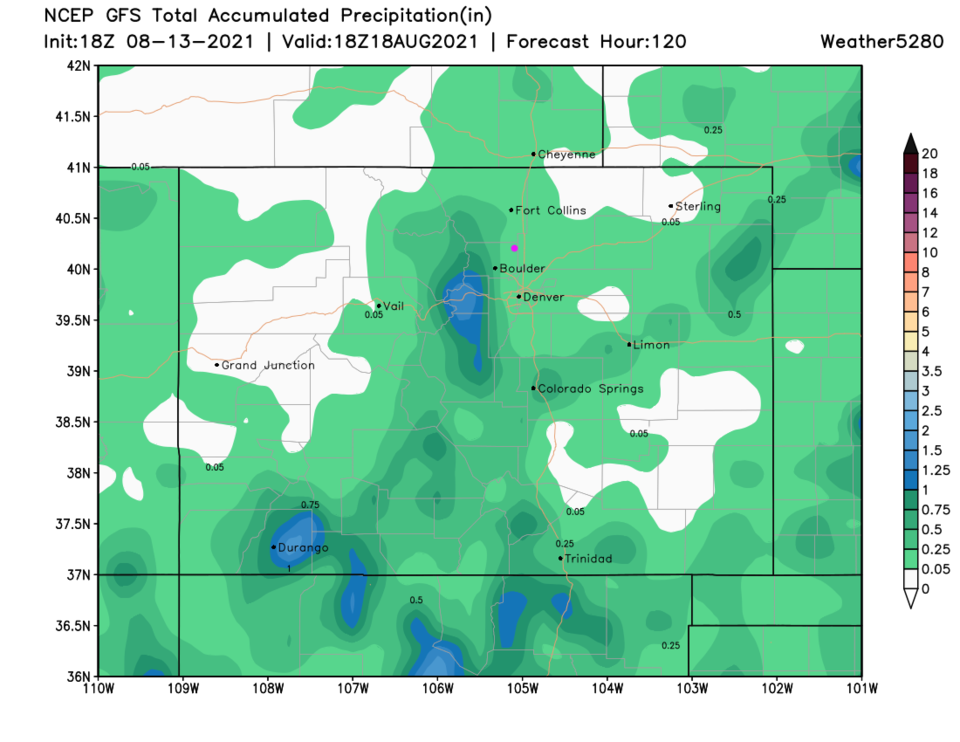 Figure 7: the 5 day precipitation total from the GFS and weather5280.com
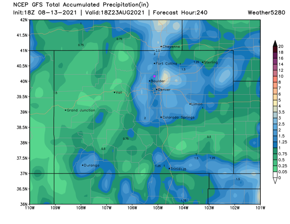 Figure 8: the 10 day precipitation total from the GFS and weather5280.com


