The video forecast for the week beginning October 15.
In brief:
Fall has arrived and pushed summer aside but not without bringing strong winds that drove the Cameron Peak fire to extremes Tuesday and Wednesday.
Forecast discussion:
An upper air pattern change has happened, and this one may stick.The ridge is off the West Coast and a broad trough dominates the entire U.S. (Figure 1 below). The airflow is coming from the northwest across Colorado before curving to the northeast near the Great Lakes (black arrow).
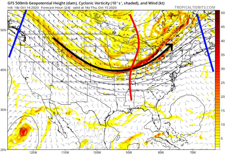 Figure 1: the 500mb upper air forecast map for Thursday noon from the GFS and tropicaltidbits.com
The water vapor satellite image shows more moist air associated with the trough (grey and white shading Figure 2). I included the 500mb features here for a reference.
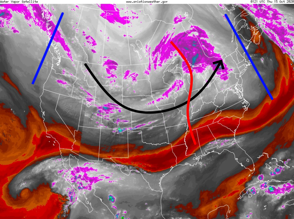 Figure 2: the water vapor satellite image from NOAA from Wednesday PM. White/purple is moist air, red/brown is very dry air.
 The thin trail of smoke (considering the size of the state or nation) doesn't capture how dramatic the smoke column was from the Cameron Peak fire (Figure 3). Ash fell across Loveland and surrounding areas.
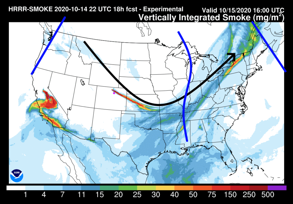 Figure 3: the HRRR smoke at all levels forecast map for Wednesday afternoon from NOAA. The blue line in the center of the nation should be red. Graphics problems.
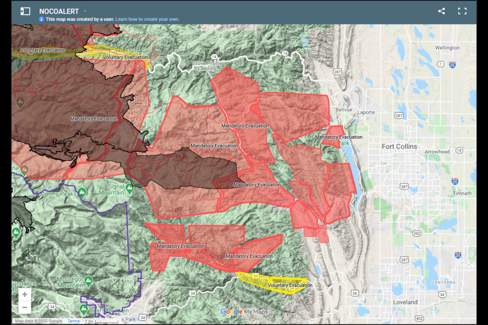
 Unfortunately, there are evacuations near the city limits of Fort Collins (and Horsetooth Reservoir Figure 4). The darker grey/red areas are now burned.
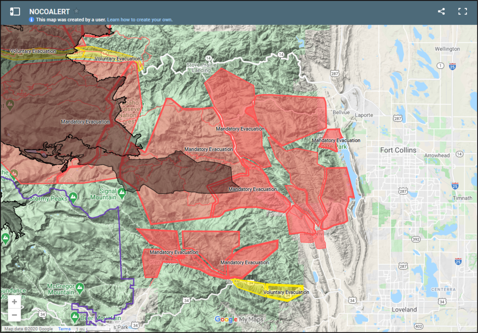 Figure 4: the Cameron Peak fire incident map from NOCOALERT
Since the northwest, and sometimes northerly, flow is going to remain for a while, we will stay chilly into the weekend (Figure 5). The winds also calm a bit, at least at lower elevations.
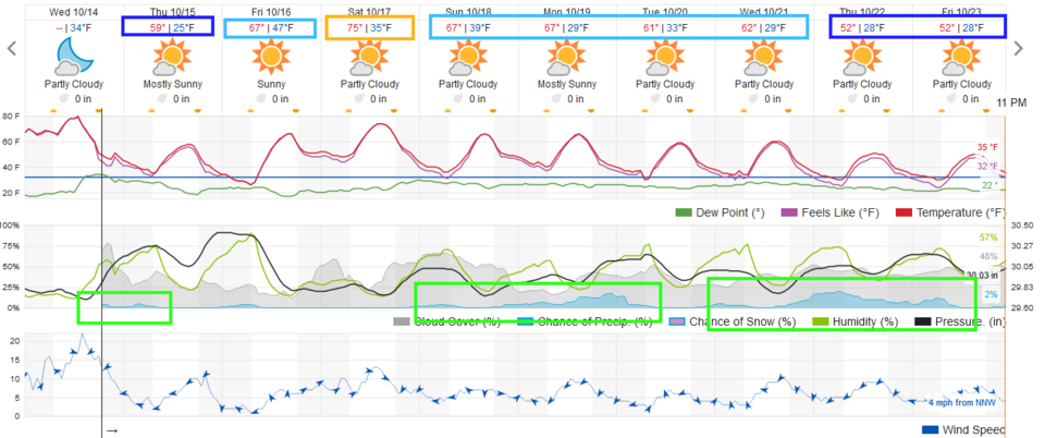 Figure 5: the 10 day graphical forecast from weather5280.com for Longmont, CO.
The longer-range forecast:
There is a nudge of the old ridge Saturday that will bring back 70s for a day, then another cold front arrives Saturday afternoon to cool us 10 degrees and bring a small chance of showers (Figure 5). Next week is looking even cooler. The rainfall totals over the next 10 days (from the GFS) are still very light (Figure 6).
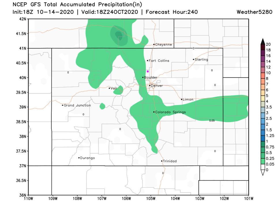 Figure 6: the 10 day precipitation total from the GFS and weather5280.com


