Skip to content
Join our Newsletter

Thursday Update: Longmont Weather Forecast: More seasonable and mostly dry

The Forecast Video for this Week

In Brief:

Abnormally warm weather for a few days, then a sharp cool down to normal, but dry conditions.

Thursday Update:

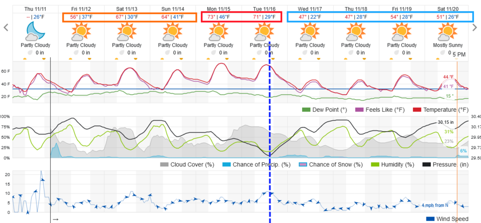
Just a quick mid-week update... after a small chance of showers (snow showers??) Thursday PMN, we warm up to abnormally warm (lower 70's highs!) at the start of next week.  A strong (but dry) cold front arrives Tuesday to knock us down to just a few degrees below normal for once.  Still, precipitation is hard to come by for another week along I-25.

Figure1u_11112021
Figure 1 update: the 10 day graphical forecast for Longmont from weatherunderground.com

End Thursday Update.

Forecast Discussion:

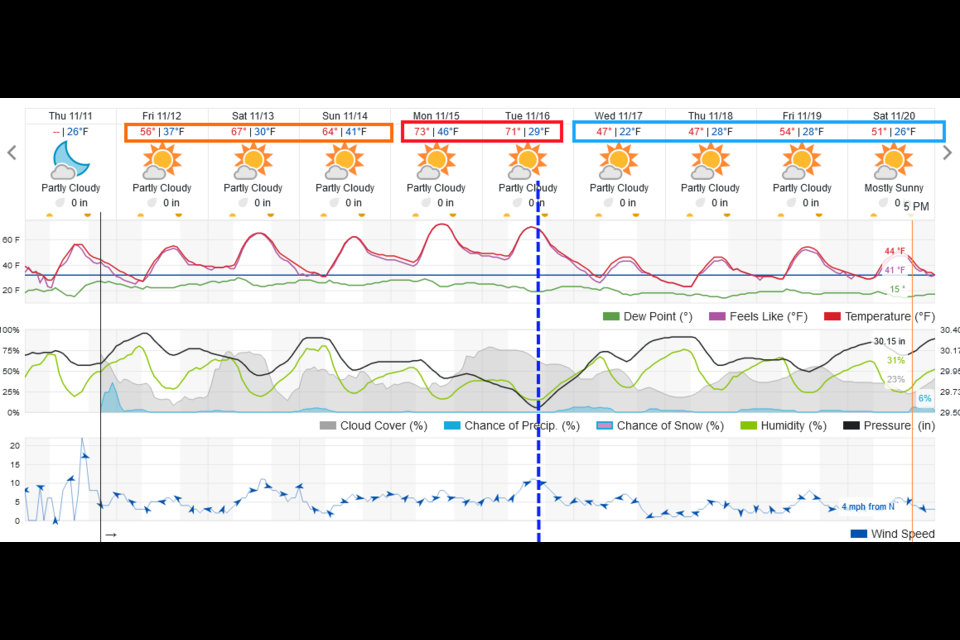
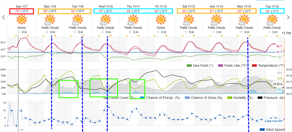
You should be outside taking a walk. .. it is fantastically warm this weekend (records may be met or set at DIA- Figure 1).  A trough approaches and settles in over the west giving us more zonal (west to east) and northwest-ish flow.  This pattern change brings in a number of weak cold fronts (blue dashed lines) that takes our high temperatures down to or just a bit above normal (rather than a LOT above normal, which is in the lower 50s right now).

Figure1_11072021
Figure 1: the 10 day graphical forecast from weatherunderground.com for Longmont, CO.

The Longer Range Forecast:

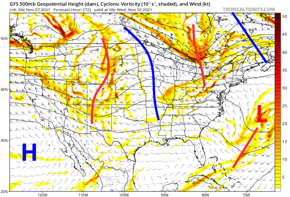
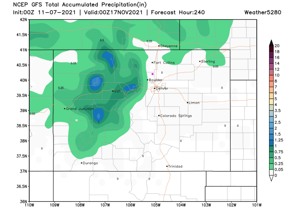
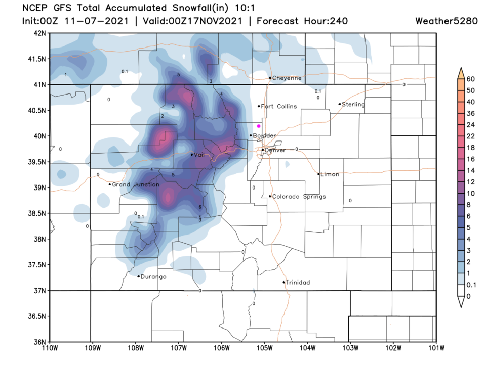
The next real "storm" will bring snow to the mountains, but only very small rain shower chances to the Plains Tuesday PM and Wednesday.  This is in response to a short wave trough (red line in Figure 2) passing early in the week.  Mountain locations in Colorado should pick up a fair amount of overall precipitation (Figure 3) and will mostly fall as snow (Figure 4). There ARE rain chances along I-25 early in the week as the cool down takes place, but amounts should remain light.

Figure2_11072021
Figure 2: the 500mb upper air forecast map for Wed AM from the GFS and tropicaltidbits.com
Figure3_11072021
Figure 3: the 10 day precipitation total from the GFS and weather5280.com
Figure4_11072021
Figure 4: the 10 day (10:1 ratio) total snowfall forecast from the GFS and weather5280.com


About the Author: John Ensworth

John Ensworth used to work from Longmont as the PI for the NASA through the IGES (The Institute for Global Environmental Strategies). He now teaches technology, algebra, astronomy, meteorology, film school, and Lego robotics to middle/high school.
Read more


Comments


Current Weather

Partly cloudy

Partly cloudy

57°F

UV Index
0 Low
Pressure
29.68 Falling
Visibility
10 miles
Dewpoint
35 °F
Humidity
43%
Wind
S 3.2 mph
Gust
5.4 mph
Wind Chill
57 °F

Hourly Forecast

Today
2 AM
58°F
Clear
Today
3 AM
57°F
Clear
Today
4 AM
55°F
Clear
Today
5 AM
54°F
Clear
Today
6 AM
53°F
Sunny
Today
7 AM
57°F
Mostly sunny
Today
8 AM
64°F
Partly sunny
Today
9 AM
71°F
Partly sunny
Today
10 AM
75°F
Partly sunny
Today
11 AM
79°F
Partly sunny
Today
12 PM
82°F
Partly sunny
Today
1 PM
84°F
Partly sunny

7 Day Forecast

Sunny

Monday

88 °F

Sunny and very warm with the temperature approaching the record of 91 set in 1962


Clear

Monday Night

53 °F

Clear


Partly sunny

Tuesday

88 °F

Very warm with partial sunshine; breezy this afternoon


Clear

Tuesday Night

50 °F

Breezy this evening; otherwise, clear


Partly sunny w/ showers

Wednesday

73 °F

Cooler with sunshine giving way to clouds, becoming windy with a shower in the area in the afternoon; elevated fire risk due to gusty winds and low humidity


Cloudy

Wednesday Night

46 °F

Overcast


Intermittent clouds

Thursday

71 °F

Beautiful with intervals of clouds and sunshine


Mostly cloudy

Thursday Night

43 °F

Cloudy most of the time


Intermittent clouds

Friday

71 °F

Beautiful with times of clouds and sun


Intermittent clouds

Friday Night

45 °F

Partly cloudy


Sunrise and Sunset

Sunrise
5:48 AM
Sunset
8:06 PM

Based on AccuWeather data