In brief:
With very normal weather for January in place, look for a chilly weekend break and a touch of snow.
Friday PM Update:
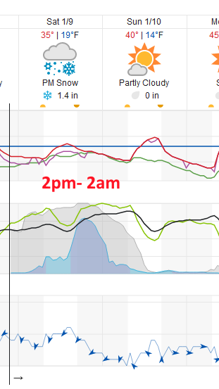
The weekend storm is looking just a touch more impactful than the coating to an inch expected the the forecast below. For Longmont, 1/2-2 inches is likely mainly between 2pm Saturday and Sunday 2am. There could be some snow flurries earlier in the day on Saturday as well (Figure 1 update and Figure 2 update). This is still not a large storm, but it will give us a bit of needed water. Stay warm this weekend!
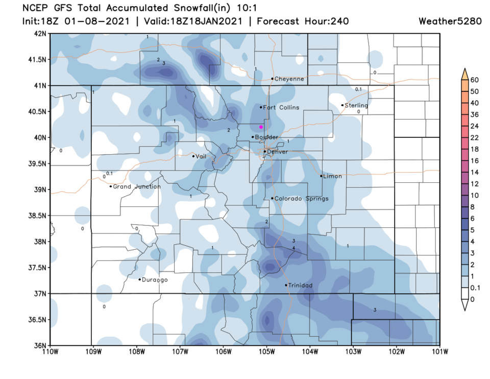 Figure 1 update: the 10 day (10:1 ratio) total snowfall forecast from the GFS and weather5280.com
 Figure 2 update: a snippet of the 10 day graphical forecast from weather5280.com for Longmont, CO.
End Friday PM Update.
Forecast discussion:
There is a system in the northern Rockies and one in the southern U.S. Colorado is sitting fairly warm and dry in the middle (Figure 1).
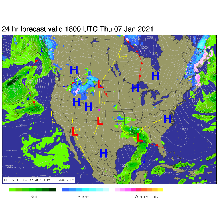 Figure 1: The surface forecast analysis for Thursday PM from NCEP.
 You can see the two systems as deep troughs (red lines) to our east and west in Figure 2.
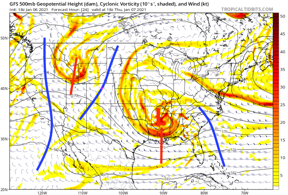 Figure 2: The 500mb upper air forecast map for Thursday noon from the GFS and tropicaltidbits.com
Until a cold front arrives Friday afternoon, we remain comfortably normal and dry (with cloudy patches at times).
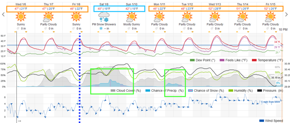 Figure 3: The 10-day graphical forecast from weather5280.com for Longmont, CO.
The longer-range forecast:
Our chance of snow after the Friday afternoon front picks up Saturday morning, peaking in the afternoon and evening. There are still some snow chances early Sunday, but amounts will be light. The Tuesday system in Figure 3 is even less certain. The weekend storm will be powered by a deep trough and cutoff low to our south (Figure 4).
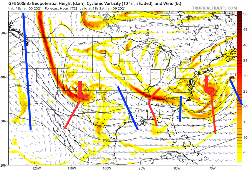 Figure 4: The 500mb upper air forecast map for Saturday noon from the GFS and tropicaltidbits.com
Snowfall amounts and precipitation amounts (Figure 5 and 6) for this weekend, for what might fall Tuesday, and for a possible storm at the end of next week, look very light at this time. Nothing to shovel along Interstate 25. We'll keep an eye on it here.
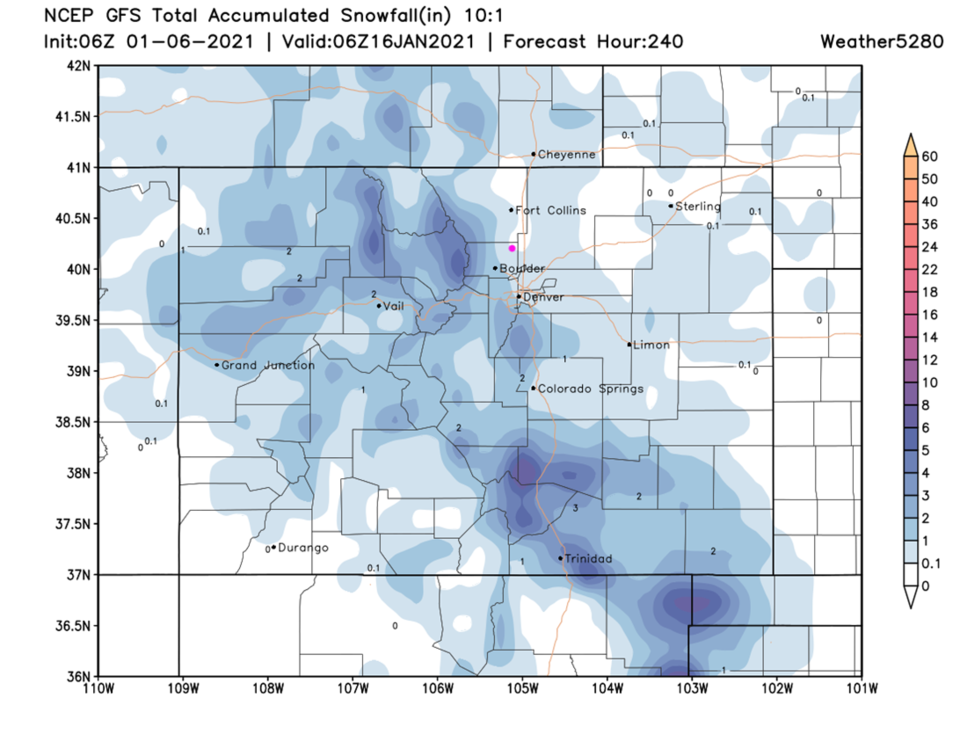 Figure 5: The 10-day (10:1 ratio) total snowfall forecast from the GFS and weather5280.com
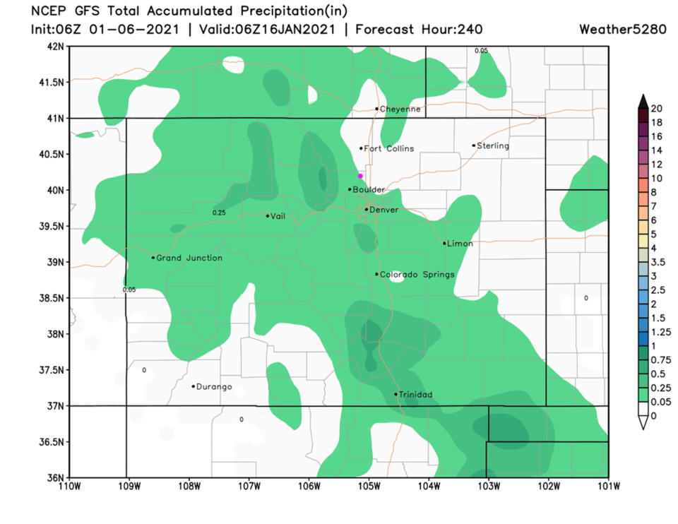 Figure 6: The 10-day precipitation total from the GFS and weather5280.com


