
The video forecast for this week.
In brief:
Very shallow frigid air may not make it uphill to Longmont, giving us a nicer weekend (and little snow).
Update Friday PM:
The forecast below is on track. Once we realized the super cold air won't make it all the way uphill to I-25, we accepted that it will be warm to very warm through the weekend. A pattern change IS in the offing for next week with highs dropping to the 30's and then the 20's next week. Some snow moves in with that pattern as well. More in the next full post!
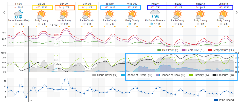 Figure 1 update: the 10 day graphical forecast from weatherunderground.com for Longmont, CO.
End Friday PM Update.
Forecast discussion:
The front that swept across Colorado Wednesday midday had made it to Texas by Wednesday evening (Figure 1 below). There are brief rain/snow chances predawn Thursday morning then the weather becomes cool and dry (Figure 2).
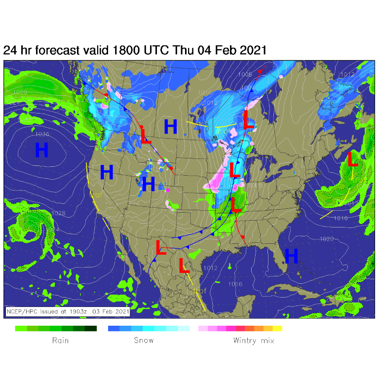 Figure 1: The forecast surface analysis for Sunday noon from NCEP.
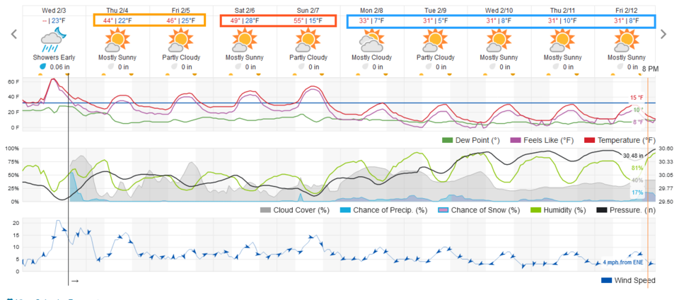 Figure 2: The 10-day graphical forecast from weatherunderground.com for Longmont.
The cold air (high near 20 degrees, lows near zero) that was slated for the weekend (see the video above) looks like it won't arrive as advertised. It is very shallow (as cold dense air is) and it won't be deep enough to get all the way up to the Interstate 25 corridor (roughly 5000 feet above sea level, see the purple colors for the brutal cold). This will result in a dramatically different (and more mild) weekend (Figure 3 and 2).
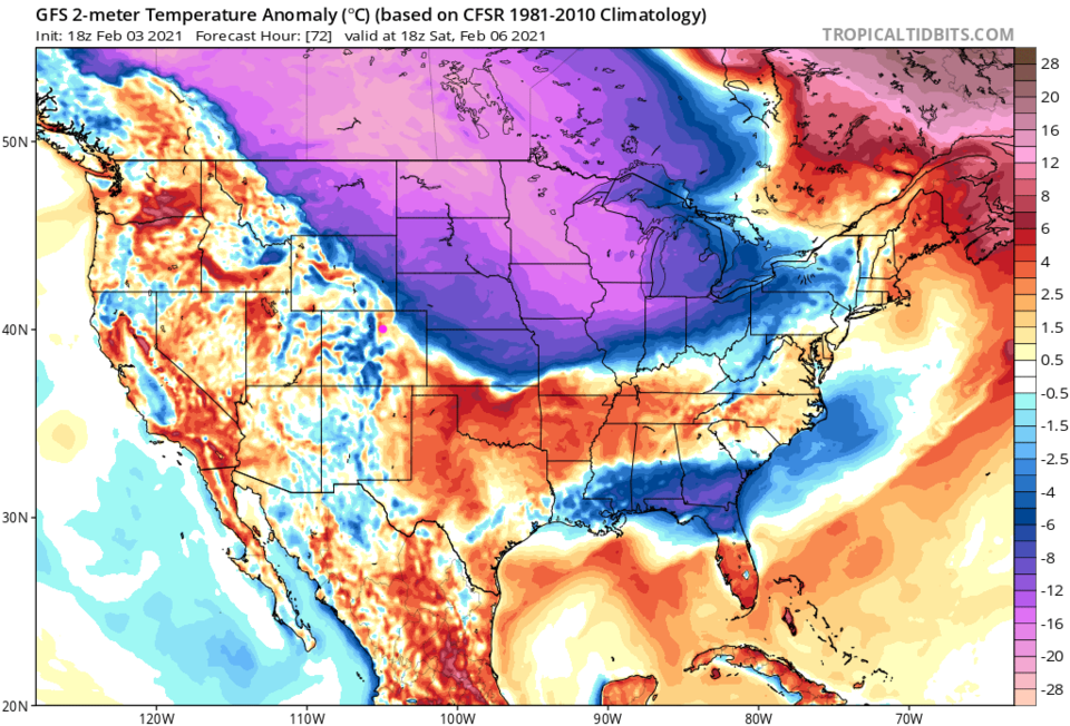 Figure 3: The temperature anomaly (departure from normal) for Saturday from weather5280.com
The longer-range forecast:
Figure 2 shows highs near 30 Monday through Friday. That is the cold we were expecting. It shows clearly in Figure 4.
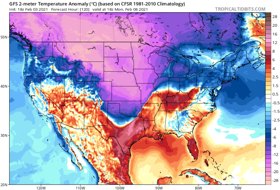 Figure 4: The temperature anomaly (departure from normal) for Monday from weather5280.com
Not a lot of precipitation is expected (see Figure 2 again) over the next 10 days except in the mountains. The GFS gives us a trace between now and Monday night (Figure 5) and just 1 to 3 inches over the next 10 days (Figure 6). It sure is hard to get a deep snow this year!
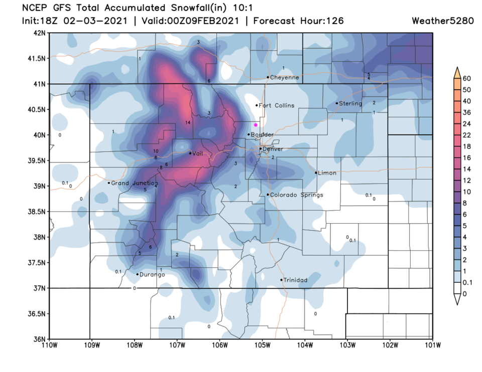 Figure 5: The five-day (10:1 ratio) total snowfall forecast from the GFS and weather5280.com
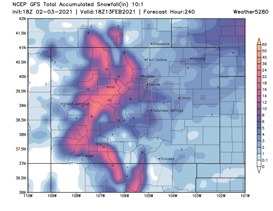 Figure 6: The 10-day (10:1 ratio) total snowfall forecast from the GFS and weather5280.com


