
In Brief:
The week begins soggy, with some snow, but ends hot and dry.
Forecast Discussion:
As this post goes up on Sunday, the western trough is approaching (Figure 2) and moisture levels are increasing. Rainfall should begin before sunset Sunday. Precipitation should be falling, more than not, until Tuesday afternoon (Figure 1). Temperatures keep falling and some good slushy snow could build up on cooler surfaces lat Monday night to Tuesday morning.
On Monday, the upslope flow will create a significant shield of rain over the eastern Colorado Plains (Figure 3). The rain expands as does the areas of snow later on Monday (Figure 4).
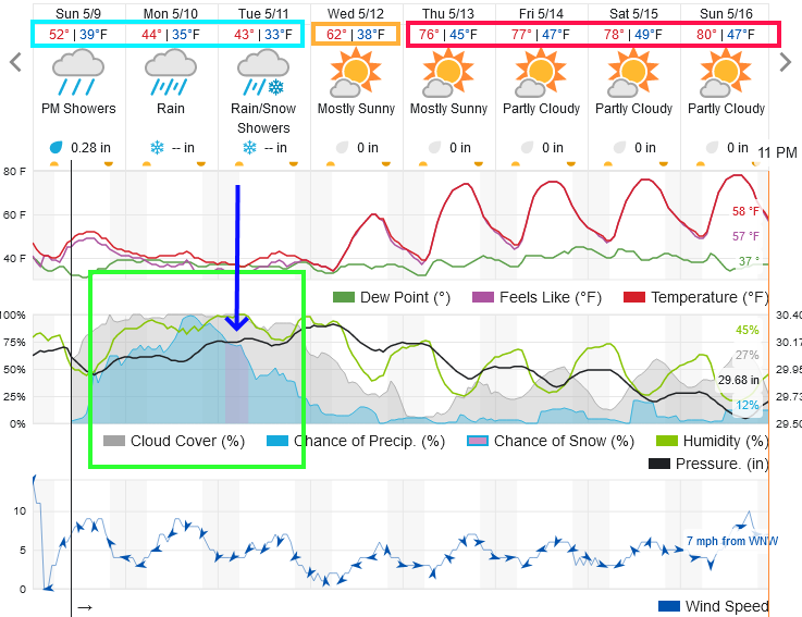 Figure 1: the 10 day graphical forecast from weatherunderground.com for Longmont, CO.
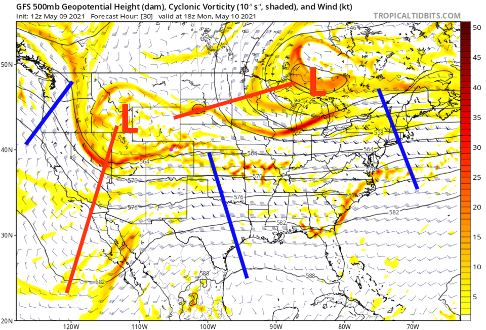 Figure 2: the 500mb upper air forecast map for Monday noon from the GFS and tropicaltidbits.com
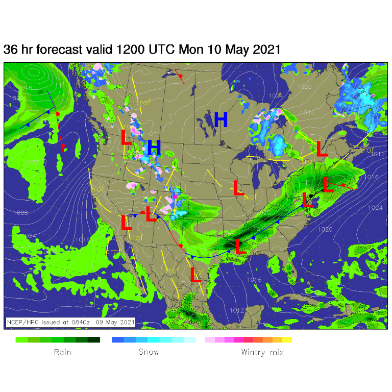 Figure 3: the surface forecast analysis for Monday AM from NCEP.
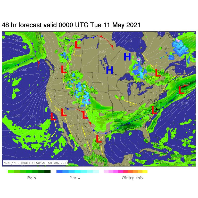 Figure 4: the surface forecast analysis for Monday PM from NCEP.
The Longer-Range Forecast:
We dry out on Wednesday and return to the 80s at the end of the week, but how much snow and rain will we get before then?
The always bullish GFS gives us 3-6 inches of snow Monday into Tuesday, a bit of snow 'might' fall late Sunday night, but I don't expect it to be significant, (Figure 5). This same model gives us 1.25 - 1.5 inches of rainfall/moisture over the next five days (Figure 6).
The Canadian GEM predicts 1-3 inches of snow, I think this is much more likely, (Figure 7) and 1.25 to 1.5 inches of water as well (Figure 8).
The ICON model predicts 1-2 inches of snow (Figure 9) and 1 to 1.25 inches of water (Figure 10).
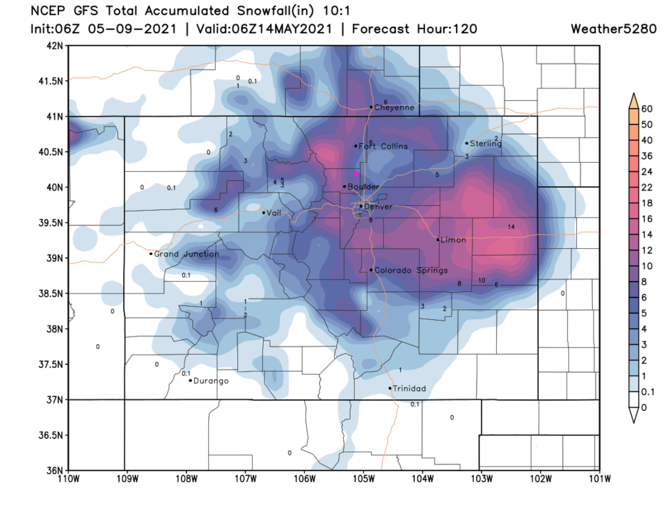 Figure 5: the 5 day (10:1 ratio) total snowfall forecast from the GFS and weather5280.com
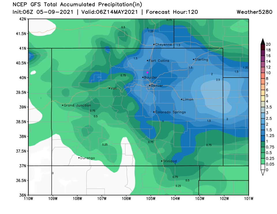 Figure 6: the 5 day total precipitation forecast from the GFS and weather5280.com
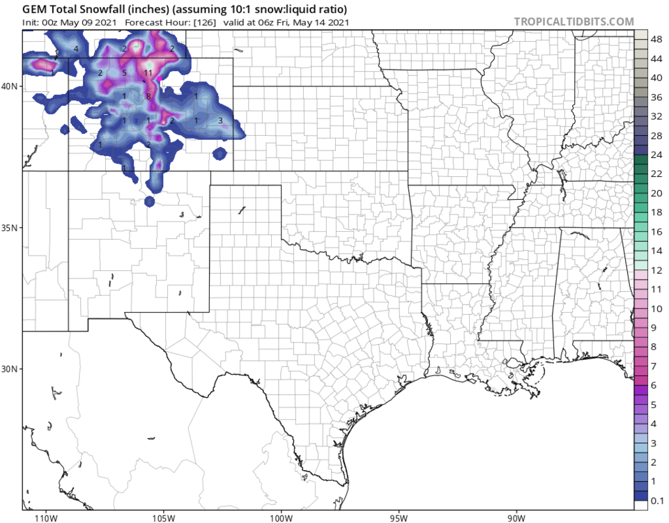 Figure 7: the GEM total snowfall forecast (10:1 ratio) for the next 5 days from tropicaltidbits.com.
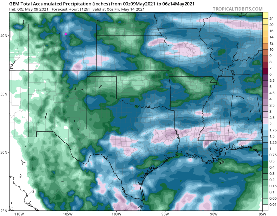 Figure 8: the GEM total rainfall forecast for the next 5 days from tropicaltidbits.com.
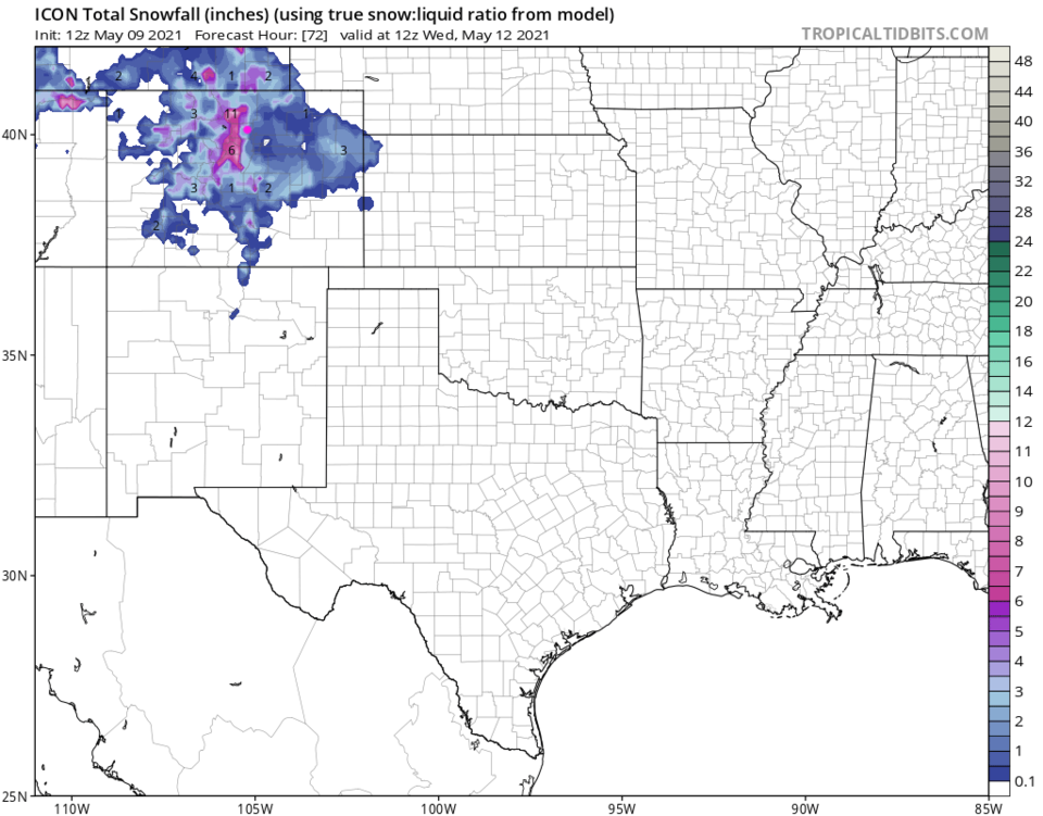 Figure 9: the ICON total snowfall forecast (10:1 ratio) for the next 5 days from tropicaltidbits.com.
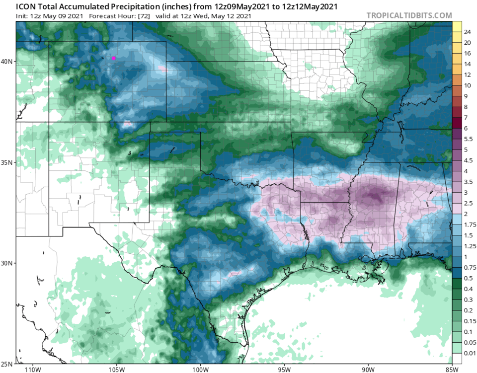 Figure 10: the ICON total snowfall forecast for the next 5 days from tropicaltidbits.com.


