In Brief:
We warm to the 80's on Saturday after our first good Spring storm.. 1 to 2 inches of rain Sunday/Monday.
Thursday Update:
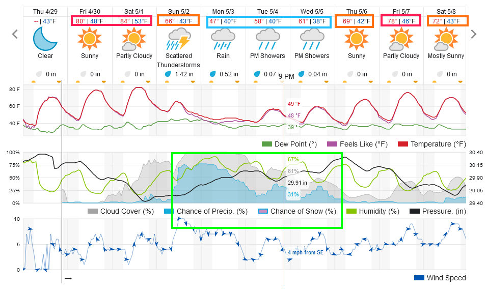
Amazing warmth is building. Figure 3 update shows lower to middle 80's F for Friday and Saturday. Watch the grass grow! A front hits around 9pm on Saturday with rain chances picking up around 9am Sunday. Models are giving us around 2 inches of rain from Sunday through Monday (with some showers through Wednesday as well). Be prepared for more umbrella use as the week begins. I'll post a full update on Saturday!
 Figure 3 update: the 10 day graphical forecast for Longmont, CO from weatherunderground.com
End Thursday update.
Wednesday Update:
We got a storm! There were 7 tornadoes in Colorado and 14 hail reports (one not too far to our southeast - Figure 1 update). Longmont also got a good soaking with 2/3rds to almost 1 inch of rainfall. Boulder saw totals right around 1 inch with 1.5 inches up in the hills above town (Figure 2 update).
We'll keep an eye on it, but after a Saturday high in the mid (to upper?) 80's, we may see another 1.5 inches of rain Sunday through Monday.
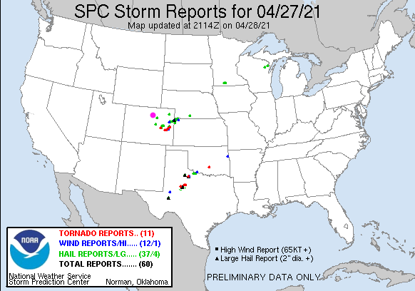 Figure 1 update: the severe weather reports from Tuesday from the SPC
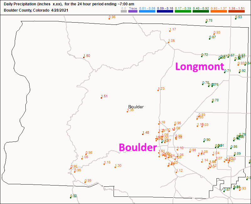 Figure 2 update: the rainfall reports up to 7am Wednesday from CoCoRaHS.
End Wednesday update.
Forecast Discussion:
A cold front and follow-up surge of reinforcing air Monday night and Tuesday morning will produce a brief period of thunderstorms around noon Tuesday followed by a prolonged (18 hour) period of up slop rain (Figure 1). The highest chances of rainfall — over an inch up to 1.5 inches — stretch from noon Tuesday to 10 a.m., Wednesday (Figure 2). This is being created by a big trough in the upper atmosphere seen in Figure 3.
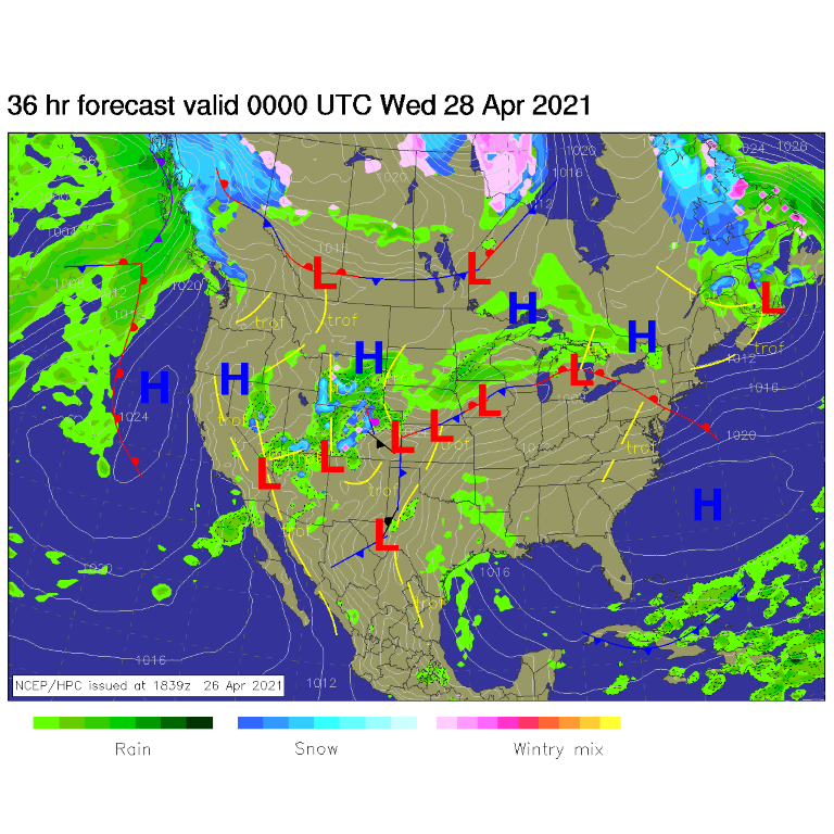 Figure 1: the forecast surface analysis for Tuesday PM from NCEP.
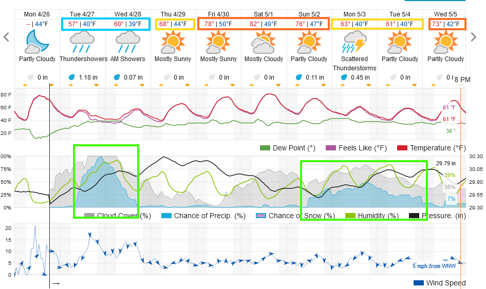 Figure 2: the 10 day graphical forecast from weatherunderground.com for Longmont, CO.
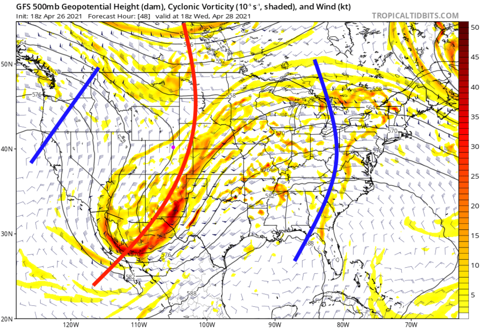 Figure 3: the 500mb upper air forecast map for Wednesday noon from the GFS and tropicaltidbits.com
Coming back, after a long absence, is the Storm Prediction Center, from Norman, OK, severe weather maps —- hello spring! Figure 4 shows the overall chance of severe weather. It puts Longmont and I-25 on the western edge of a Marginal Risk — only a 1 on a scale of 1-5, minimal. Figure 5 isolates the chance of large damaging hail — we are in the 5% chance of seeing damaging hail within 25 miles. We also have a 5% chance, within 25 miles, of seeing damaging straight-line winds (Figure 6). Figure 7 shows a tiny chance of tornadoes out east of us.
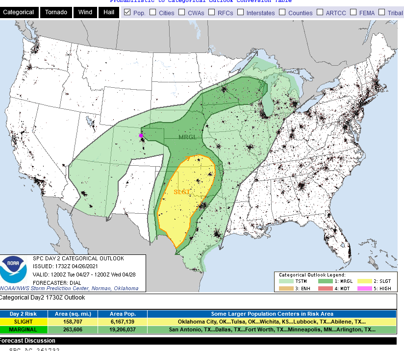 Figure 4: the risk of severe weather from the Storm Prediction Center, Norman OK for Day 2, Tuesday.
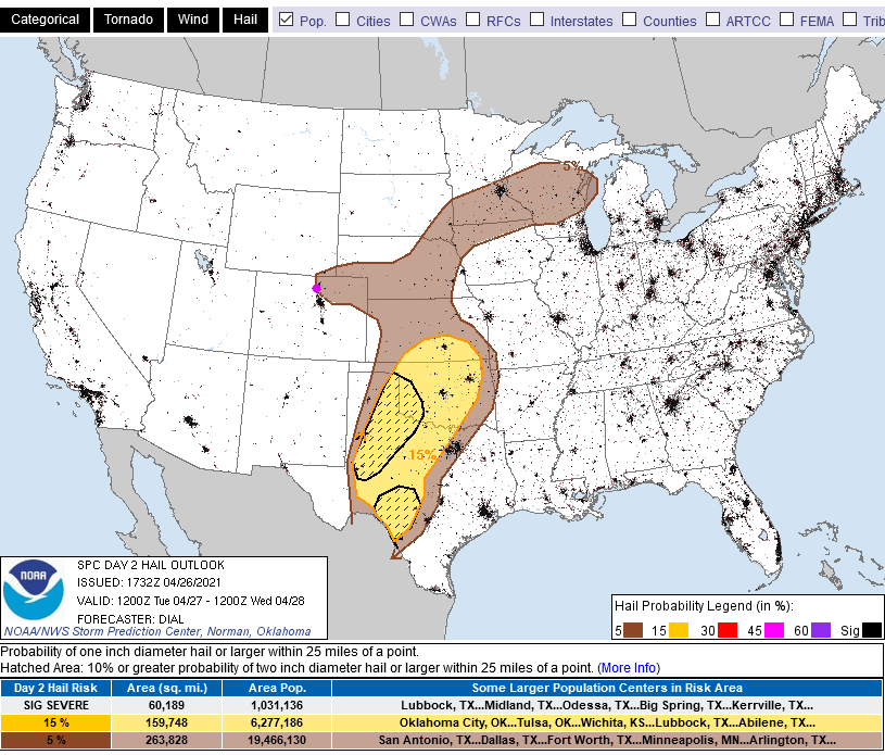 Figure 5: the risk of severe hail from the Storm Prediction Center, Norman OK for Day 2, Tuesday.
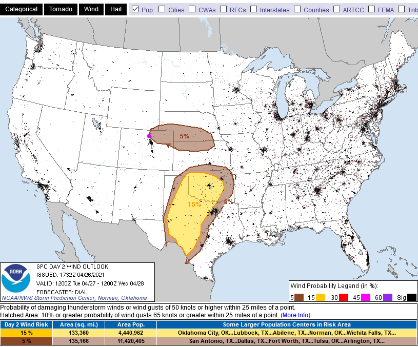 Figure 6: the risk of severe winds from the Storm Prediction Center, Norman OK for Day 2, Tuesday.
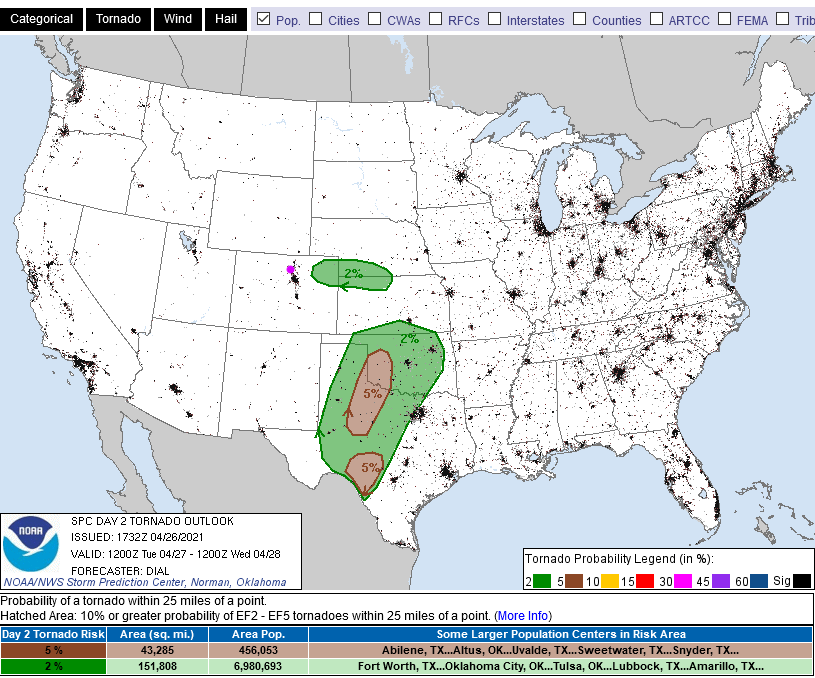 Figure 7: the risk of tornadoes from the Storm Prediction Center, Norman OK for Day 2, Tuesday.
The Longer-Range Forecast:
Things are warming up, so snow — maybe up to 1.5 feet in the mid to higher mountains — will be restricted to elevations above 7,000 feet, mostly (Figure 8). The weatherunderground model's (Figure 2) latest update gives us 1.3 inches of water, the GFS gives us 1 to 1.25 inches of rainfall (Figure 9). Spring showers are coming.
We break the 80s again with dry weather for the weekend under a big ridge (Figure 2 and Figure 10). Enjoy that dry wonderful weekend — with grass and flowers growing like crazy.
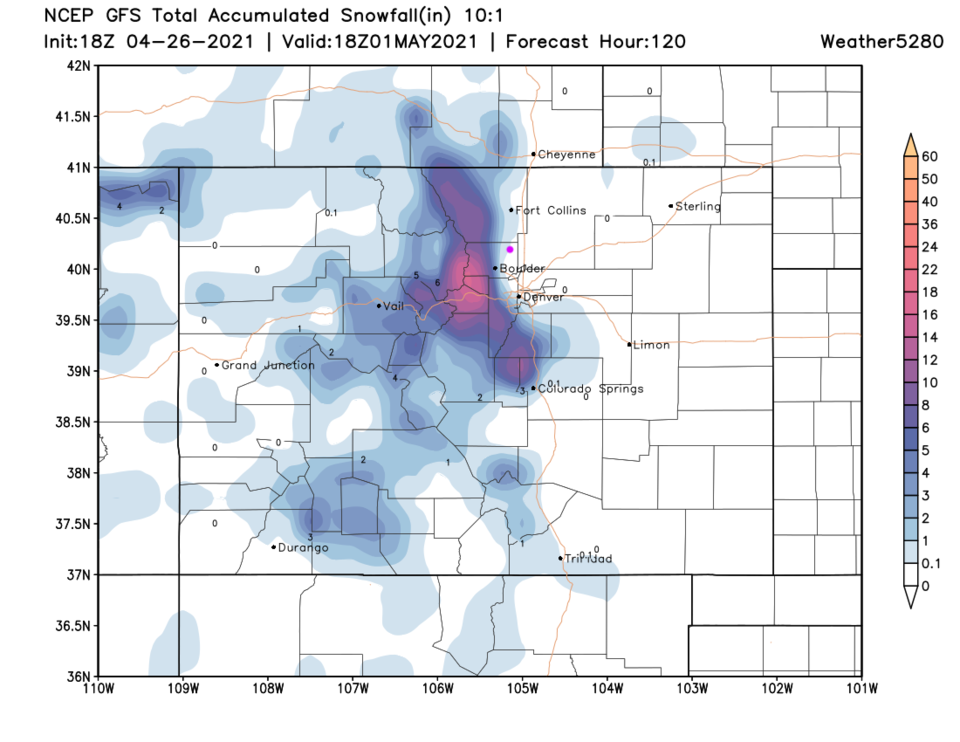 Figure 8: the 5 day (10:1 ratio) total snowfall forecast from the GFS and weather5280.com
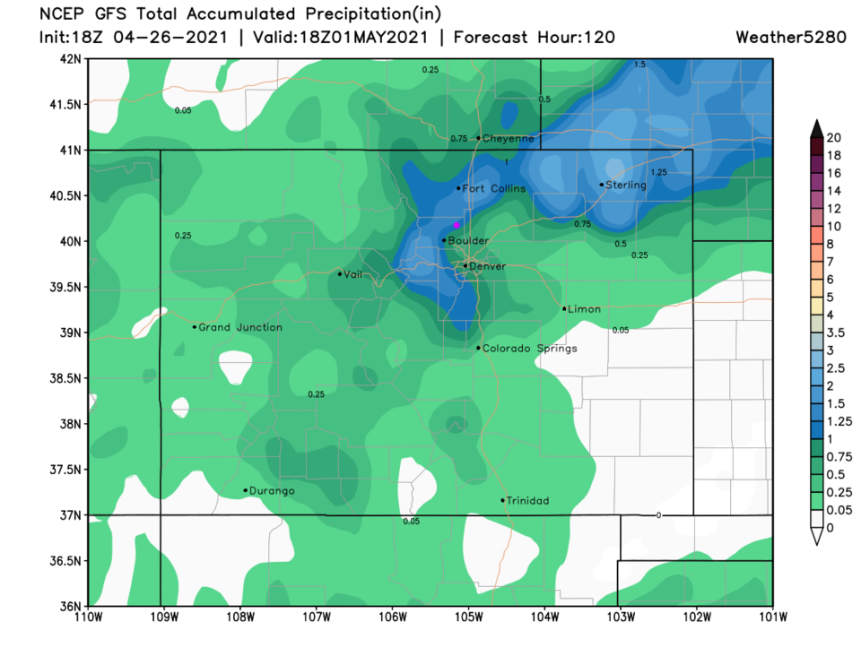 Figure 9: the 5 day total rainfall forecast from the GFS and weather5280.com
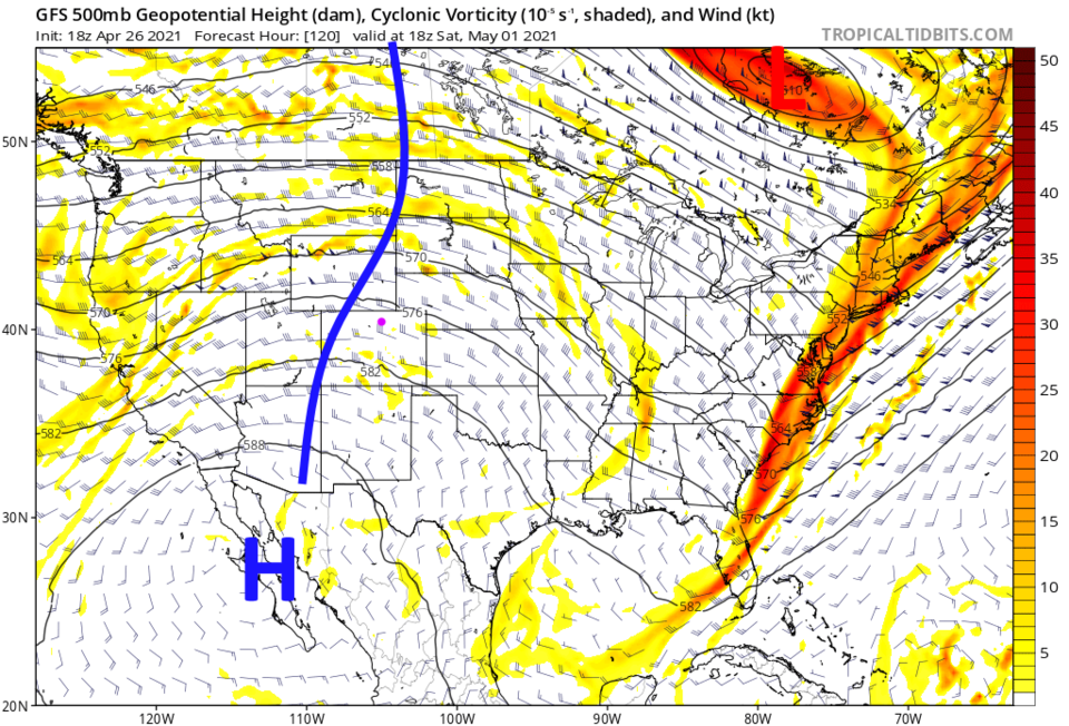 Figure 10: the 500mb upper air forecast map for Saturday noon from the GFS and tropicaltidbits.com


